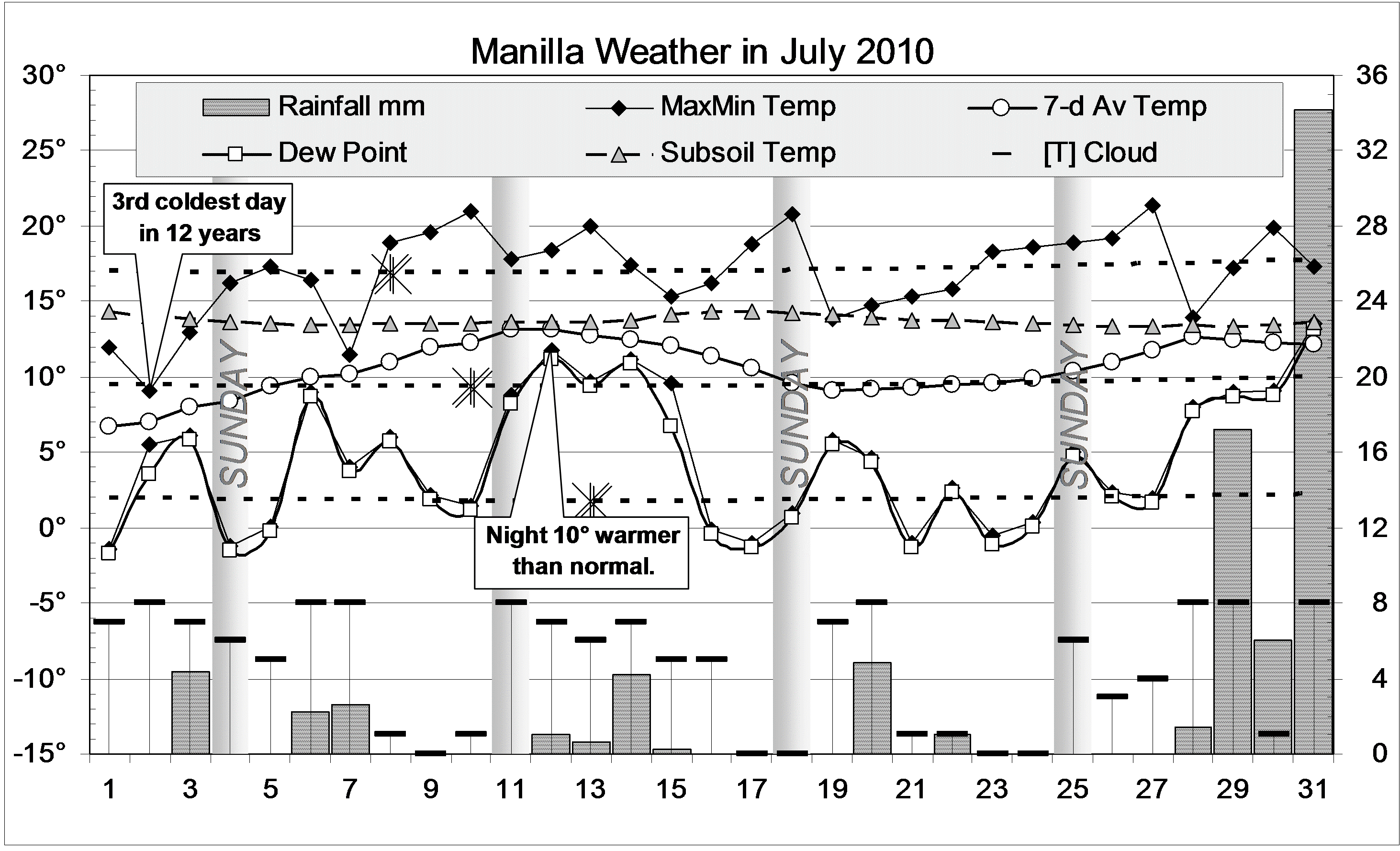
The daily weather log
July began cold. The 2nd, with a maximum temperature of 9.1°, was the coldest July day in the record from 1999. The only two colder days were: 8/06/07 (8.8°), and 20/06/07 (8.3°).
Two warm spells followed, marked mainly by nights that were very warm for mid-winter. The minimum on the 12th (11.8°) was 10° above normal, and that on the 31st (13.5°) was 11.3° above normal. Colder nights included twelve mild frosts, the fewest on record.
There were 13 rain days spread through the month. The reading of 17.2 mm on the 29th was topped by 34.2 mm on the 31st.
“Normal Temperature”
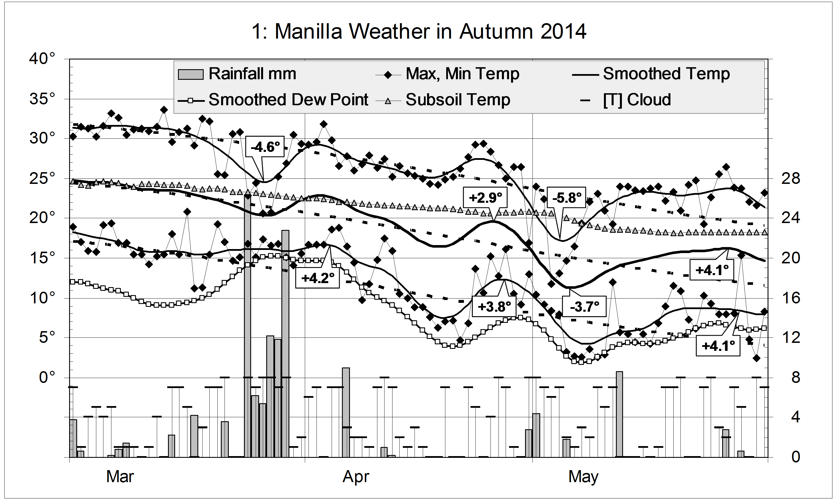
Each Manilla monthly weather graph has dashed curves to show the temperatures that are normal for each day of the year. They are harmonic curves matching 10-year averages from March 1999. On this July graph, the lowest values are marked with a double “X”. Winter cold is due to lack of heat from the sun, which yields least heat on the 21st of June (the winter solstice). On that day the sun is lowest and shines the shortest time. However, it takes many days for the air to cool down. On average, the coldest day in Manilla comes 17 days later (July 8th) and the coldest night 22 days later (July 13th). Manilla’s coldest day and night follow the solstice with an unusually short lag time. (See Wikipedia: “Seasonal lag”.)
See the monthly weather report for January 2010 for the highest normal temperatures of the year. These relationships are shown on a graph here.
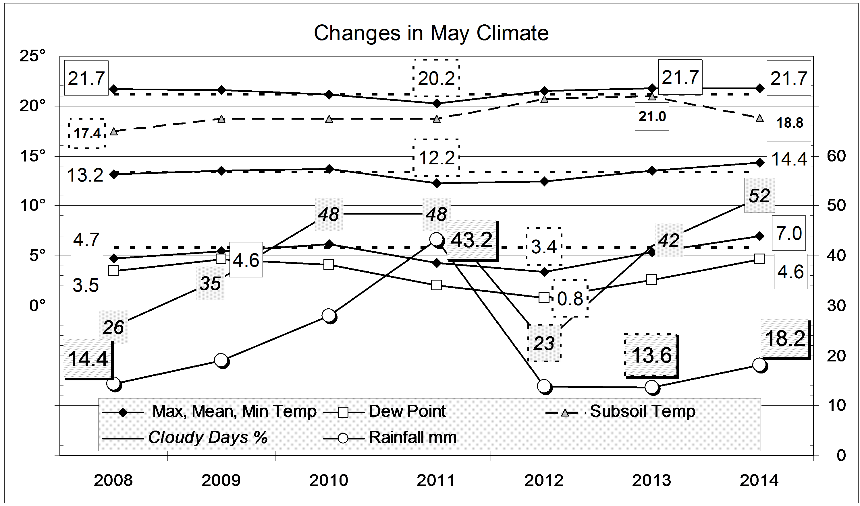
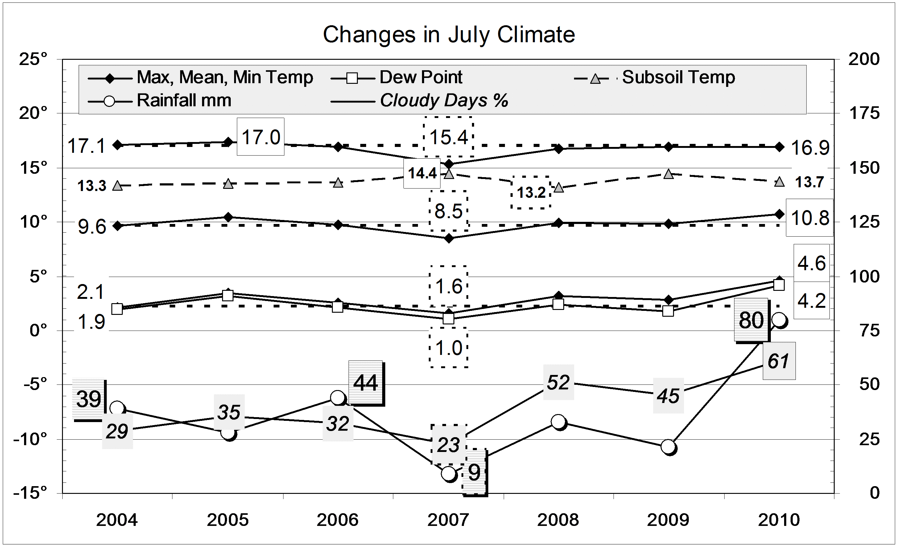
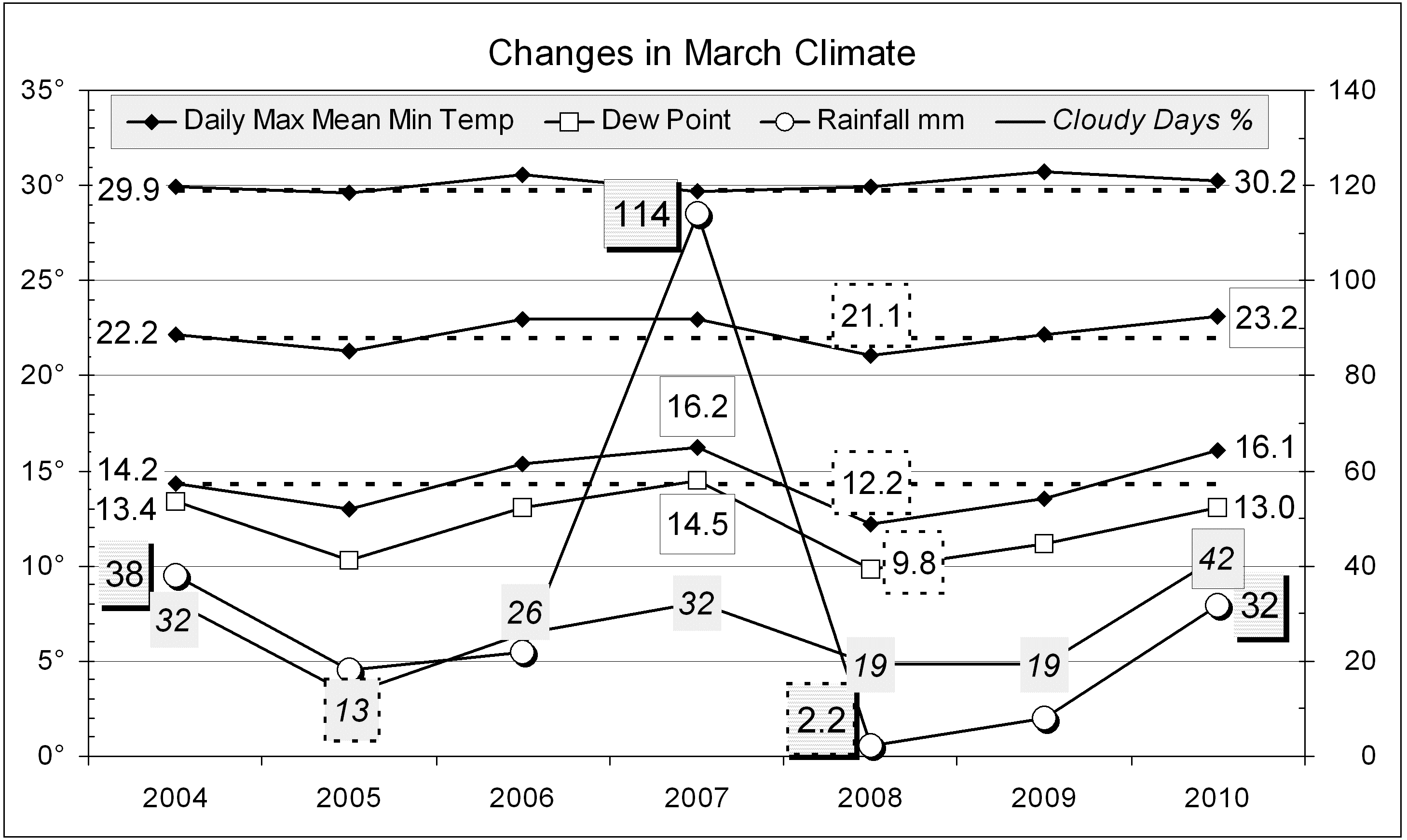
Comparing July months
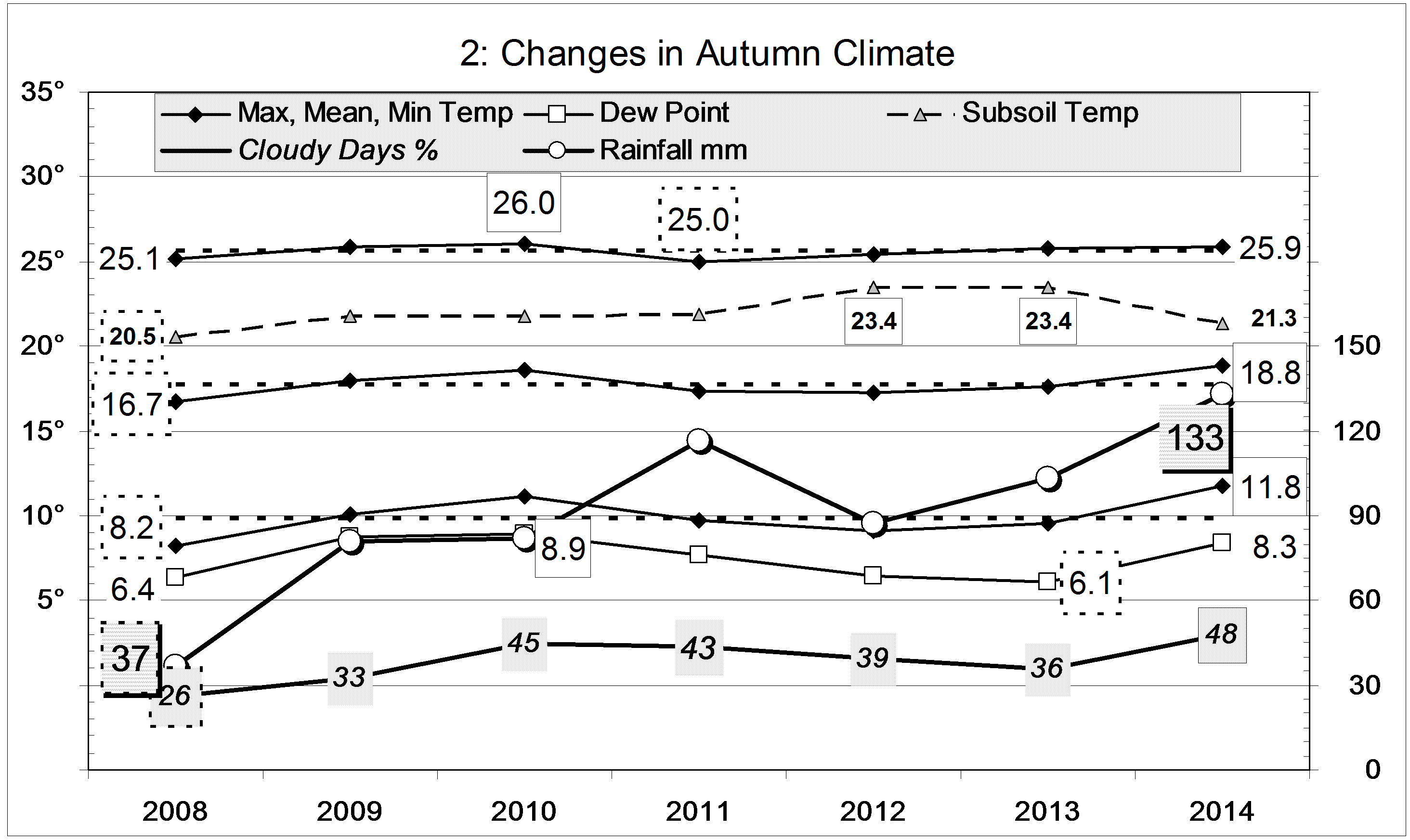
Due to cloudy nights, the mean daily minimum temperature (4.6°) was by far the highest in the 12-year record for July, and 2.4° above the average. Because the mean maximum temperature was normal (16.9°), the mean average temperature was also high (10.8°). The mean daily temperature range (12.3°) was the narrowest in the July record.
Very high humidity was shown by a mean early morning Dew Point of 4.6°, higher than any since July 1999 (5.7°). The percentage of cloudy mornings (61%) was the highest, not only for July months, but for any month in this record. Nineteen mornings were completely overcast.
The rainfall of 79.8 mm is in the 90th percentile for July: only 12 July months have been wetter. It is close to double the long-term average of 41 mm. As a result, total rainfalls for the last two months and three months are now above the median. No serious rainfall shortages remain. The worst shortages are far from serious: the 15-month and the 9-year totals are both in the 14th percentile.
Data. Rainfall data is from Manilla Post Office, courtesy of Phil Pinch. Temperatures, including subsoil at 750 mm, and other data are from 3 Monash Street, Manilla.