
The daily weather log
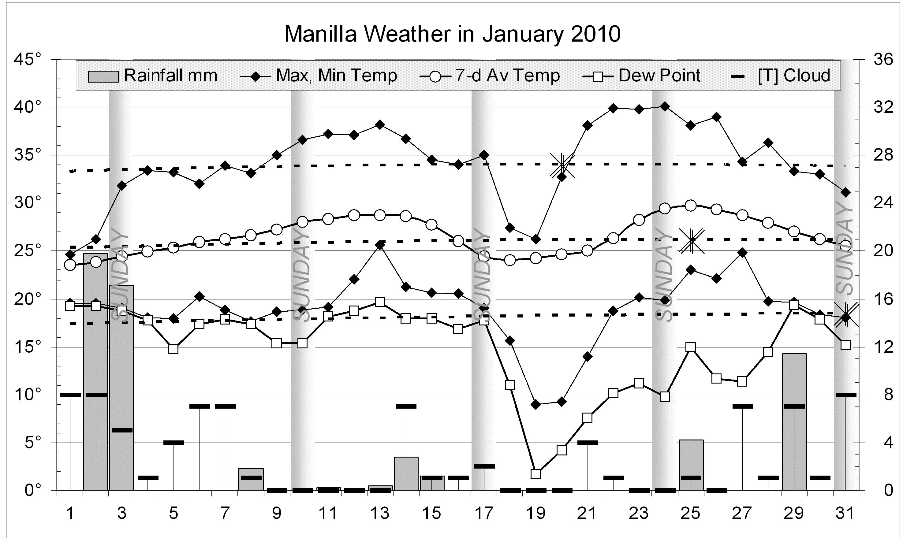
Cool, cloudy, rainy, humid weather at New Year soon gave way to warm sunny, humid weather. On the 19th temperatures and humidity fell very low, but the next days were hot. Storms marked the final week.
Nine rain days yielded 59.0 mm, with 19.8 mm registered on the 2nd.
“Normal Temperature”
Each monthly weather graph has dashed curves to show the temperatures that are normal for each day of the year. They are harmonic curves matching 10-year averages from March 1999. On this January graph, the highest values are marked with a double “X”. Summer heat is due to the sun, which can give most heat on the 21st of December (the summer solstice). On that day the sun is highest and shines the longest. However, it takes many days for the air to warm up. On average, the hottest day in Manilla comes 30 days later (January 20th) and the hottest night 41 days later (January 31st). (See the monthly weather report for July 2010 for the lowest normal temperatures of the year.) These relationships are shown on a graph here.
Comparing January months
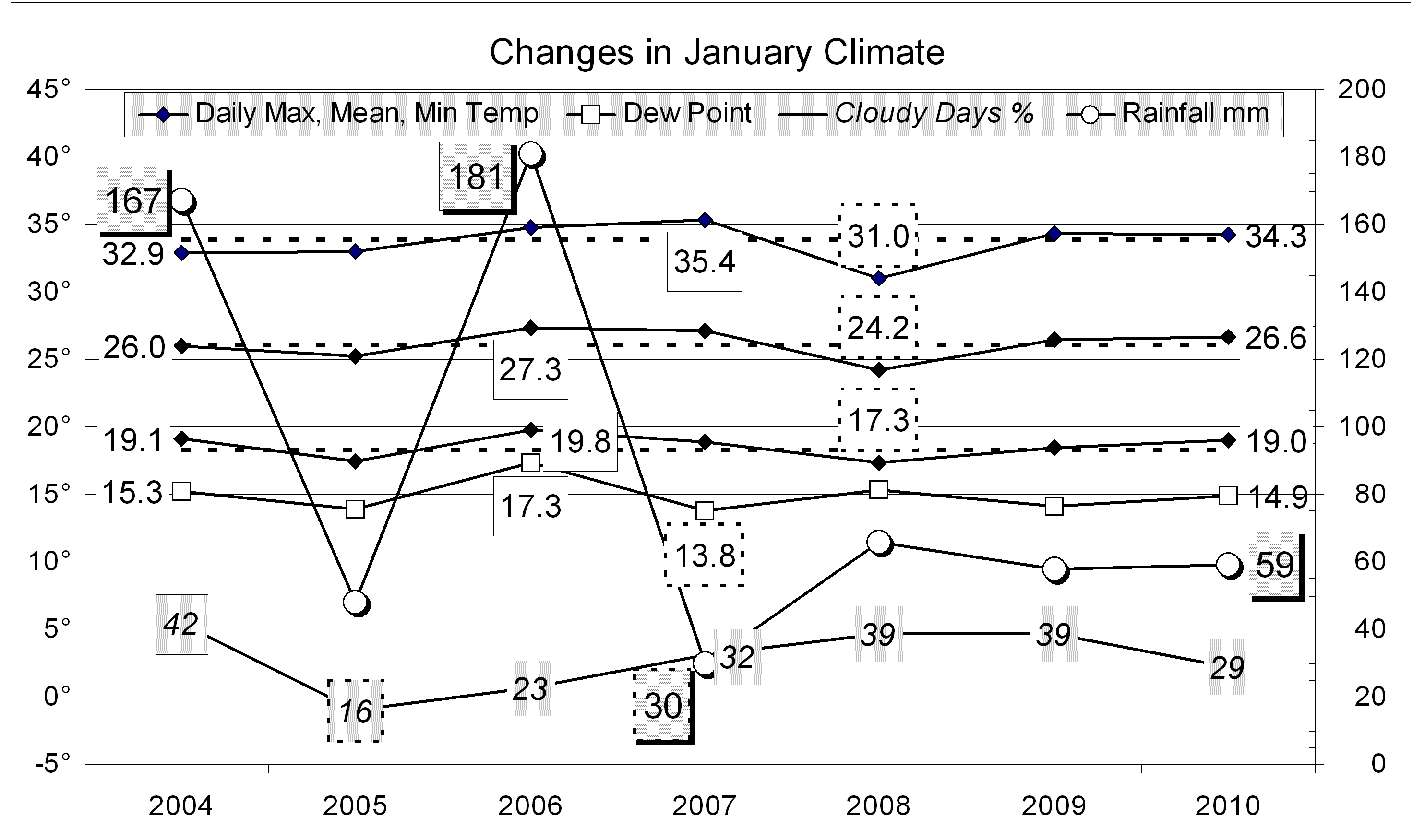
All average values except rainfall are near normal for the month.
The rainfall total of 59.0 mm is in the 40th percentile, rather lower than the median for January (75 mm). Most totals for more than one month are still good. Even the 9-month total (now 339 mm) has risen to the 15th percentile.
Data. Rainfall data is from Manilla Post Office, courtesy of Phil Pinch. Temperature and other data are from 3 Monash Street, Manilla.
