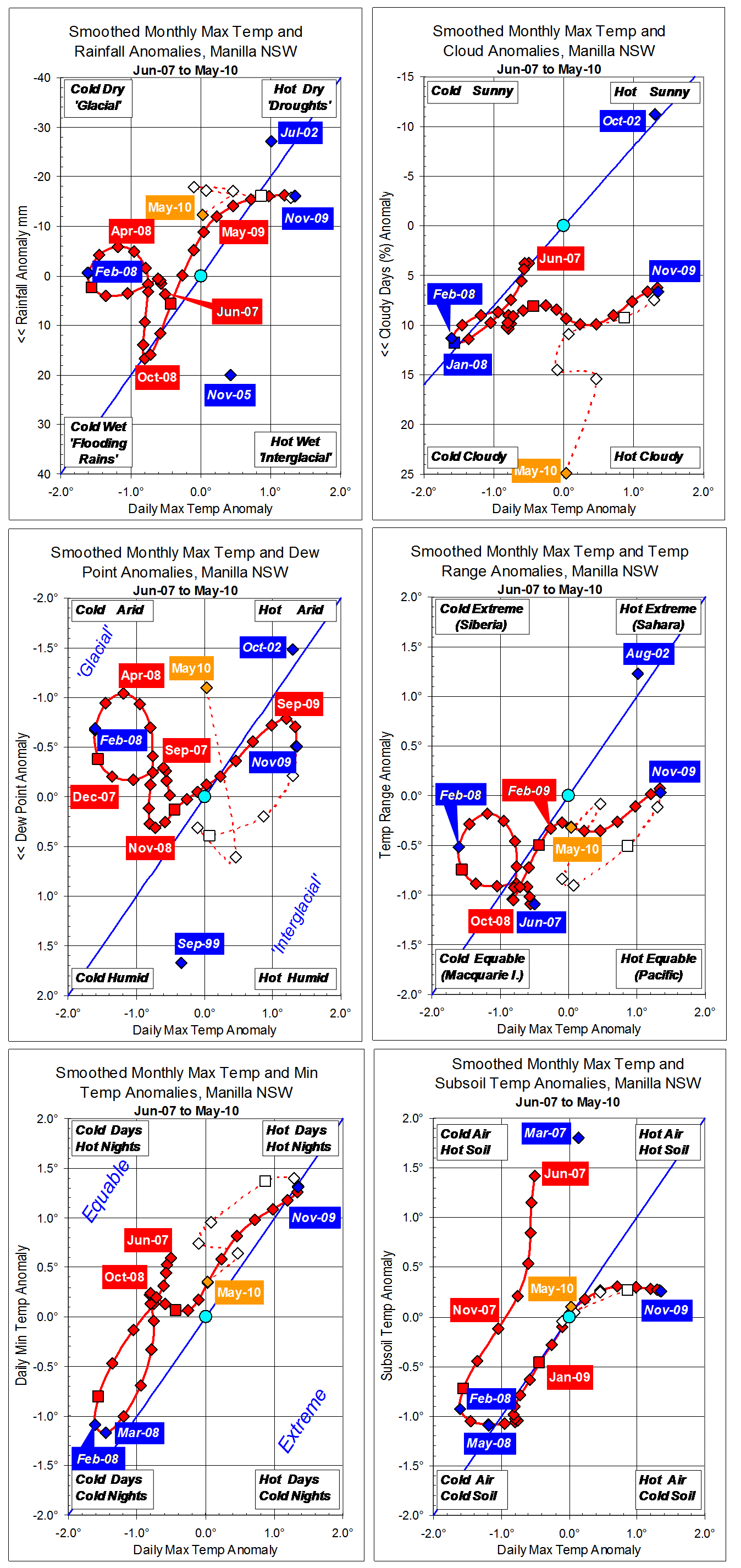
This scatter-plot shows only daily minimum temperatures, indoors and outdoors, and displays the average values. The Manilla average outdoor minimum of 10.1° is far too cold for comfort. Solar-passive design has raised the indoor minimum by 10.6° without applied heating. The indoor average minimum of 20.7° is near the middle of the comfort zone.
The slope of the linear regression line shows that indoor minima vary only 34% as much as outdoor minima. This results from effective insulation, daily and seasonal heat storage in thermal mass material, and warmth from the sun captured in winter.
A dashed line in the lower right shows that nearly all points have indoor minima warmer than outdoor minima. This is a disadvantage only on nights warmer than about 20 deg.
A dashed line in the upper left shows that many cold nights have indoor minima nearly 20° warmer than outdoors. One morning (9/5/06) the indoor temperature was 21.8° warmer than outdoors. Could this be a record for an unheated house? Such large over-temperatures come with very dry air in autumn and early winter.
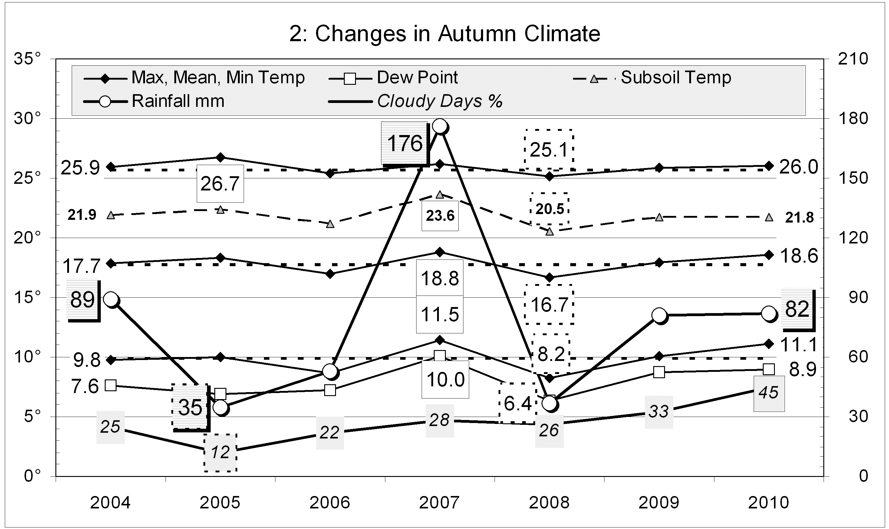
This post is one of a set of four back-dated to June 2010:
Indoor versus Outdoor Temperatures (1096 days)
Indoor versus Outdoor Minima (1096 days) (This post.)
Indoor versus Outdoor Maxima (1096 days)
Indoor/Outdoor Regressions for Maxima and Minima
[For a more personal perspective, there are testimonials.]
This article was originally posted in the weatherzone forum thread “Indoor Climate” on 7th June 2010. It is backdated here to 17th June 2010.