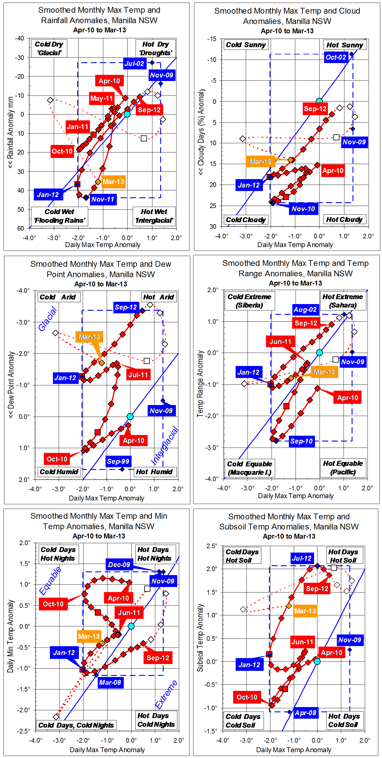
Parametric plots of smoothed climate variables at Manilla
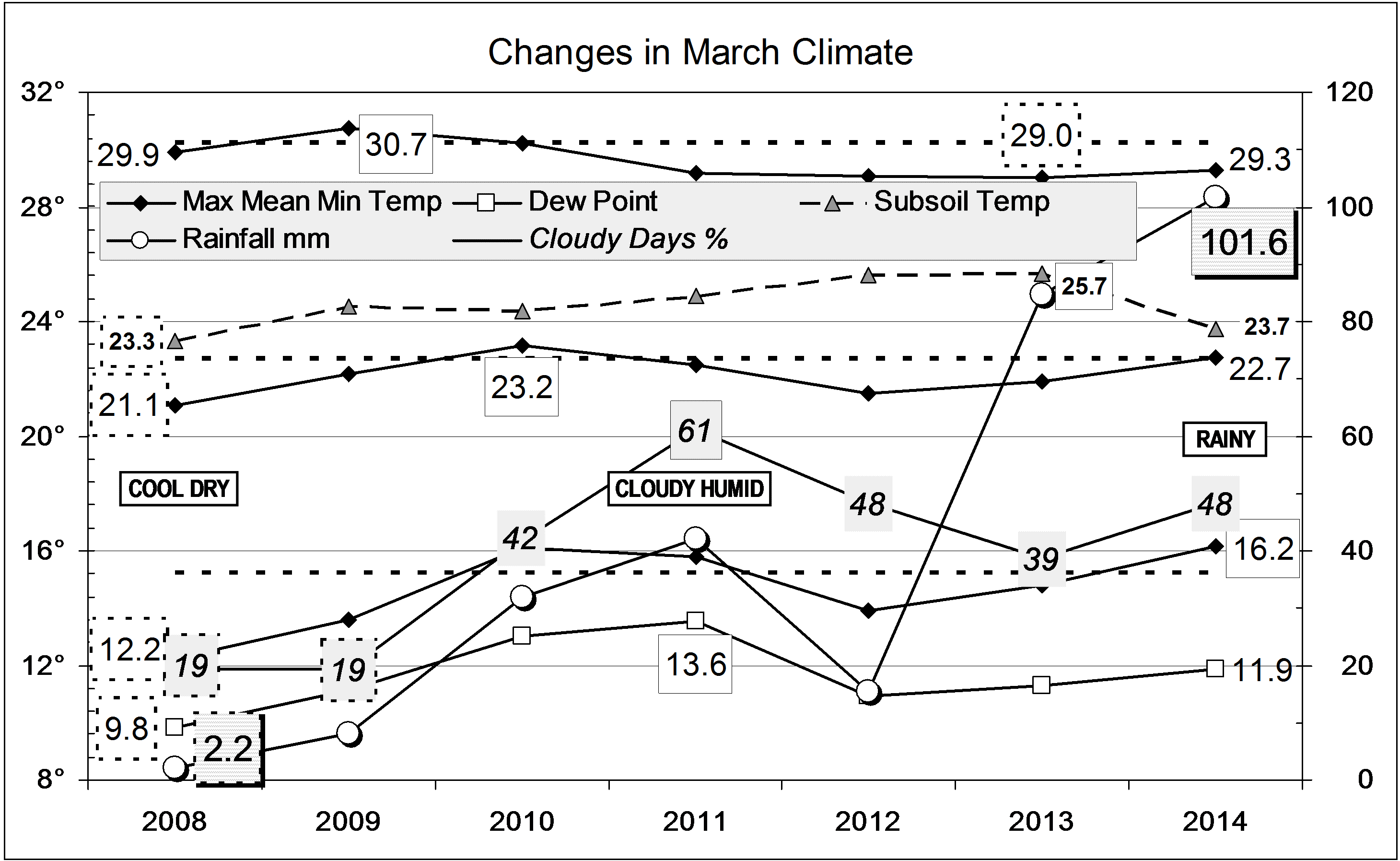
“March 2015: hot”

March raw anomaly data (orange)
In March, the daily maximum temperature anomaly became very high (+1.6 degrees), but not nearly as high as the raw value had been in November (+5.1 degrees). Most other anomalies moved up the graphs towards “droughts” but not beyond normal values. Dew point remained as low as in February, and rainfall returned from very low to normal.
Fully smoothed data (red)
The latest fully-smoothed data anomalies (September 2014) moved a little towards “droughts” from the near-normal values of the winter.
Note:
Fully smoothed data – Gaussian smoothing with half-width 6 months – are plotted in red, partly smoothed data uncoloured, and raw data for the last data point in orange. January data points are marked by squares.
Blue diamonds and the dashed blue rectangle show the extreme values in the fully smoothed data record since September 1999.
Normal values are based on averages for the decade from March 1999.* They appear on these graphs as a turquoise (turquoise) circle at the origin (0,0). A range of anomalies called “normal” is shown by a dashed rectangle in aqua (aqua). For values in degrees, the assigned normal range is +/-0.7°; for cloudiness, +/-7%; for monthly rainfall, +/-14 mm.
* Normal values for rainfall are based on averages for the 125 years beginning 1883.