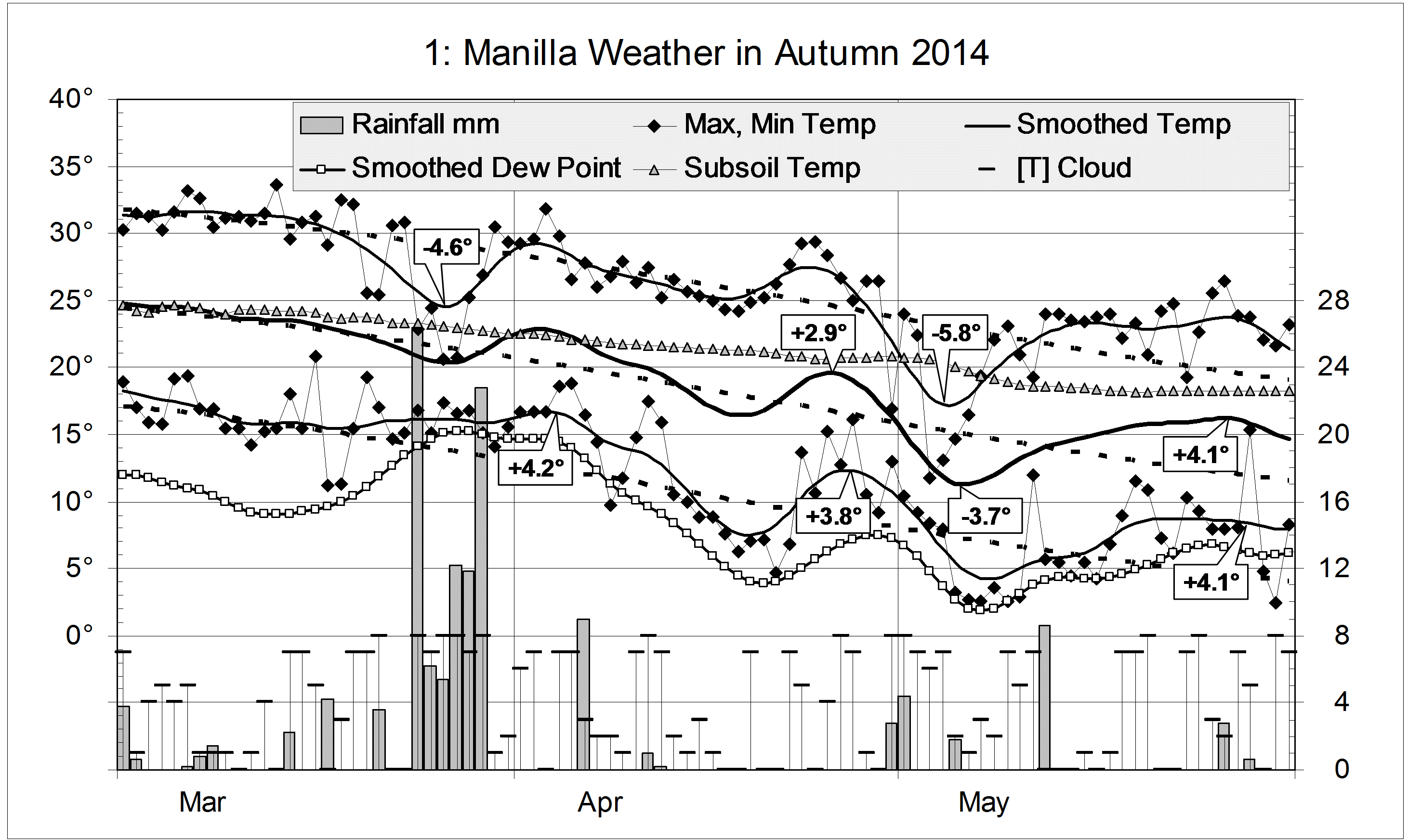
Parametric plots of smoothed climate variables at Manilla
“August 2014 back to normal”

August data (orange)
Most raw anomaly values for August have returned to near normal. The daily maximum temperature anomaly has finally fallen below normal and rainfall has risen above normal. The dew point anomaly remains well below normal, but its value is on the (green) trend line that has applied during the last three years.
Fully smoothed data (red)
Fully-smoothed data is now available for the summer season ending in February 2014. During the summer all variables except daily minimum temperature moved decisively away from drought. Rainfall increased rather slowly, but cloudiness increased very rapidly, and daily temperature range fell very rapidly.
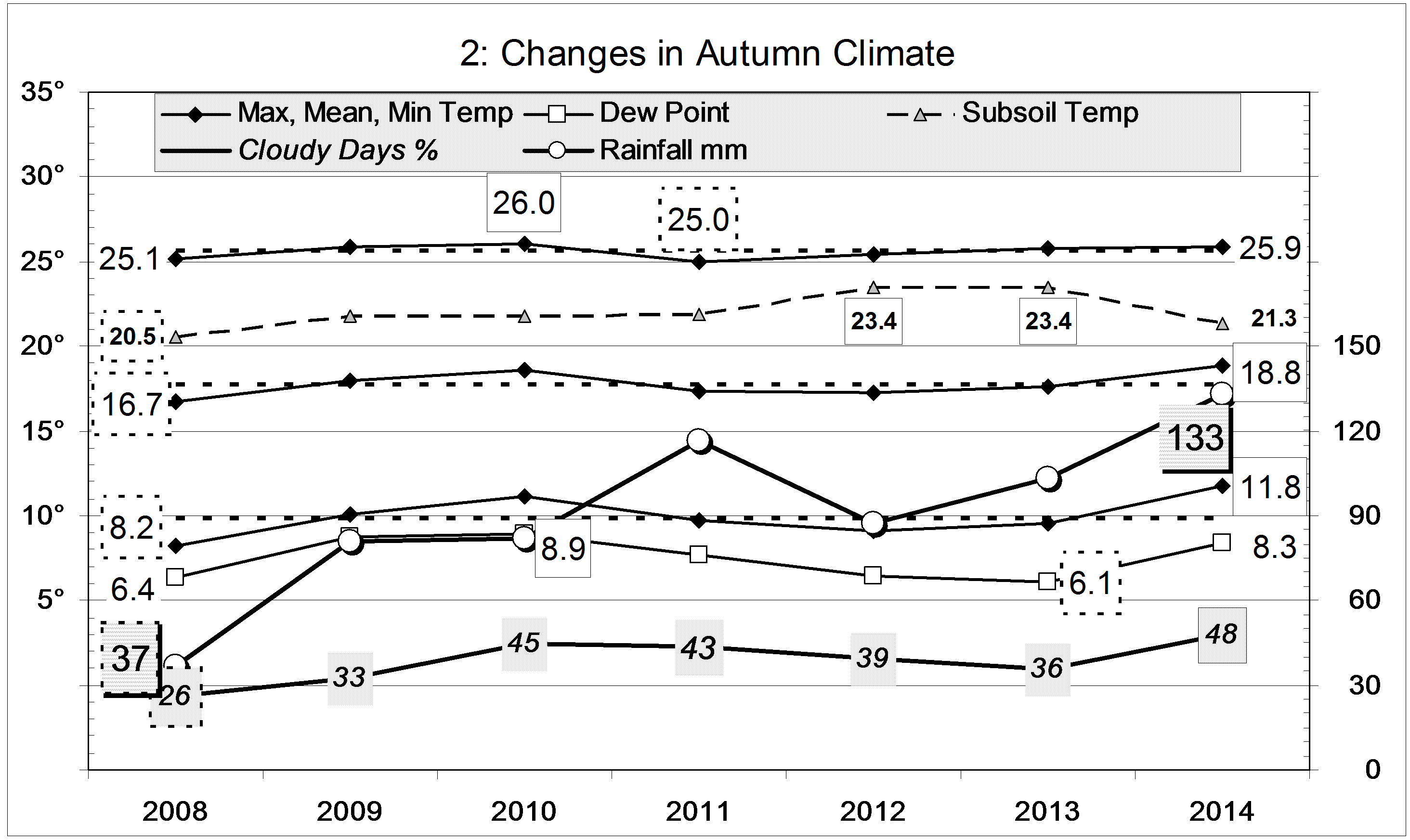
The hot-arid climatic peak (drought) of spring 2013
Extreme anomaly values of climate variables came in the following order:
Highest minimum temperature (not high): July;
Highest subsoil temperature (extreme): July;
Widest temperature range (very wide): October;
Highest maximum temperature (extreme): October;
Least cloudiness (normal): October;
Lowest dew point (extreme): December;
Lowest rainfall (very low): December-January.
This is not the order that is typical in recent extreme episodes. The smoothed rainfall anomaly minimum of -22.3 mm (not nearly as low as the -27.1 mm of July 2002) came much later than the peak of daily maximum temperature. On the top left graph the trace curved anti-clockwise, which is unusual.
Note:
Fully smoothed data – Gaussian smoothing with half-width 6 months – are plotted in red, partly smoothed data uncoloured, and raw data for the last data point in orange. January data points are marked by squares.
Blue diamonds and the dashed blue rectangle show the extreme values in the fully smoothed data record since September 1999.
Normal values are based on averages for the decade from March 1999. They appear on these graphs as a turquoise (turquoise) circle at the origin (0,0). A range of anomalies called “normal” is shown by a dashed rectangle in aqua (aqua). For values in degrees, the assigned normal range is +/-0.7°; for cloudiness, +/-7%; for monthly rainfall, +/-14 mm.