In the whole of this summer, only 3 days went over 35° (usually 23) and only 5 nights went over 20° (usually 19).
The smoothed curves of temperature reached up as high as normal only twice. In early January both days and nights were normal. Later, with persistent rain around the 1st of February, nights warmed to normal, but days were extremely cold.
All the mean daily temperatures were the lowest in 13 summers: maximum 28.9°, mean 22.2°, and minimum 15.4°. Summer ’07-’08 had been just slightly warmer.
Daily temperature range this summer (13.5°) was very narrow, as in ’07-’08 and ’10-’11; all wet summers with very cloudy skies. Strangely, this cloudy wet summer had very low humidity, with morning Dew Point (12.7°) the lowest on this record.
While this was a very wet summer, at 333 mm, it was only the 19th wettest (86th percentile), and not much wetter than summers 4, 6, and 8 years ago.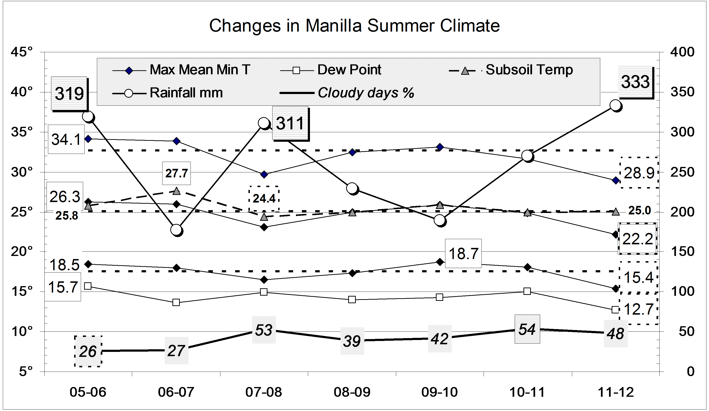
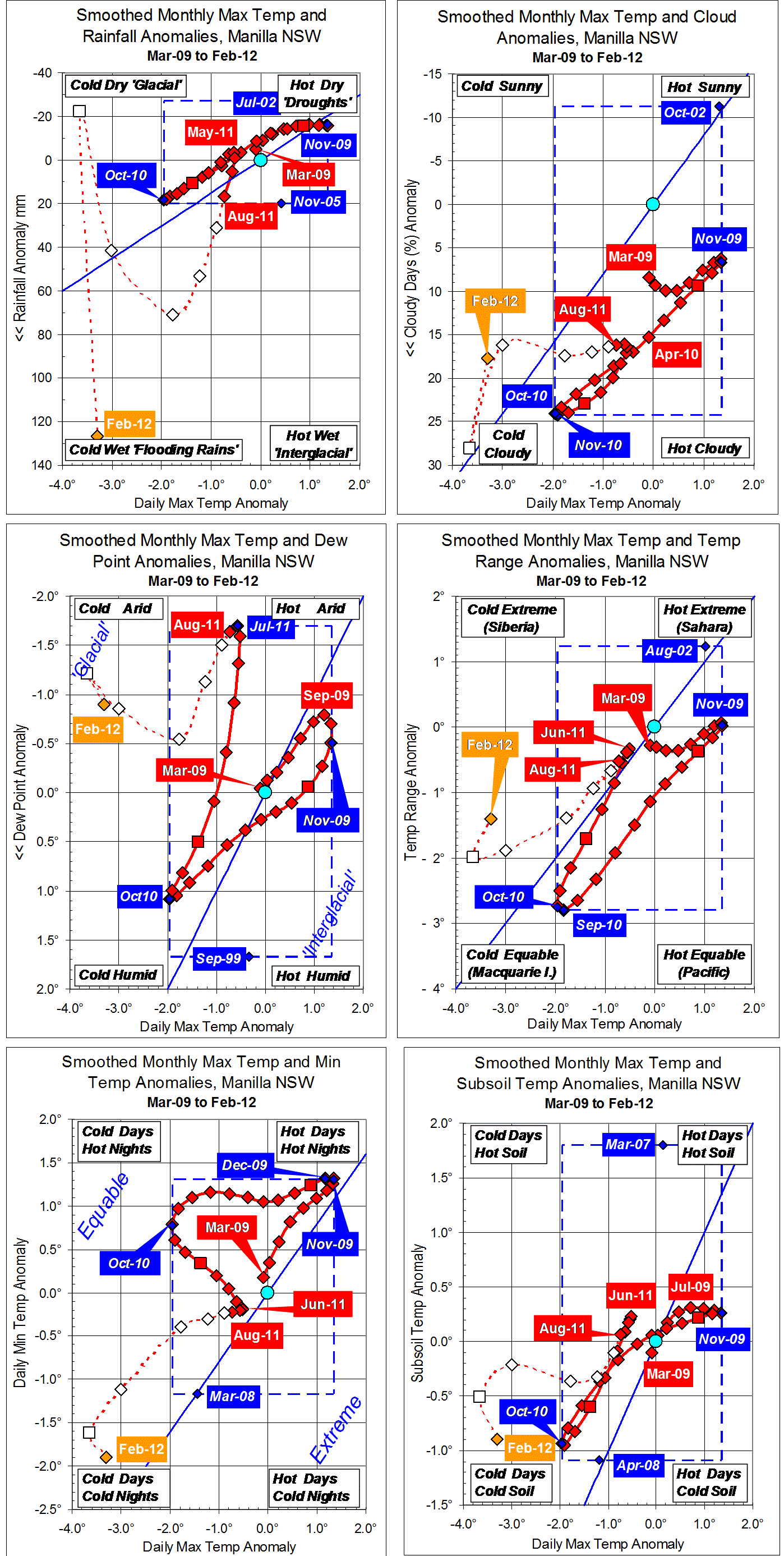
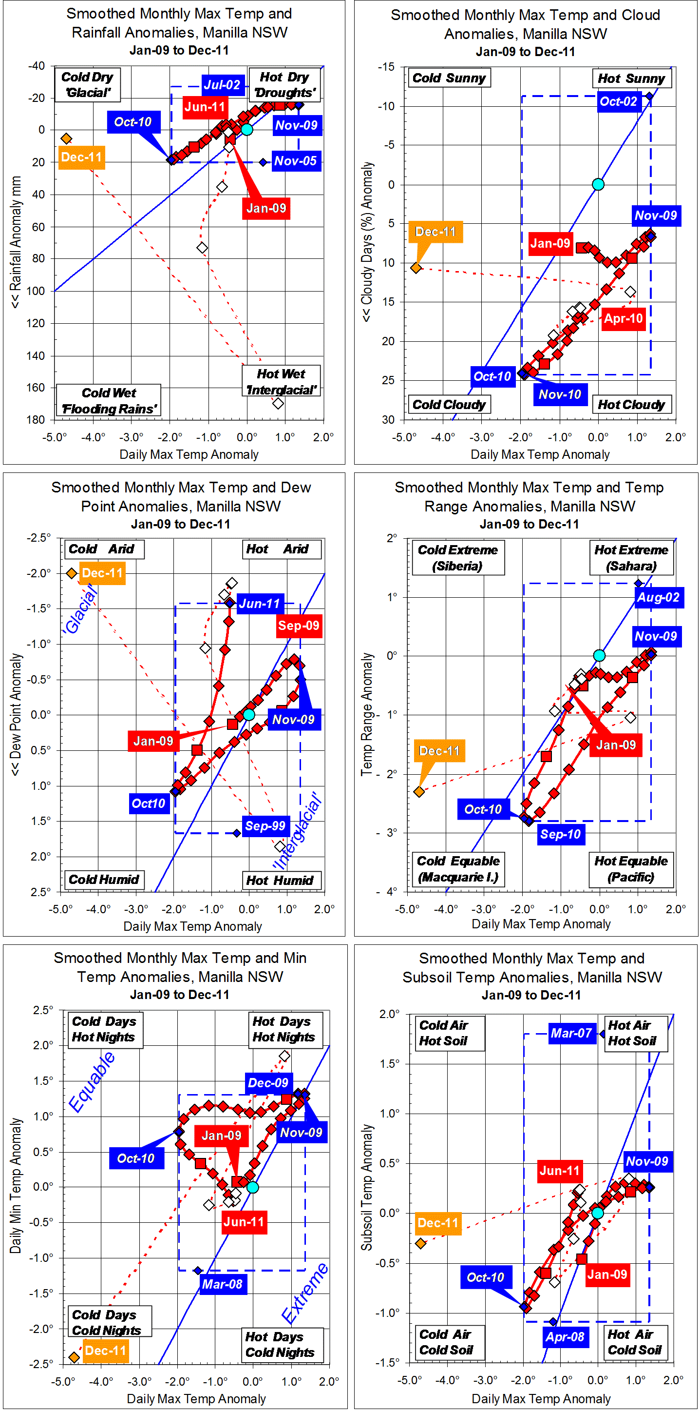
Data. Rainfall data is from Manilla Post Office, courtesy of Phil Pinch. Temperatures, including subsoil at 750 mm, and other data are from 3 Monash Street, Manilla.

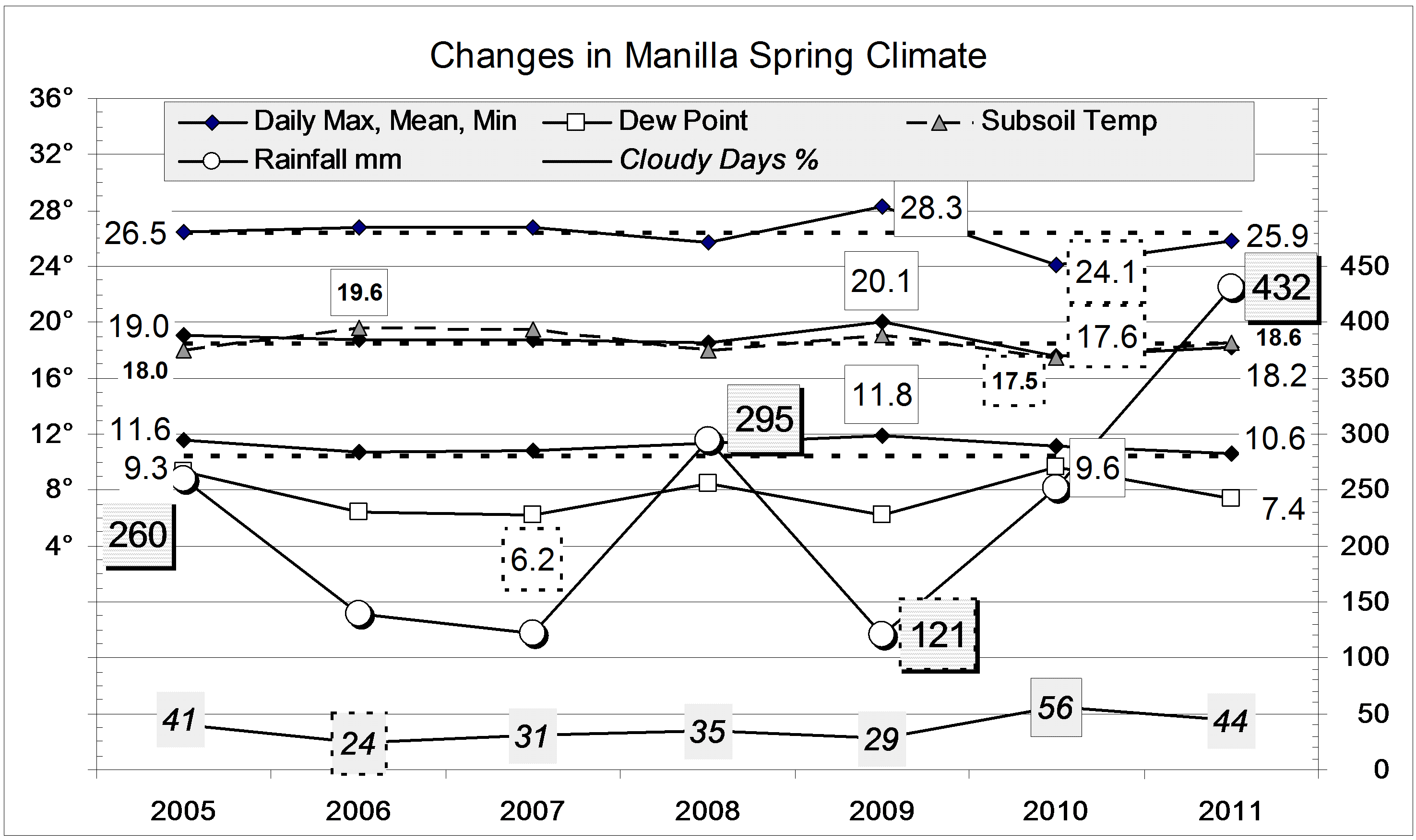
 This spring’s rainfall of 431.7 mm far exceeded that of any other spring in the record from 1883. Winter had been very dry, with only 55 mm. While there was a lot of rain in September (91.4 mm) and October (97.4 mm), much more fell in November (242.9 mm), mainly in the second half.