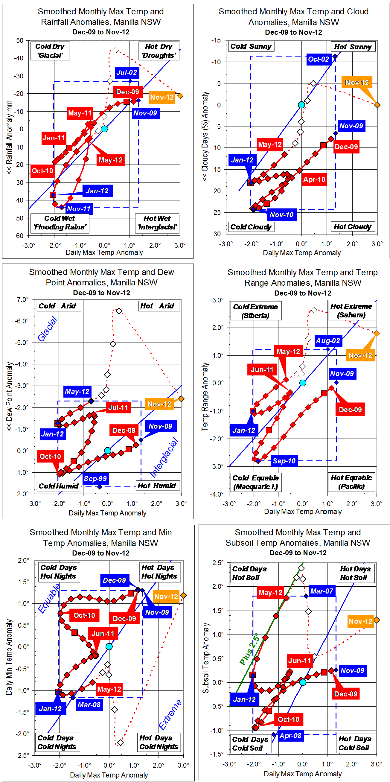
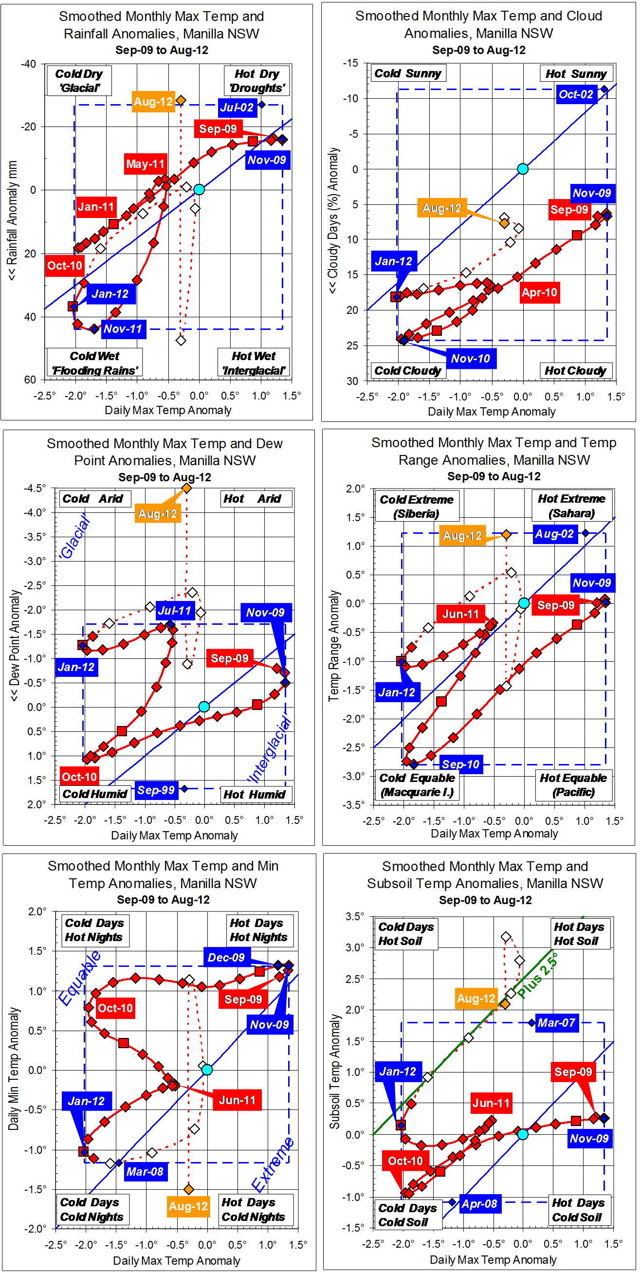
Parametric plots of smoothed climate variables at Manilla
“Retreat from drought”
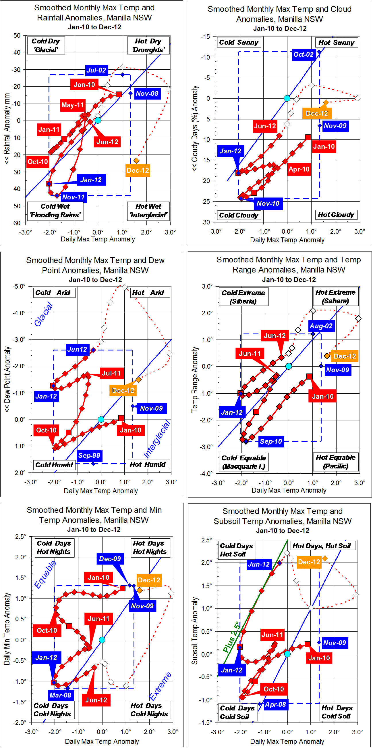
In December, the anomaly of daily maximum temperature retreated from the November extreme of +3 degrees to +1.5 degrees. Dew Point and daily temperature range also retreated from drought values. Cloudiness remained normal and daily minimum temperature high. Subsoil temperature returned to the very high values of the winter months.
The variables maximum temperature, minimum temperature, and temperature range are now close to the smoothed values they had three years ago, in December 2009.
Fully-smoothed data (in red) for June 2012 have reached new records for low Dew Point anomaly (-2.61 degrees) and for high subsoil temperature anomaly (+1.99 degrees).
Note: Fully smoothed data – Gaussian smoothing with half-width 6 months – are plotted in red, partly smoothed data uncoloured, and raw data for the last data point in orange. January data points are marked by squares. Blue diamonds and the dashed blue rectangle show the extreme values in the fully smoothed data record since September 1999.