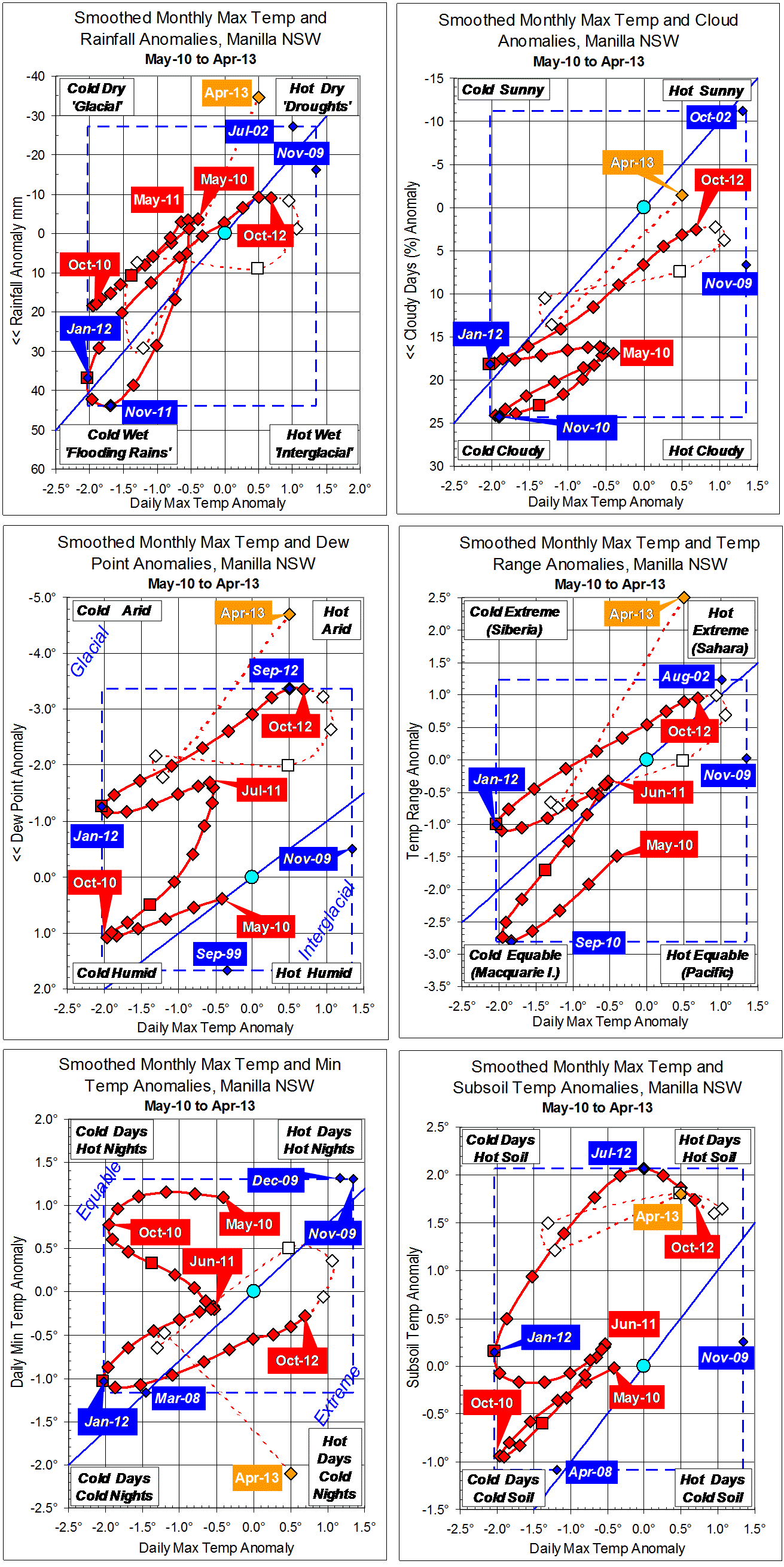
Parametric plots of smoothed climate variables at Manilla
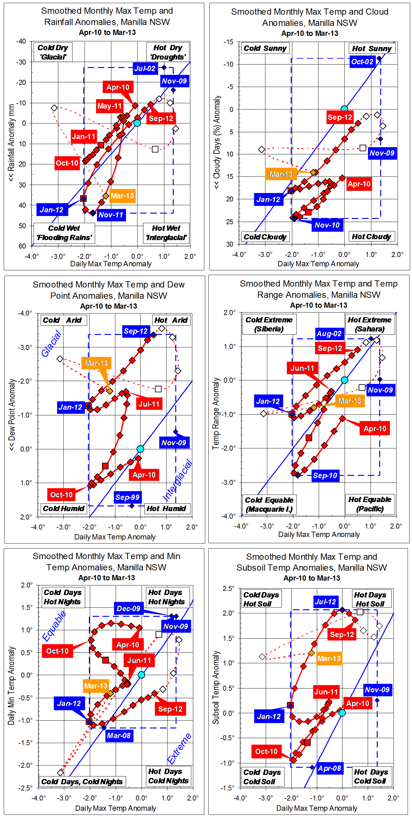
“Still warm; not quite so dry”
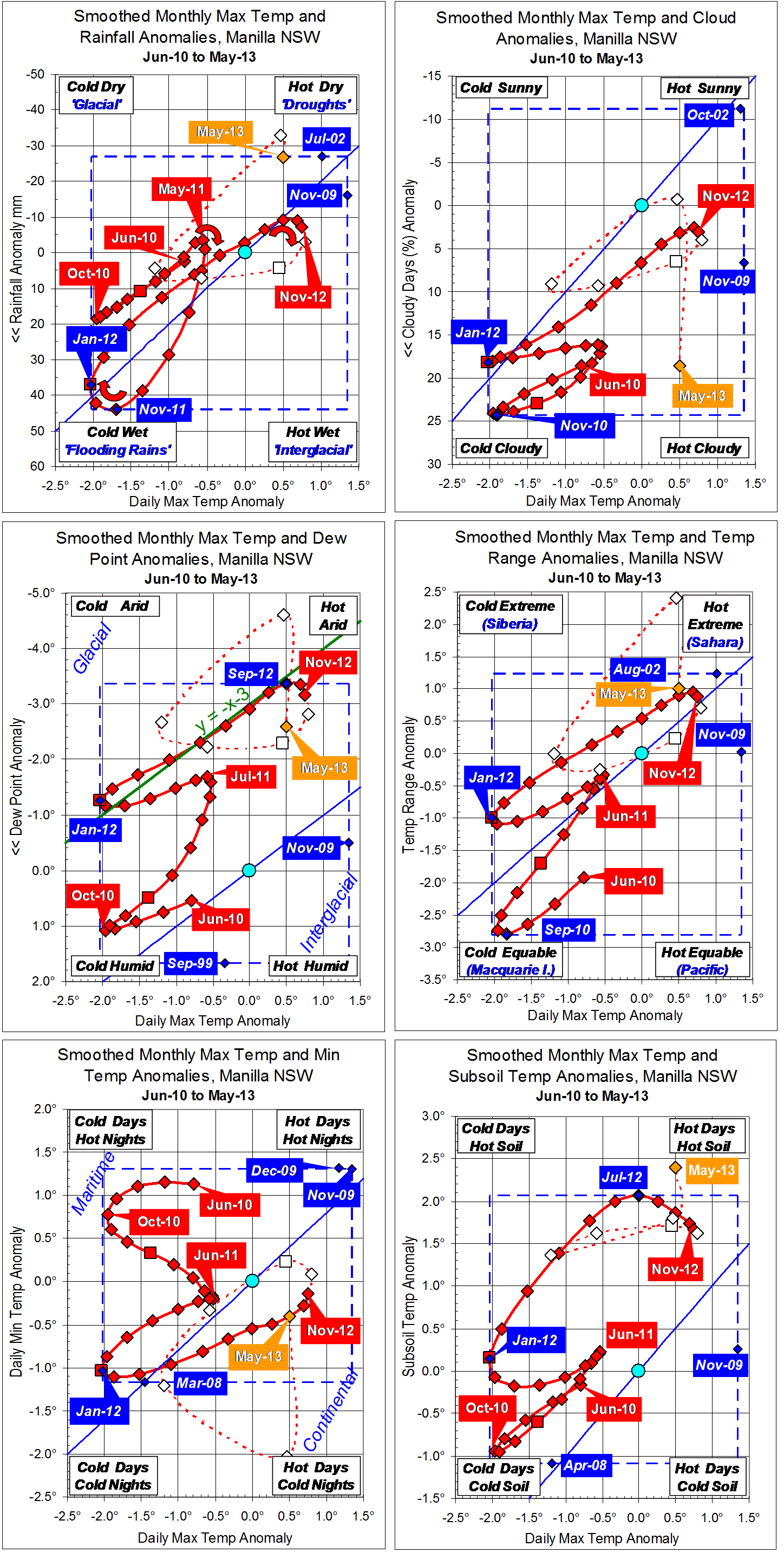
May continued warm, but not quite so dry. Skies became cloudy again, and minimum temperature rose back to normal.
Points in red for November 2012 complete fully-smoothed data for spring 2012. They define a reversal of climate. Anomalies of moisture variables (rainfall, cloud, dew point, and (minus) temperature range) peaked in the “drought” sense in September or October. The anomaly of daily maximum temperature peaked (probably) in November, and that of daily minimum temperature peaked later (date uncertain).
The curved red arrows on the first graph emphasise the fact that, for these peaks and troughs, temperature extremes came a month or more after rainfall extremes.
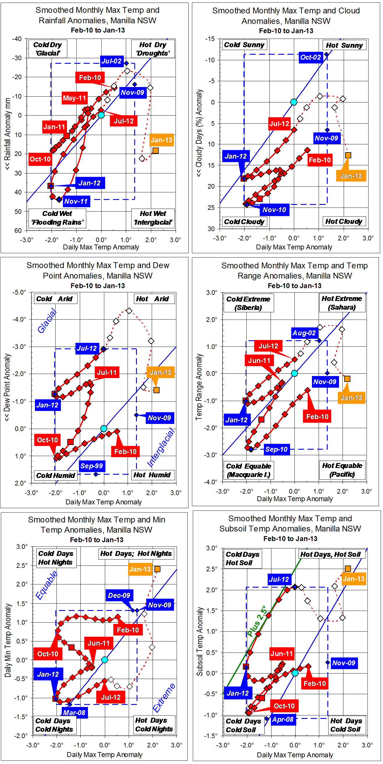
ENSO and this 3-year temperature-rainfall-humidity record
I discussed the match between Manilla climate variation at this time and the El Niño – Southern Oscillation in a post on the weatherzone forum thread “ENSO Discussion 2013”: Post #1195723 of 26 May 2013.
Note: Fully smoothed data – Gaussian smoothing with half-width 6 months – are plotted in red, partly smoothed data uncoloured, and raw data for the last data point in orange. January data points are marked by squares. Blue diamonds and the dashed blue rectangle show the extreme values in the fully smoothed data record since September 1999.