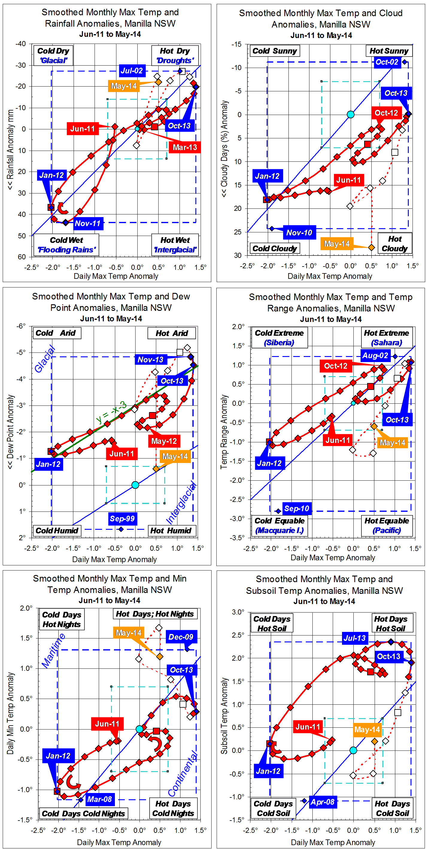
Parametric plots of smoothed climate variables at Manilla
“Climate normal for now”

June data (orange)
Raw anomaly values for June 2014 have nothing in common with the droughty conditions at the end of 2013. Daily maximum temperature and rainfall (top left graph) are both normal. A return to a moist climate, like that in spring 2011, shows as cloudy skies (top right), high dew point (mid left), and narrow temperature range (mid right). Daily minimum temperature (lower left) has moved independently to a high value (that is, very warm nights). Only subsoil temperature (lower right) has jumped back to warm 2013 values, after a period of normalcy.
Fully smoothed data (red)
December 2013 is now the latest fully-smoothed data point. It seems to mark the point of lowest rainfall and dew point anomalies in recent months. In other variables (except daily minimum temperature) December continued a retreat from recent extreme (drought) values.
Note:
Fully smoothed data – Gaussian smoothing with half-width 6 months – are plotted in red, partly smoothed data uncoloured, and raw data for the last data point in orange. January data points are marked by squares.
Blue diamonds and the dashed blue rectangle show the extreme values in the fully smoothed data record since September 1999.
Normal values are based on averages for the decade from March 1999. They appear on these graphs as a turquoise (turquoise) circle at the origin (0,0). A range of anomalies called “normal” is shown by a dashed rectangle in aqua (aqua). For values in degrees, the assigned normal range is +/-0.7°; for cloudiness, +/-7%; for monthly rainfall, +/-14 mm.