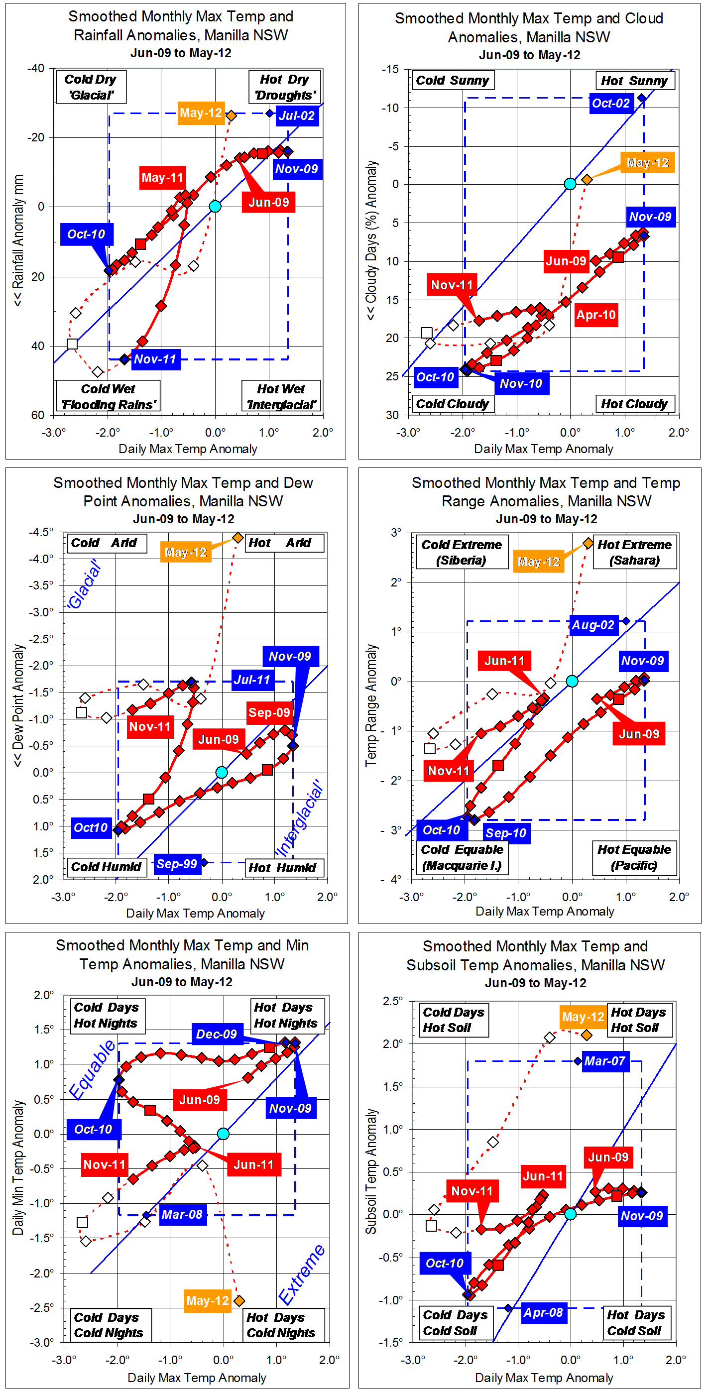
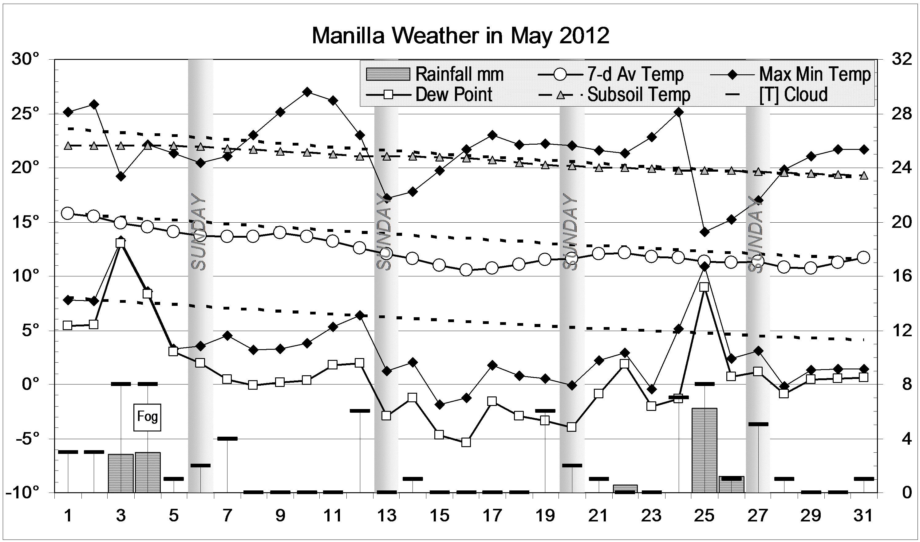
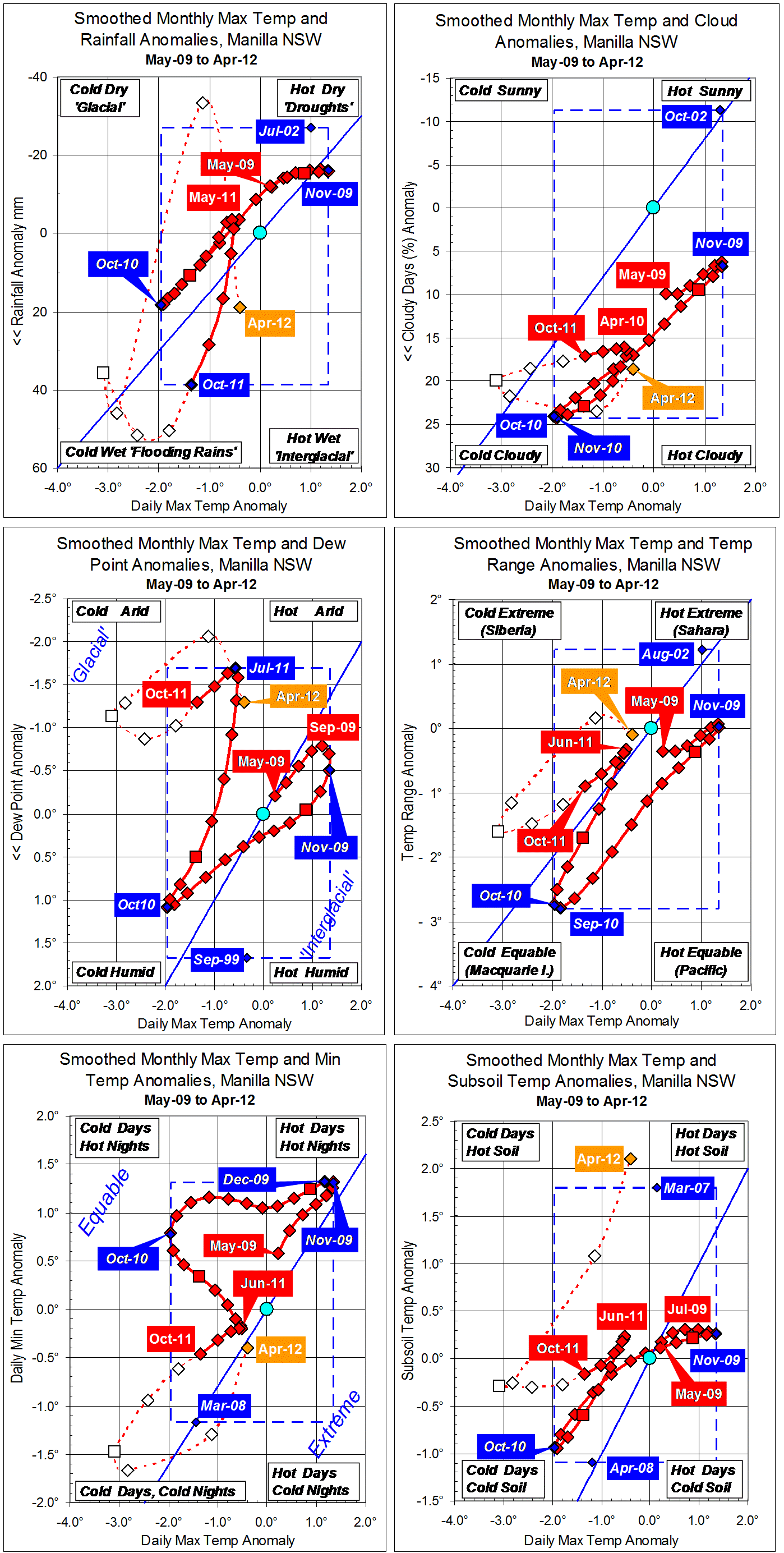
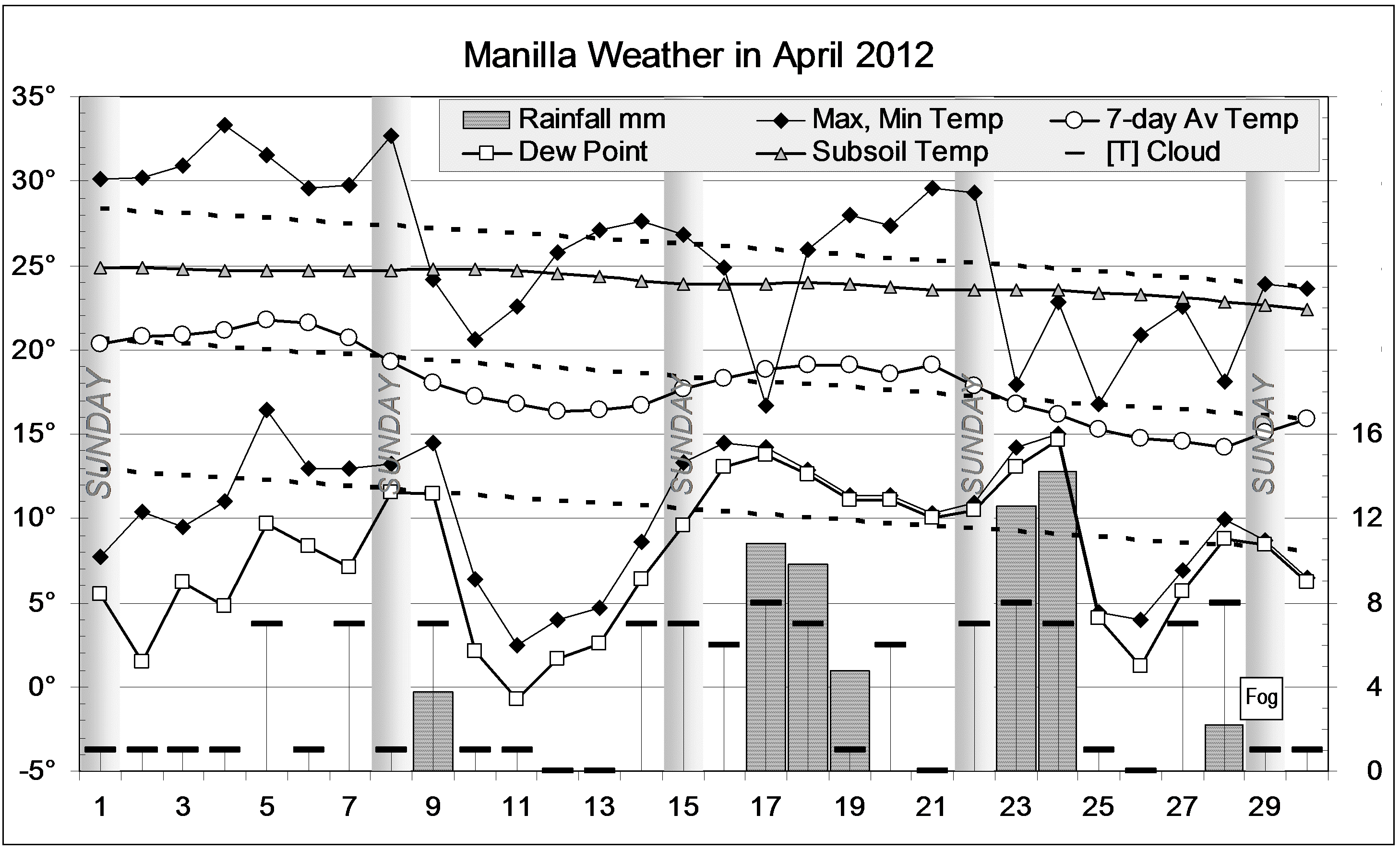
After the cold, wet summer, autumn weather was normal, like last year. Days were warm in early April, and nights cold in mid-May. Rain was rather light: the four days with more than 10 mm of rain came in late April.
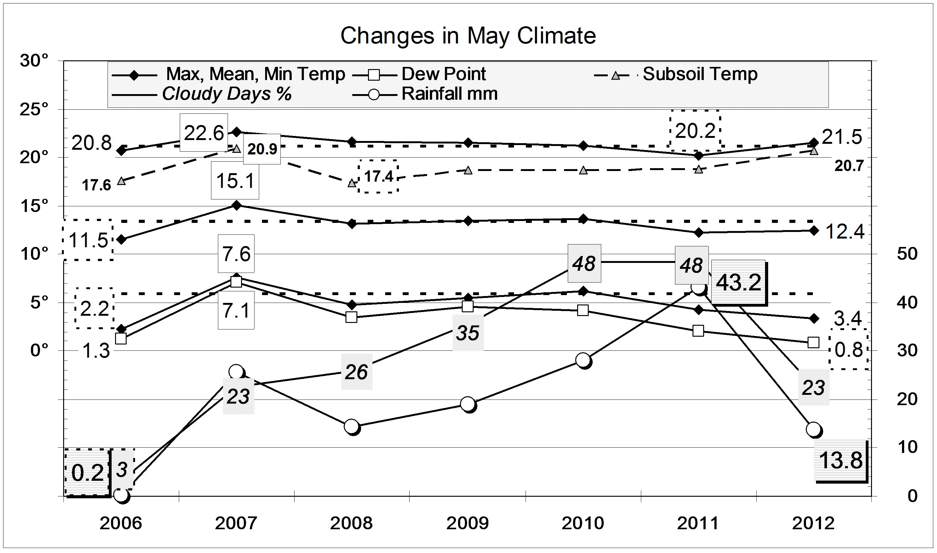
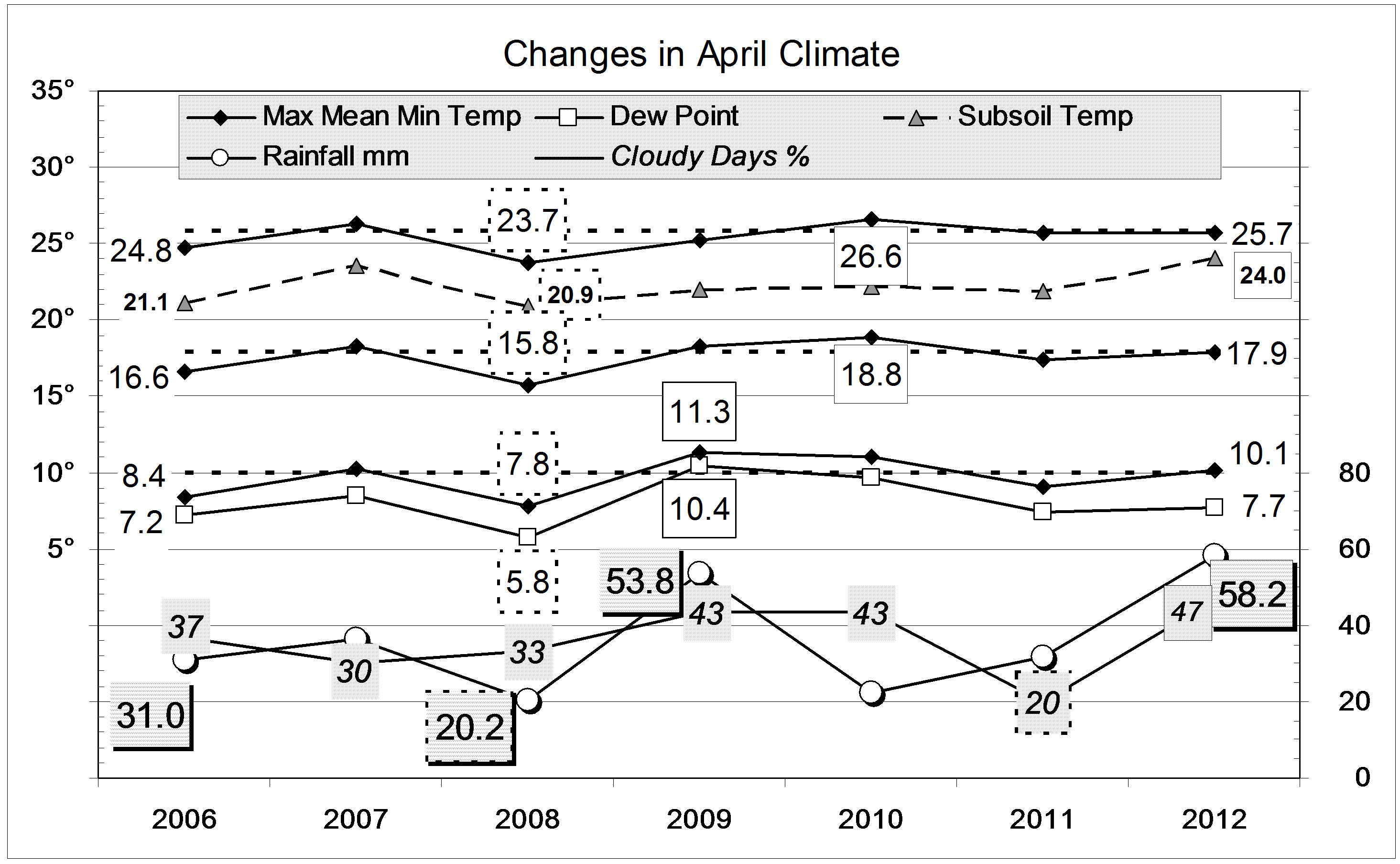
Average air temperatures were close to normal, but the early morning Dew Point was 2.1 degrees down, showing very dry air, as in autumn 2008. The subsoil was very warm.
While the percentage of mornings with more than 4/8 cloud (39%) was lower than in the last two autumns, it is still nearly twice that of autumns in the previous decade, which averaged just 25%.
Rain fell on 16 days (normally 12), but the total rainfall of 87.4 mm is only on the 35th percentile for autumn. Like autumns in 2009 and 2010, it is about 45 mm below the average (133 mm). Nevertheless, an enormous amount of rain fell in spring, summer, and autumn taken together: 852 mm! Only 1956 and 1890 had more rain in those three seasons: 1012 mm and 939 mm.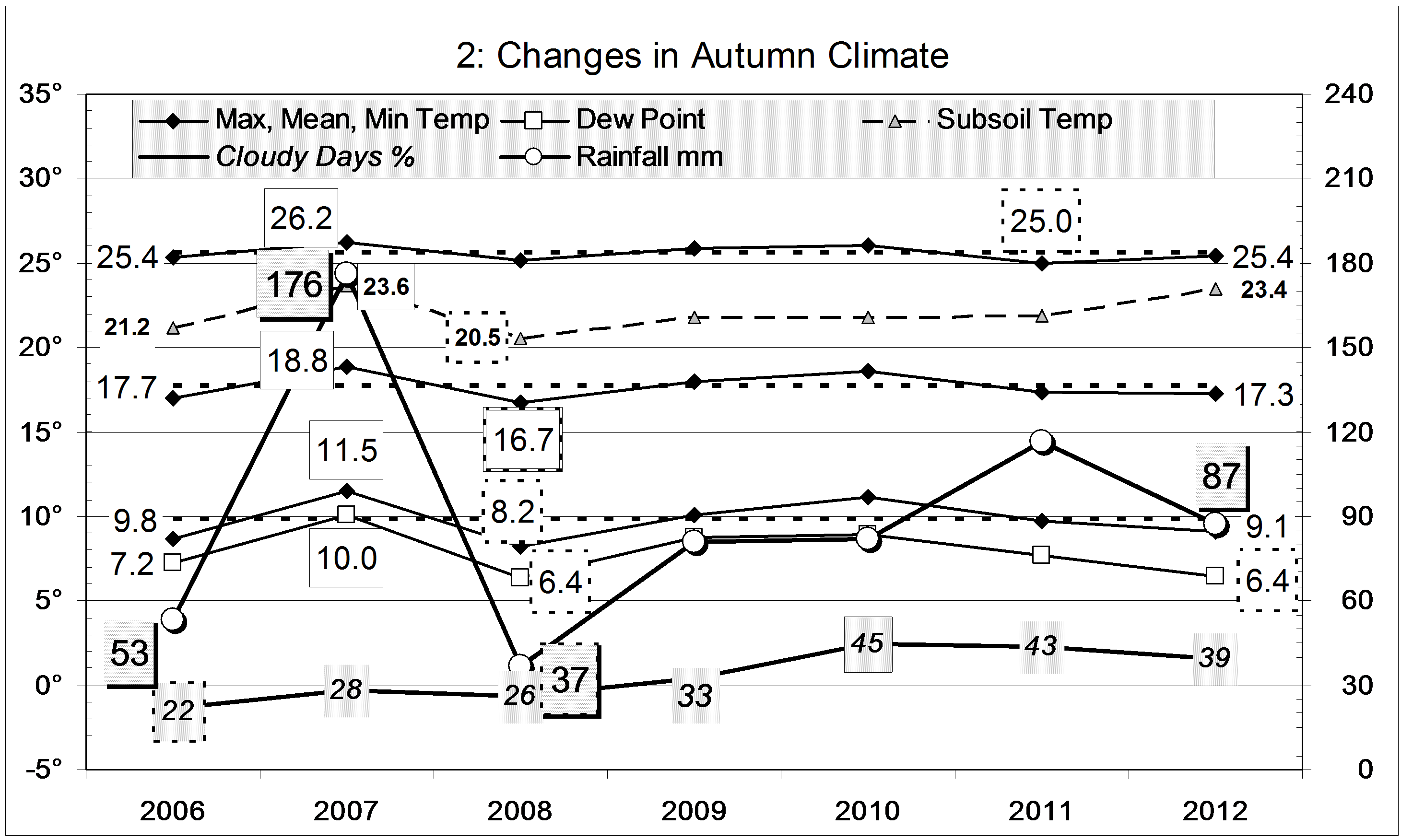
Data. Rainfall data is from Manilla Post Office, courtesy of Phil Pinch. Temperatures, including subsoil at 750 mm, and other data are from 3 Monash Street, Manilla.