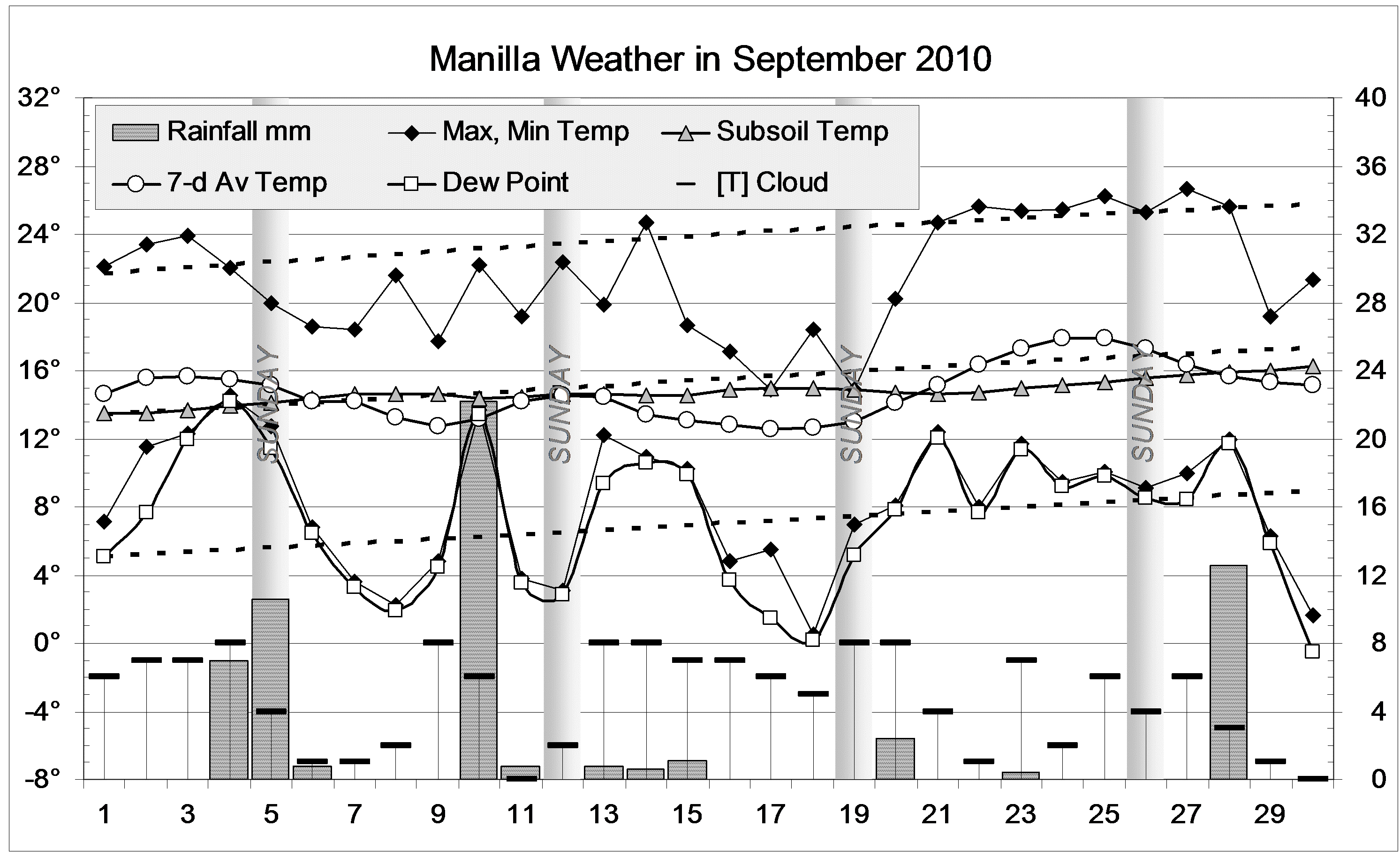
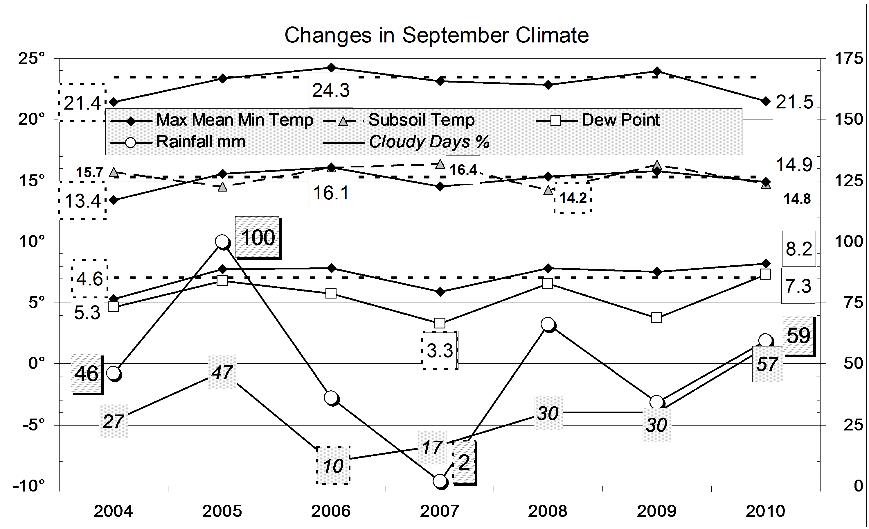
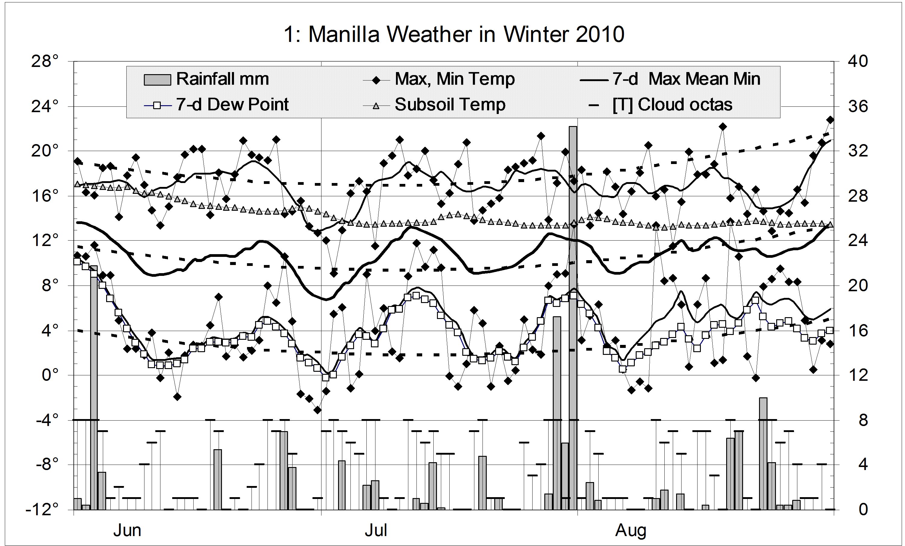
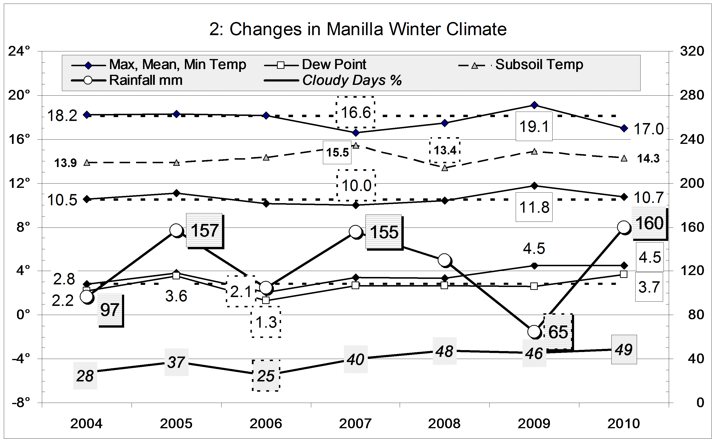
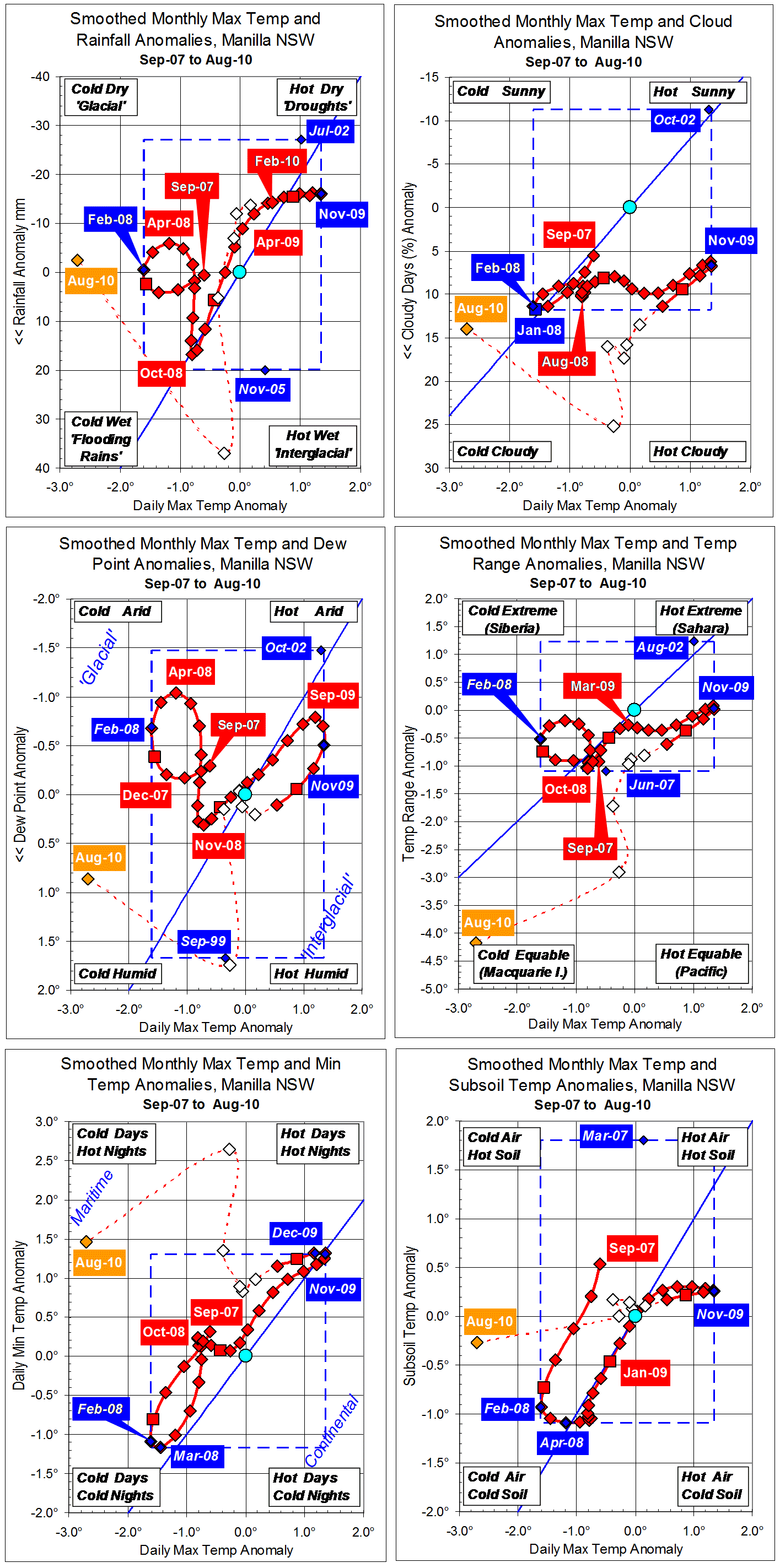
Parametric plots of smoothed climate variables at Manilla
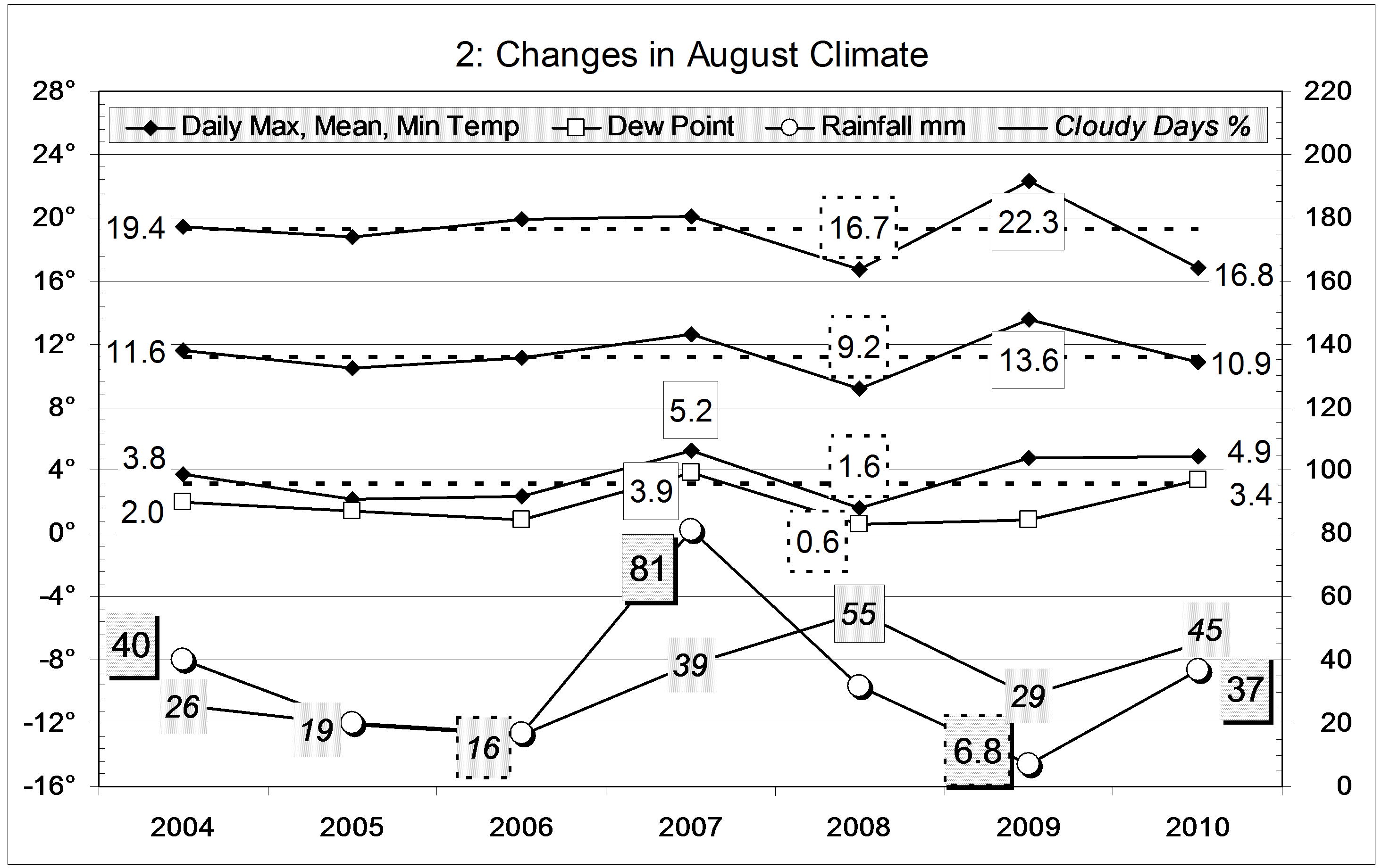
“Summer retreated from drought”

Manilla’s recent climate continues to be marked mainly by cloudier skies and a narrower daily temperature range than in the 12-year averages.
In the current plots we see final smoothed trends for summer (DJF) of 2009-10.
Daily maximum temperature anomaly is shown on the x-axis of each plot. The minimum value in Feb 2008 (-1.61) and maximum value in Nov 2009 (+1.35) are also the extremes (in blue) of the smoothed data set. In summer 2009-10 the smoothed temperature anomaly fell much faster than it had risen in the previous winter and spring. During autumn the max temp anomaly was near zero, and the raw value for August is so low (cold) the scale has had to be extended.
Monthly total rainfall anomaly is on the y-axis (inverted) of the first graph. It showed a very mild drought throughout the last winter, spring, and summer. Autumn seems to have been less droughty, much like the previous autumn, but with the opposite trend. Recently, July 2010 was very wet, but August rainfall was normal.
The anomaly of per cent cloudy mornings fell during winter 2009 as the maximum temperature anomaly rose. During summer 2009-10 it rose again as the maximum temperature anomaly fell. However, for a given maximum temperature anomaly the cloudiness anomaly was now more positive (it was cloudier). Since the end of summer, skies have been extremely cloudy
On the graph for early morning dew point anomaly, the final year’s data plots like that of the cloudiness graph. However, dew point anomalies were not so positive: in winter and spring 2009 they were quite strongly negative. By autumn 2010, dew points seem normal, and recent values are high (humid climate).
For daily temperature range anomaly, again, the last year’s pattern on this graph is like that on the previous two graphs. In this case, values low on the graph are negative anomalies, representing narrow daily temperature ranges. For a given maximum temperature anomaly, the anomaly of daily temperature range was lower during the summer than it had been the previous winter.
(Note on the “Macquarie Island” label. This August Manilla’s anomalously low maximum temperature (16.8°) is actually much higher than that of Macquarie Island (5.0°), and the anomalously narrow daily temperature range (11.9°) is still much wider than that of Macquarie Island (3.5°).)
In the case of daily minimum temperature anomaly, summer 2010 began with a maximal value, and the value stayed high through the season. Values may have been lower in autumn, then they seem to have risen even higher (very warm nights).
World-wide low temperature
At Manilla, in early 2008 there were record low values of daily minimum temperature, daily maximum temperature and subsoil temperature. These did NOT come with high rainfall and high dew point as would occur in a “flooding rains” peak of the quasi-biennial oscillation. They match low temperature at that time world-wide.
Subsoil temperature anomalies have remained close to zero for 17 months, despite big changes in the anomalies of other temperatures.
Note:
Fully smoothed data – Gaussian smoothing with half-width 6 months – are plotted in red, partly smoothed data uncoloured, and raw data for the last data point in orange. January data points are marked by squares.
Blue diamonds and the dashed blue rectangle show the extreme values in the fully smoothed data record since September 1999.