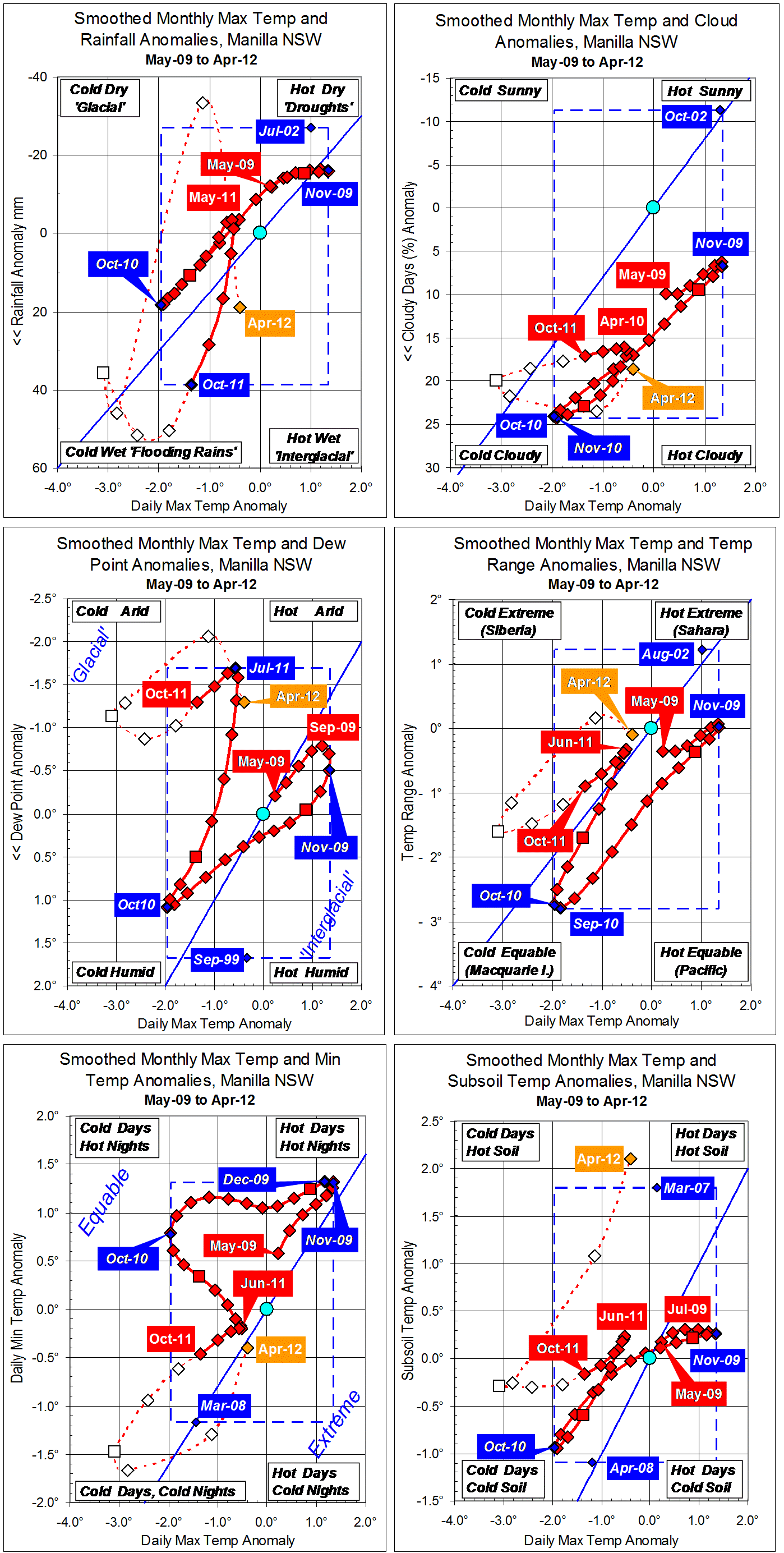
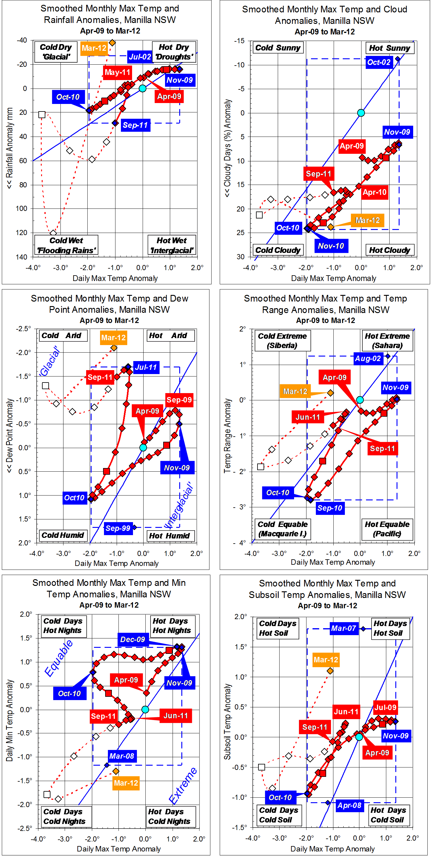
Parametric plots of smoothed climate variables at Manilla
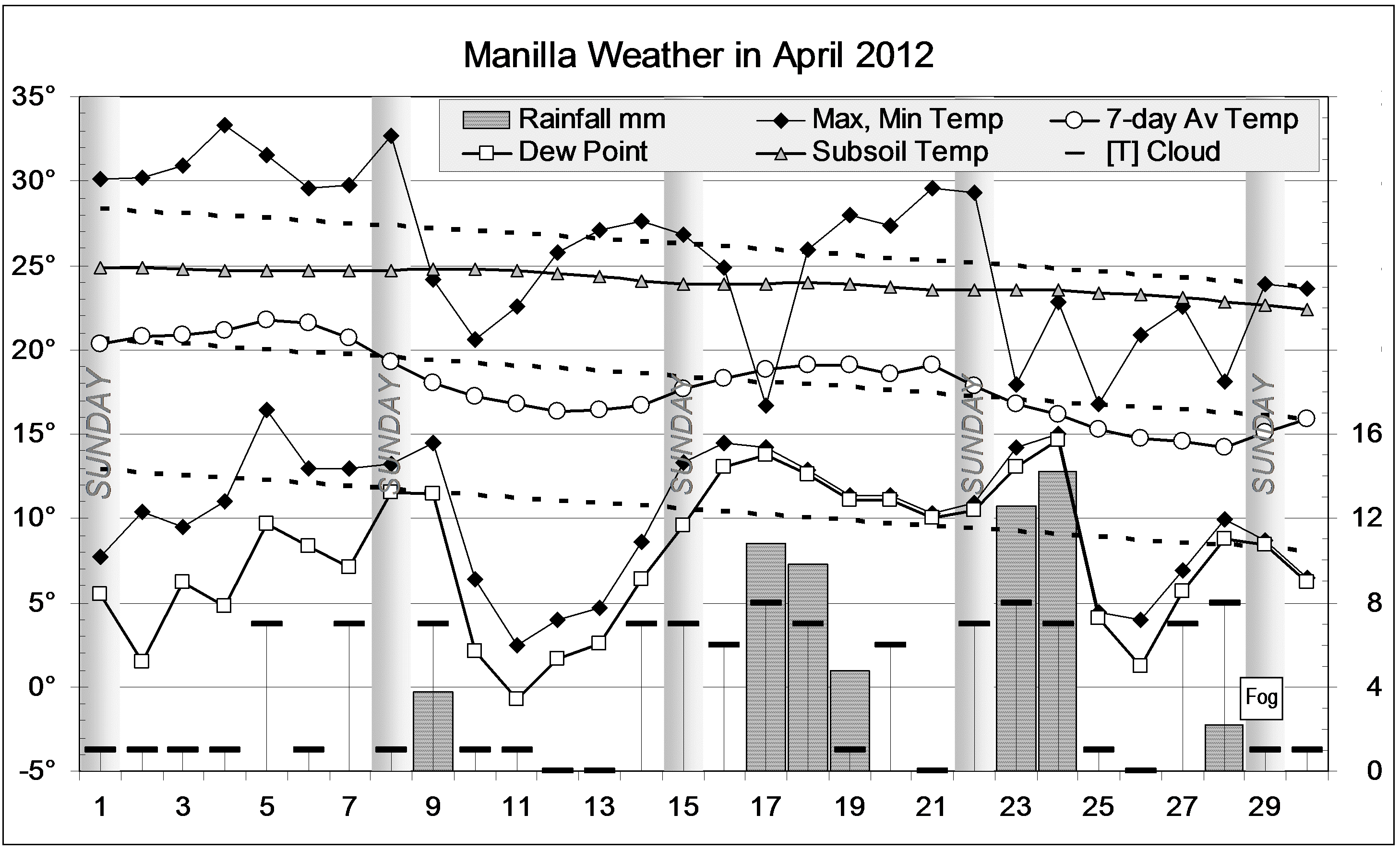
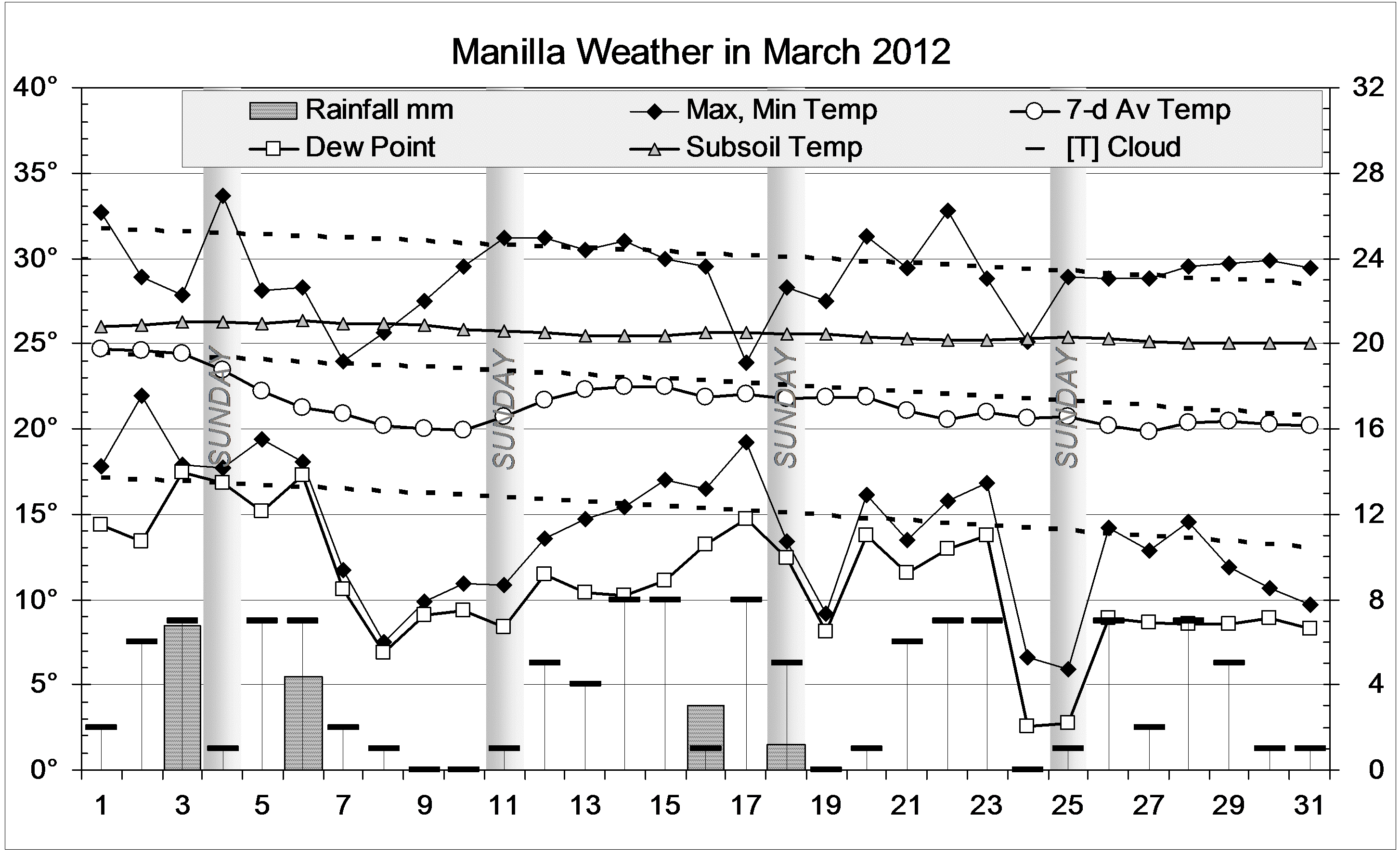
“April 2012 like winter 2011”
New raw data for April 2012 anomalies are quite similar to the smoothed values for winter 2011 for all variables but one: subsoil temperature is very high, as it has not been since March 2007.
As in winter 2011, most anomalies are near zero, but skies are very cloudy and, paradoxically, Dew Points are very low.
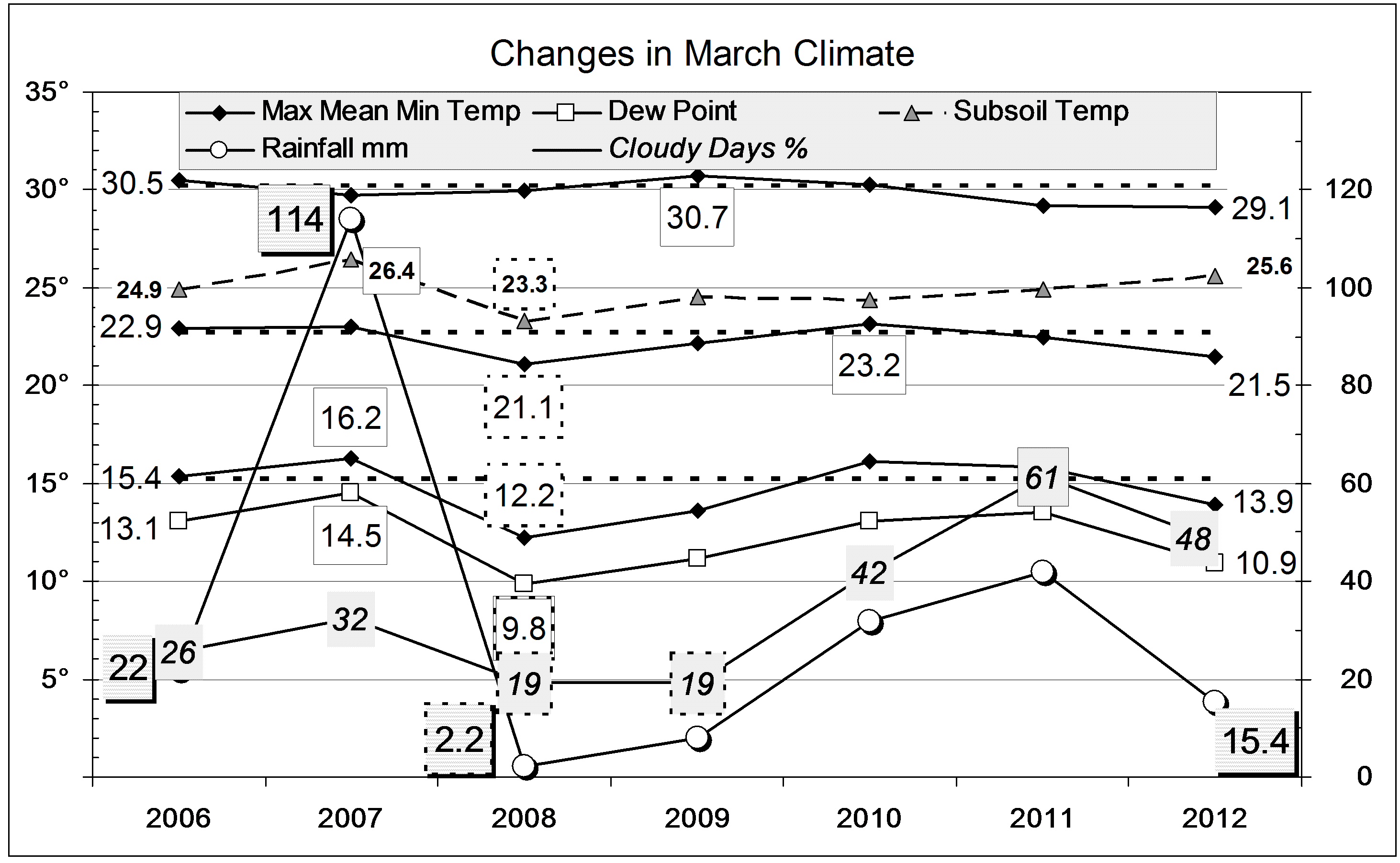
Record rainfall anomaly
Fully-smoothed data points for October 2011 include a new 13-year record high monthly rainfall anomaly of +38.6 mm (first graph). This beats the record set the previous month by 10 mm, but it will be beaten the following month by a similar margin. Smoothed rainfall anomalies in the last months of 2011 will be well over twice as high as those in the last months of 2010.
Note: Fully smoothed data – Gaussian smoothing with half-width 6 months – are plotted in red, partly smoothed data uncoloured, and raw data for the last data point in orange. January data points are marked by squares. Blue diamonds and the dashed blue rectangle show the extreme values in the fully smoothed data record since September 1999.
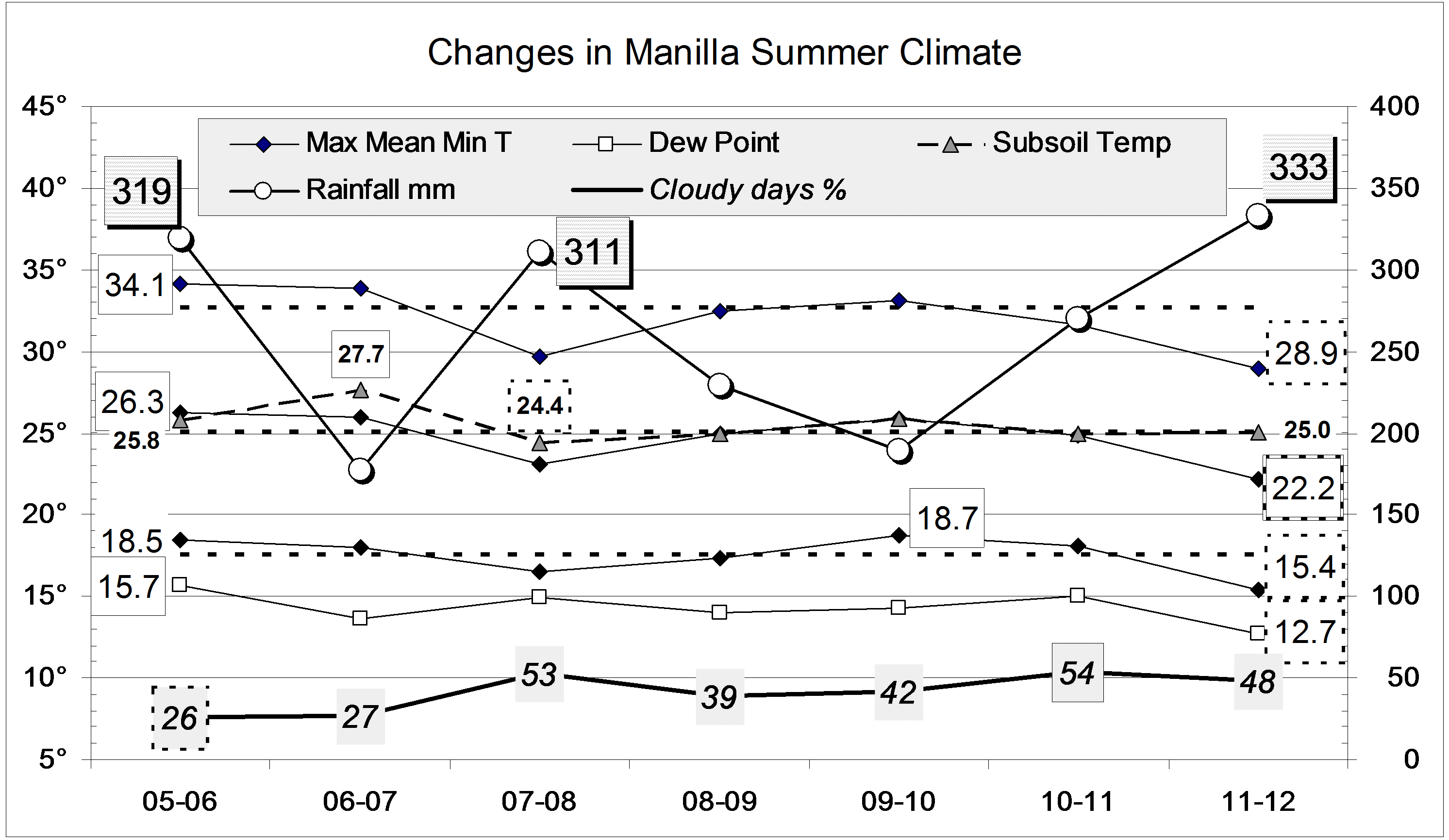
 In the whole of this summer, only 3 days went over 35° (usually 23) and only 5 nights went over 20° (usually 19).