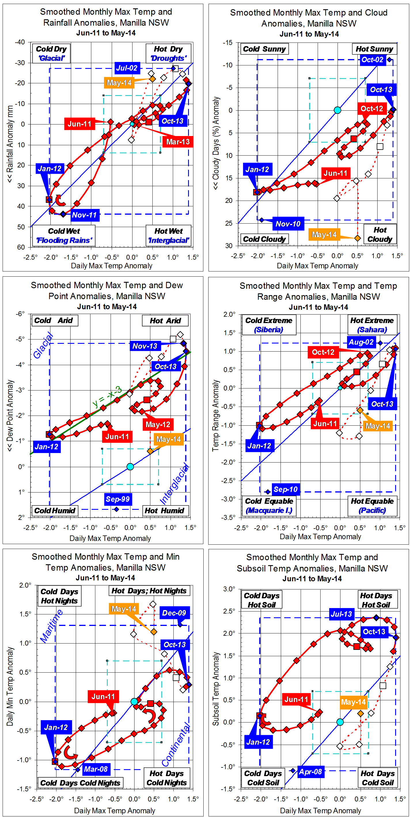
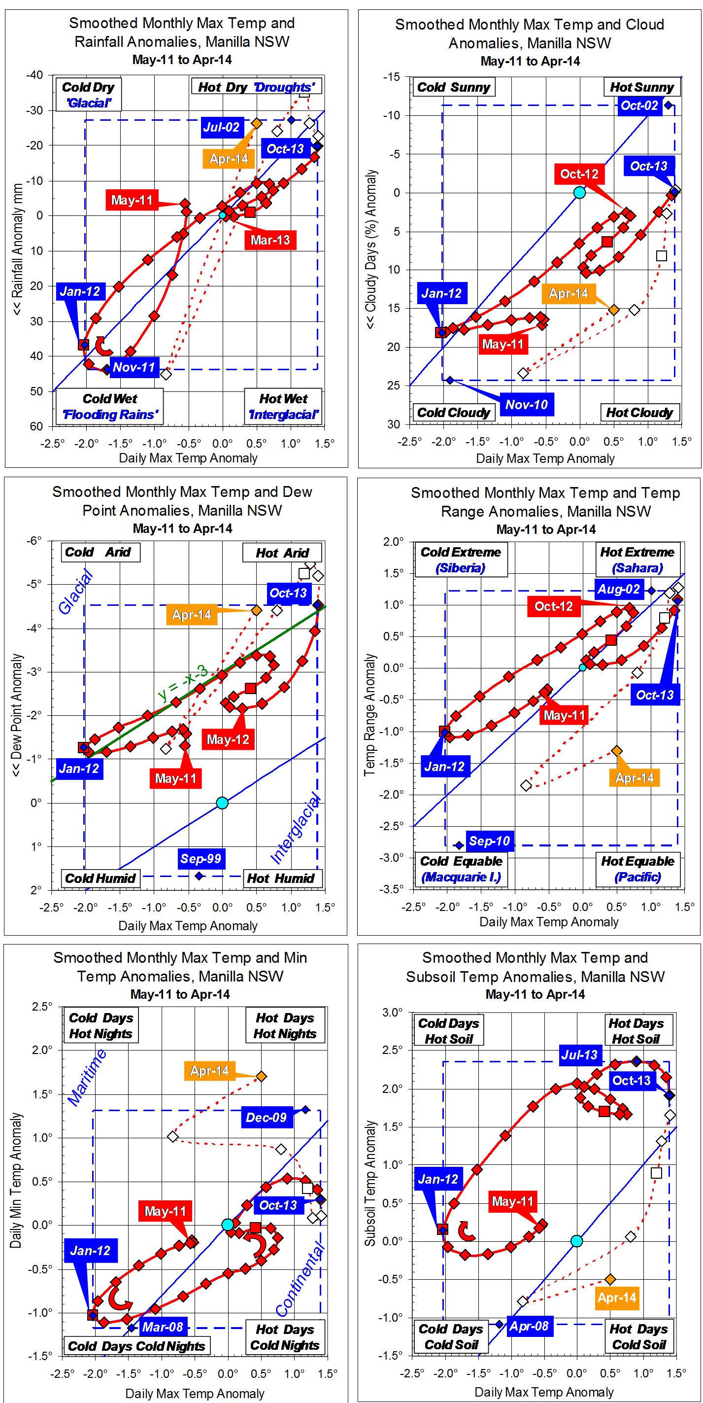
Parametric plots of smoothed climate variables at Manilla
“July 2014 dry again”

July data (orange)
Most raw anomaly values for July have now moved back to be like the smoothed values during the summer drought. Very few of the partially-smoothed values during the last few months suggested a trend in this direction.
Fully smoothed data (red)
January 2014 is now the latest fully-smoothed data point. Through November, December and January all variables moved decisively away from drought, except for rainfall and daily minimum temperature. In those months, rainfall remained near a (drought) minimum. Daily minimum temperature (which has a cryptic relation to drought) increased, bringing very warm nights in autumn.
Note:
Fully smoothed data – Gaussian smoothing with half-width 6 months – are plotted in red, partly smoothed data uncoloured, and raw data for the last data point in orange. January data points are marked by squares.
Blue diamonds and the dashed blue rectangle show the extreme values in the fully smoothed data record since September 1999.
Normal values are based on averages for the decade from March 1999. They appear on these graphs as a turquoise (turquoise) circle at the origin (0,0). A range of anomalies called “normal” is shown by a dashed rectangle in aqua (aqua). For values in degrees, the assigned normal range is +/-0.7°; for cloudiness, +/-7%; for monthly rainfall, +/-14 mm.