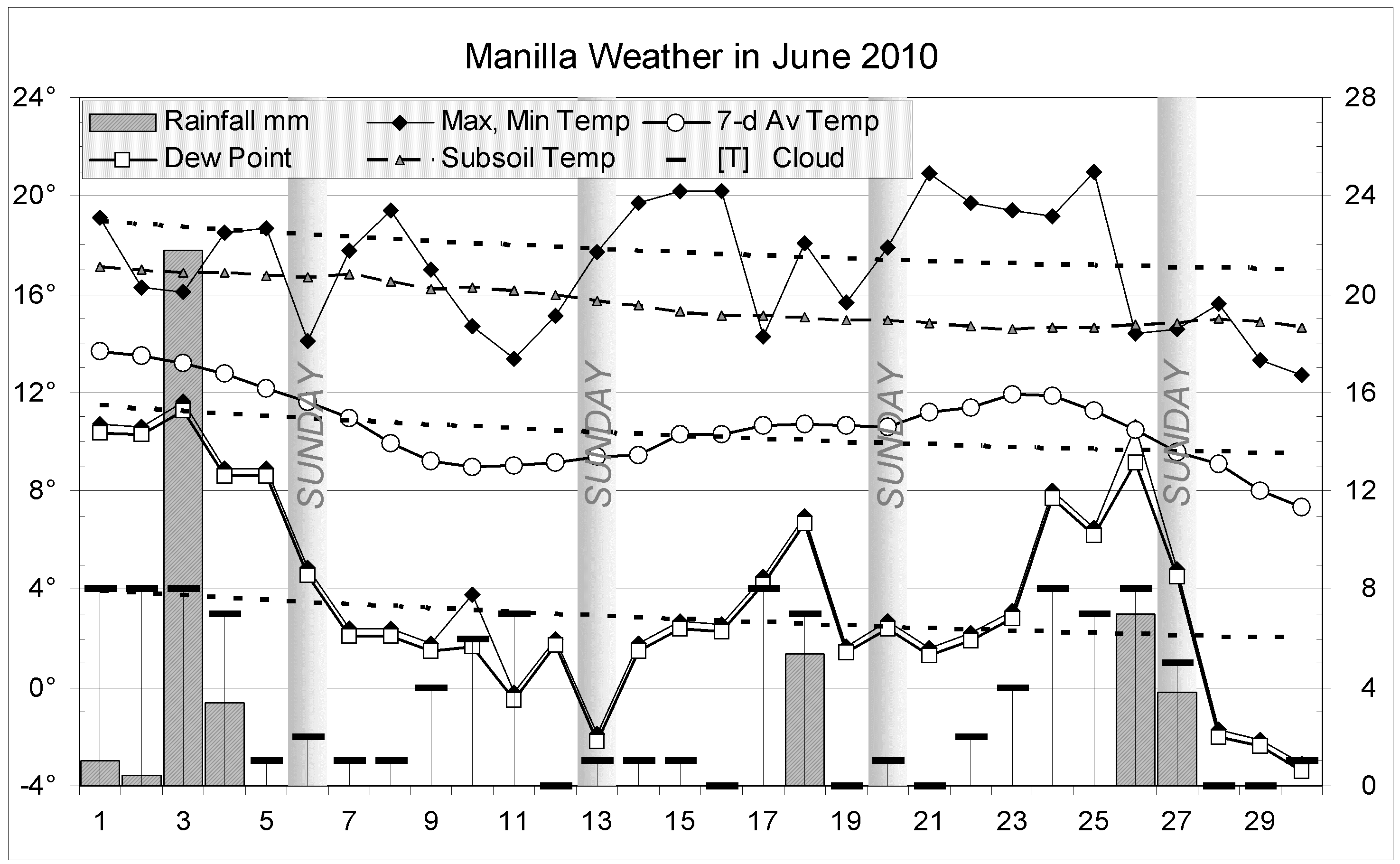
The daily weather log

October days were very cool: no days went above 30°, when usually seven days do, and the 16th, at 14.2°, was 13° below normal. The following night (the only frost) was 10° below normal. A day earlier, overcast skies brought an extremely narrow daily temperature range (2.3°) on the 15th.
Rain fell on 8 days. The highest reading was 20.4 mm on the 4th.
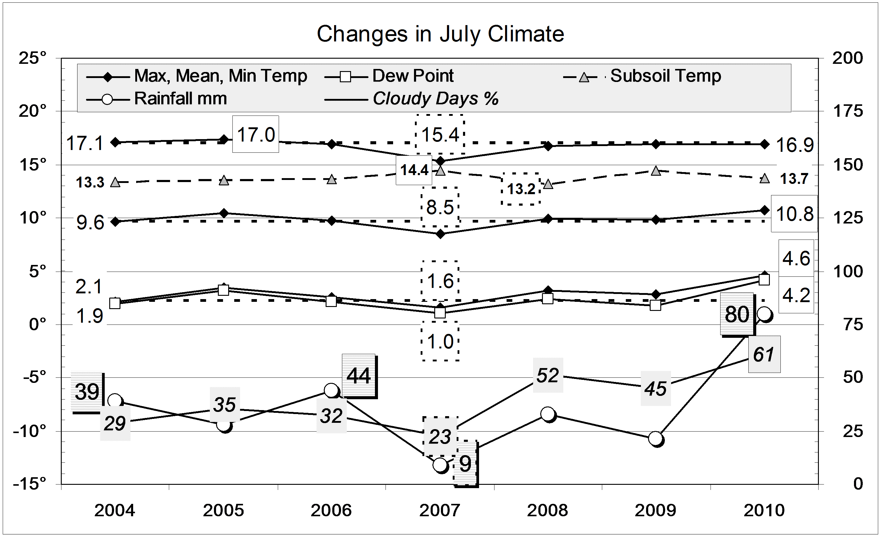
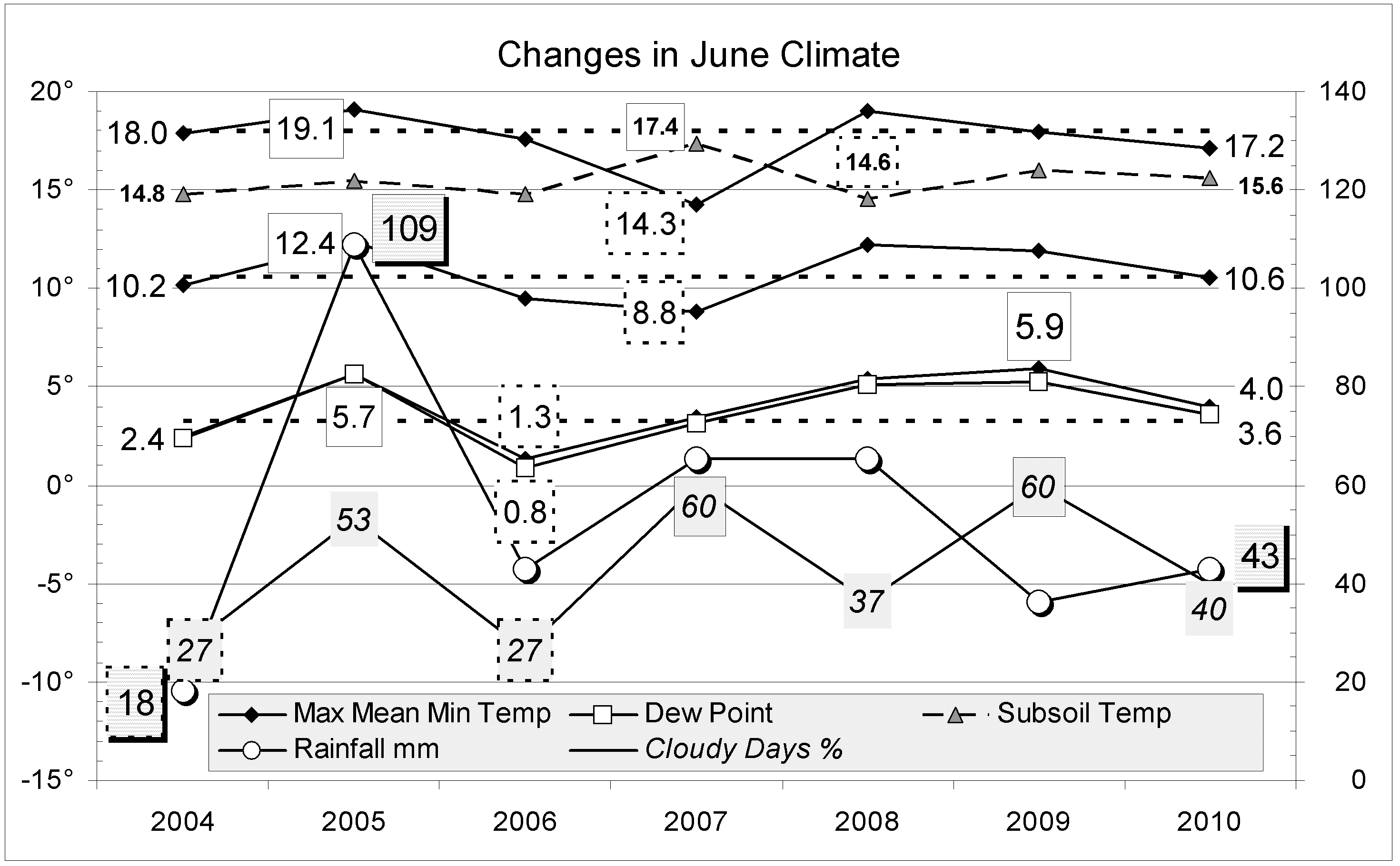
Comparing October months
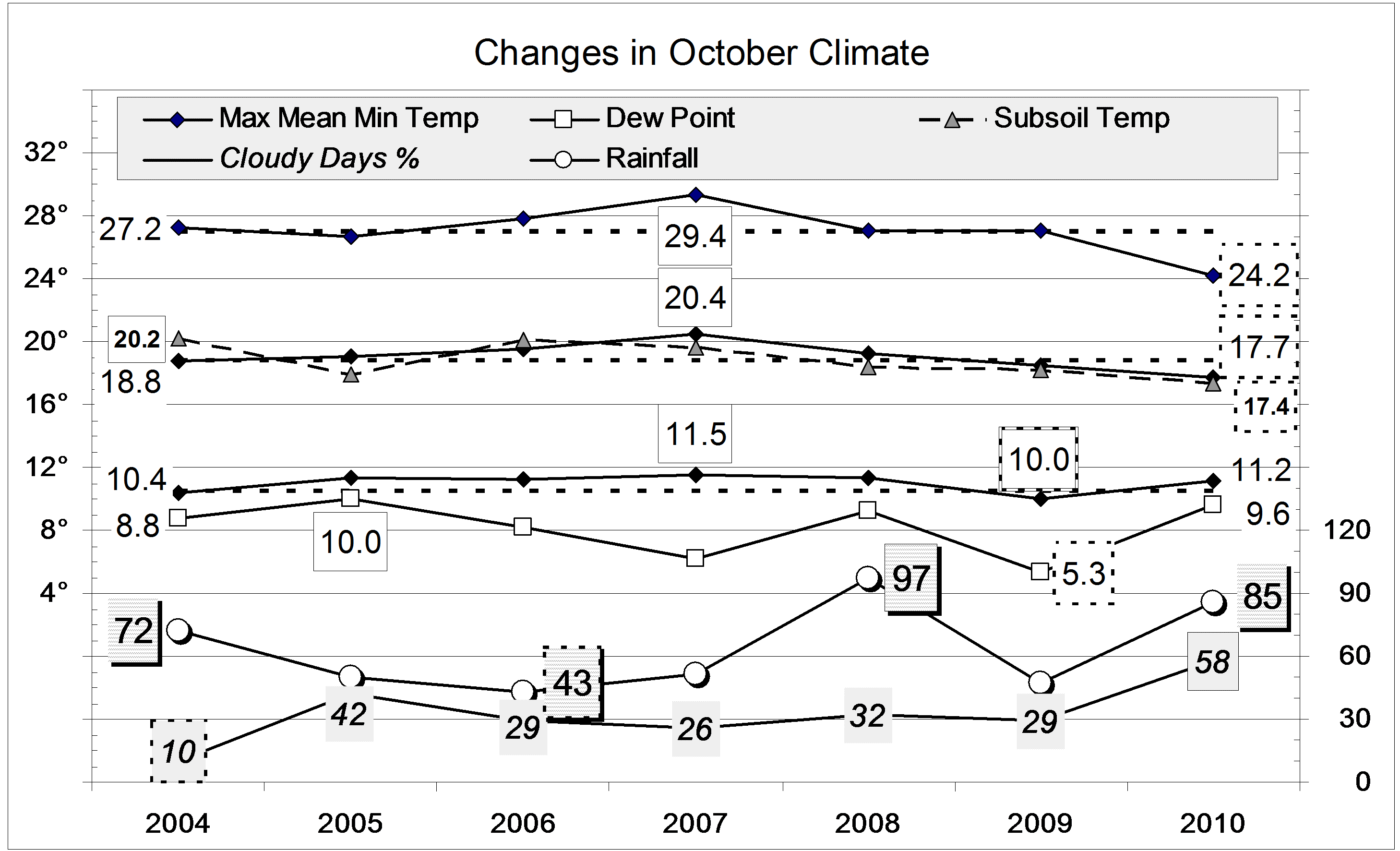
The mean daily maximum temperature (24.2°) was the lowest for October on this 12-year record. The mean daily mean temperature (17.7°) was low, but the mean daily minimum temperature (11.2°) was normal. The mean daily temperature range (13.1°) was a record low value.
Mean subsoil temperature was remarkably low: 17.4° against a 12-year October mean of 19.4°. The month ended with subsoil temperature (then 18.8°) trailing 22 days later than its usual date.
There were more cloudy mornings (58%) than in any October on this record. The mean early morning Dew Point (9.6°) was also high.
The rainfall of 85.4 mm is in the 80th percentile for October, far above the long-term average of 58 mm. Totals for groups of months up to six months are now all above the median, as is the thirty-year total.
Data. Rainfall data is from Manilla Post Office, courtesy of Phil Pinch. Temperatures, including subsoil at 750 mm, and other data are from 3 Monash Street, Manilla.