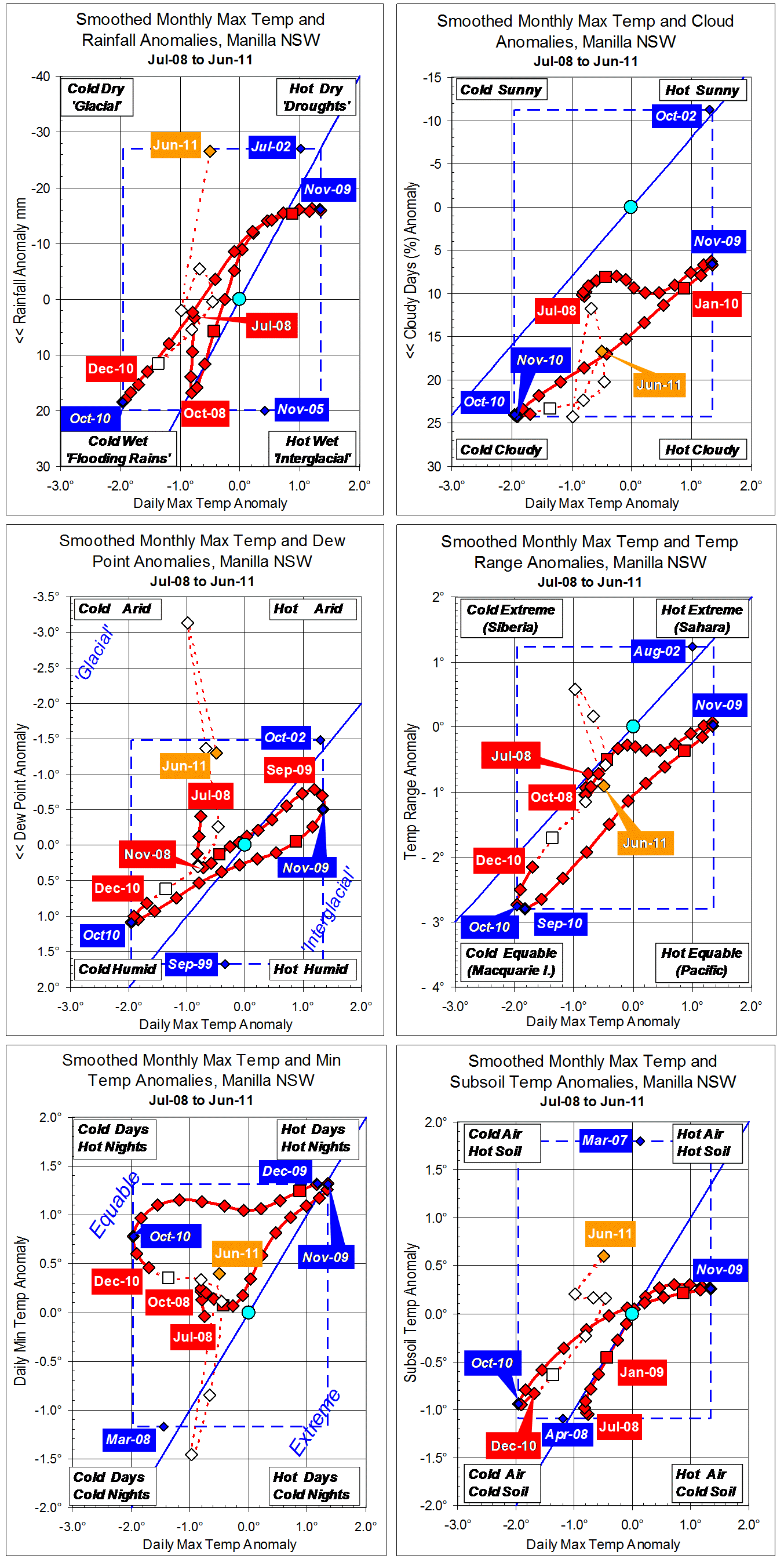
Parametric plots of smoothed climate variables at Manilla
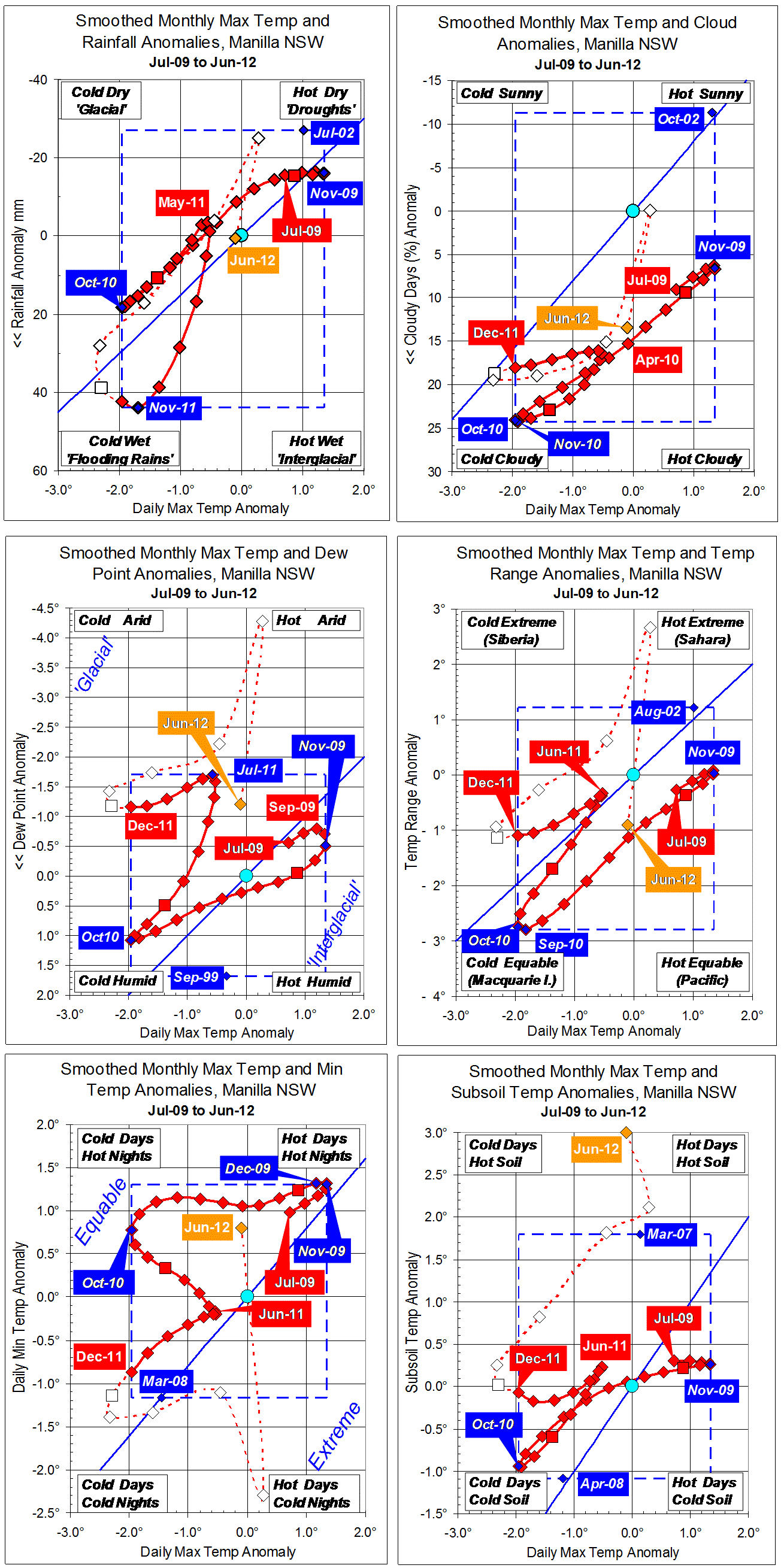
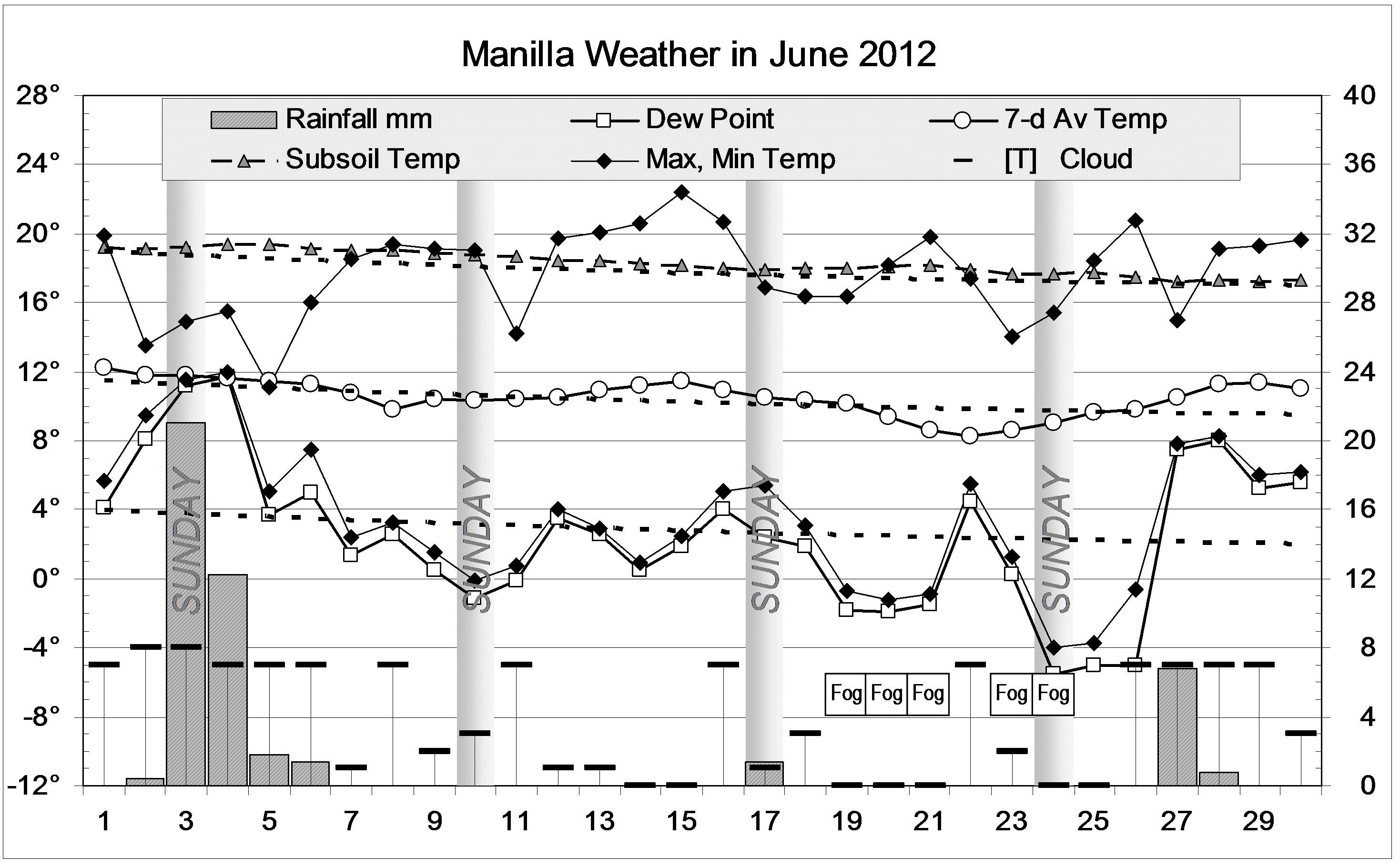
June 2012 anomalies show a return to normalcy for rainfall and maximum temperature. Three moisture-related measures returned to the values of last winter: rather high cloudiness, rather low daily temperature range, and (strangely) rather low Dew Point. Daily min temp returned to the high positive anomaly last seen in 2010.
The subsoil became extraordinarily warm. (Why?)
Fully-smoothed data (in red) show that the 13-year record high monthly rainfall anomaly of November 2011 (+43.8 mm) was not beaten in December, as had seemed likely. The smoothed maximum temperature of December 2011 equalled the record cool anomaly of -1.96 degrees set in October 2010.
Note: Fully smoothed data – Gaussian smoothing with half-width 6 months – are plotted in red, partly smoothed data uncoloured, and raw data for the last data point in orange. January data points are marked by squares. Blue diamonds and the dashed blue rectangle show the extreme values in the fully smoothed data record since September 1999.