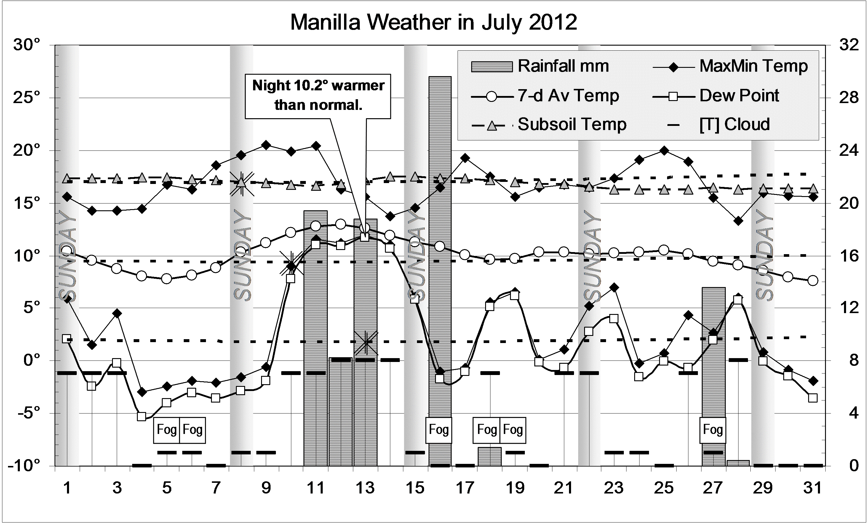
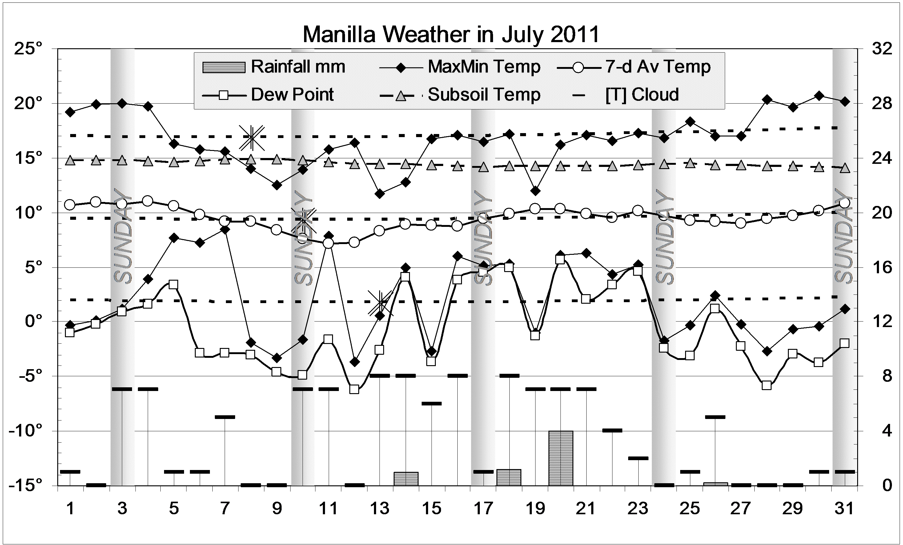
The daily weather log
There were three warm spells and no cold spells in July. Fourteen days went over 20 degrees, instead of the usual four. There were only eleven frosts, the fewest in 15 July months (usually 17). In five rain days, two high rainfall figures came on the 20th (19.2mm) and the 21st (9.6mm).
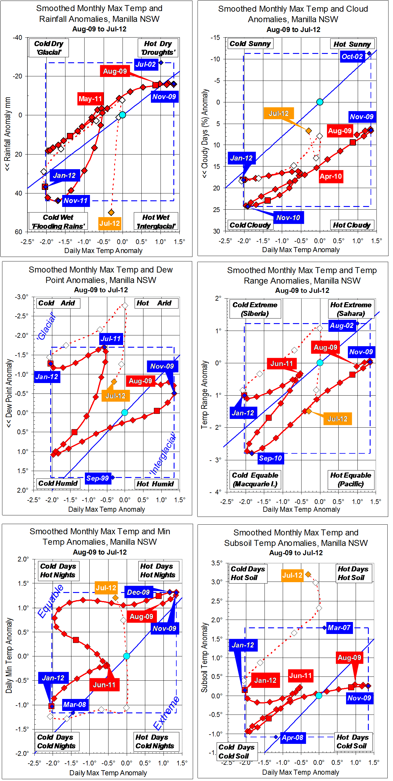
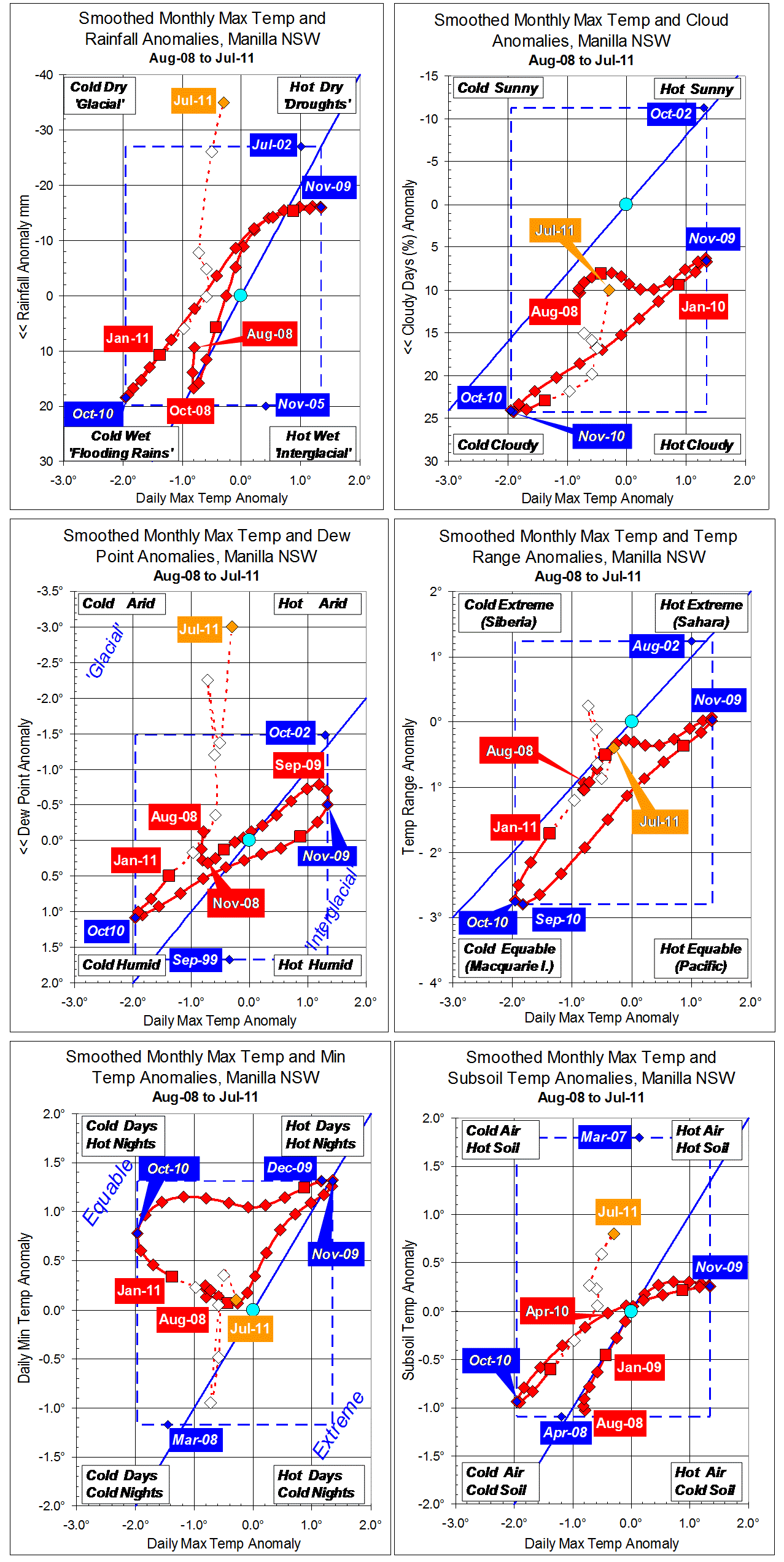
Comparing July months
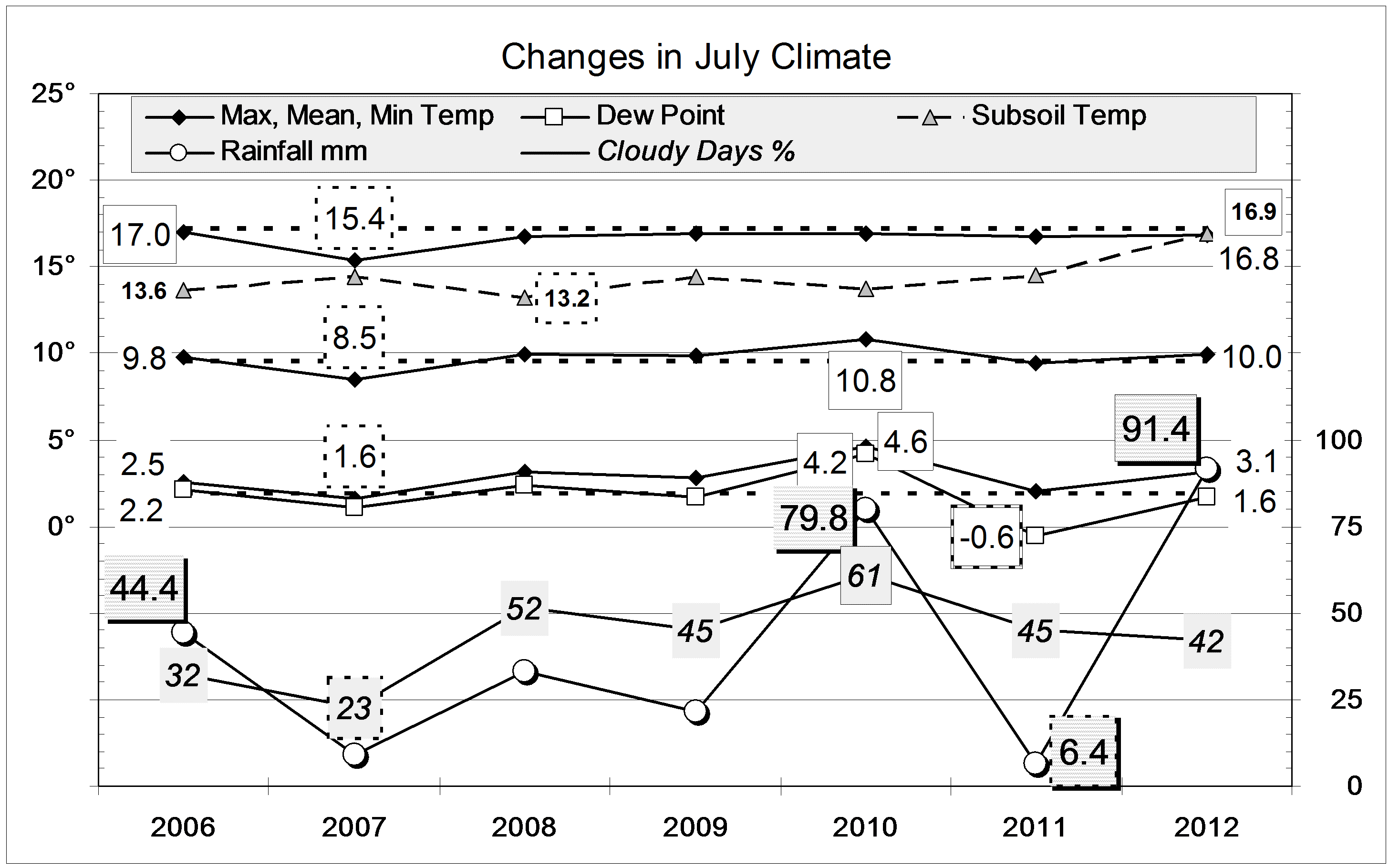
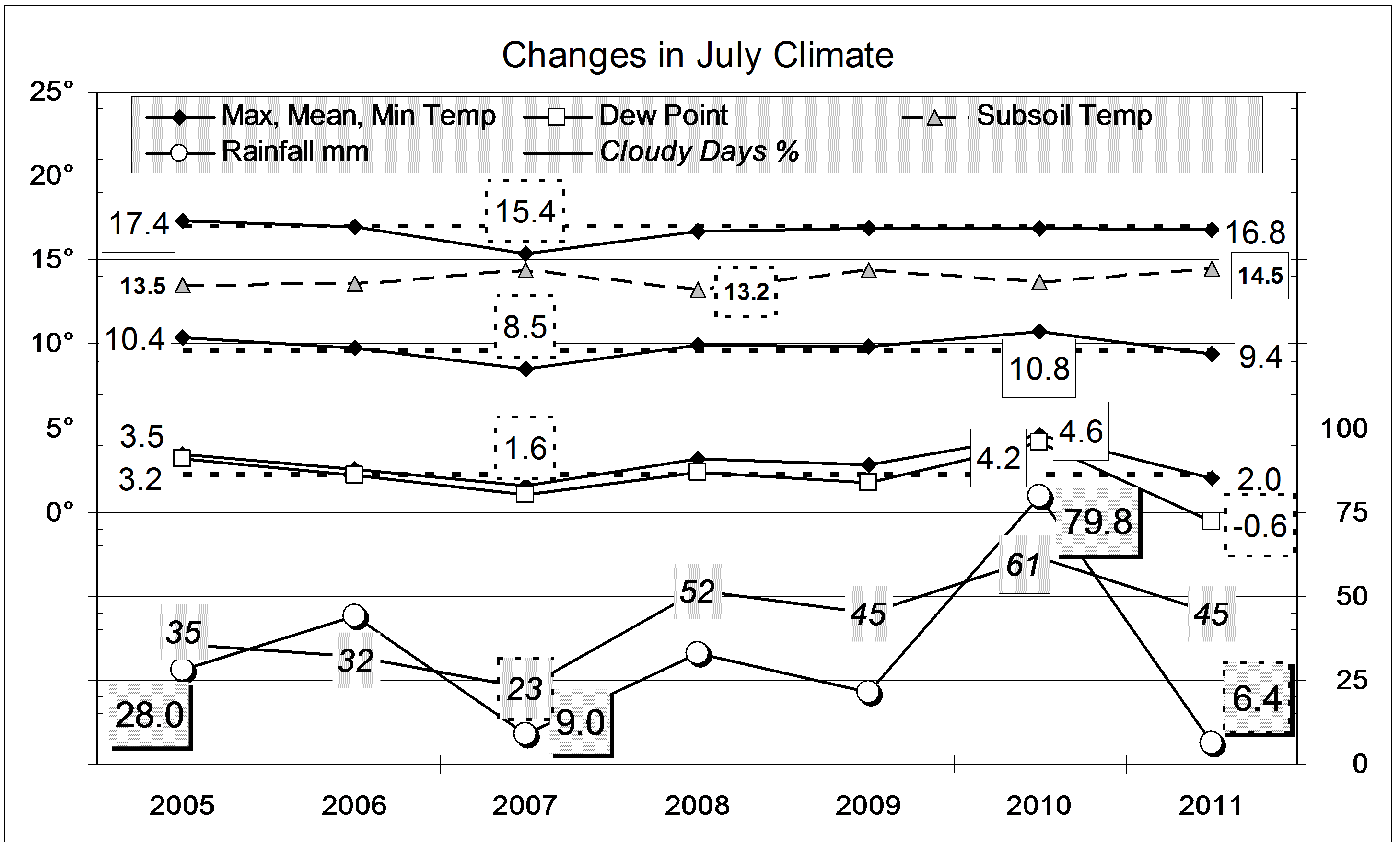
After June’s extreme cloudiness and rain, July was very near to normal in everything but temperature. The average values of daily maximum, daily minimum, and daily mean temperature were all just under two degrees above normal. The daily maximum and daily mean are 15-year record high values, but the daily minimum had been higher in July 2010: 2.4 degrees above normal.
(Note: My “normal” is the ten year average from March 1999. For the official normal period 1961-1990 there are no Manilla figures (except rainfall). This month’s very high temperatures would be (perhaps) just over 2 degrees above the 1961-1990 average.)
Rainfall, at 29.8 mm, is in the 43rd percentile, a bit below the average (41.1mm). Rainfall totals for 24 months and more are very high. This accounts for the rare appearance of water flowing locally in Greenhatch Creek.
Data. Rainfall data is from Manilla Post Office, courtesy of Phil Pinch. Temperatures, including subsoil at 750 mm, and other data are from 3 Monash Street, Manilla.