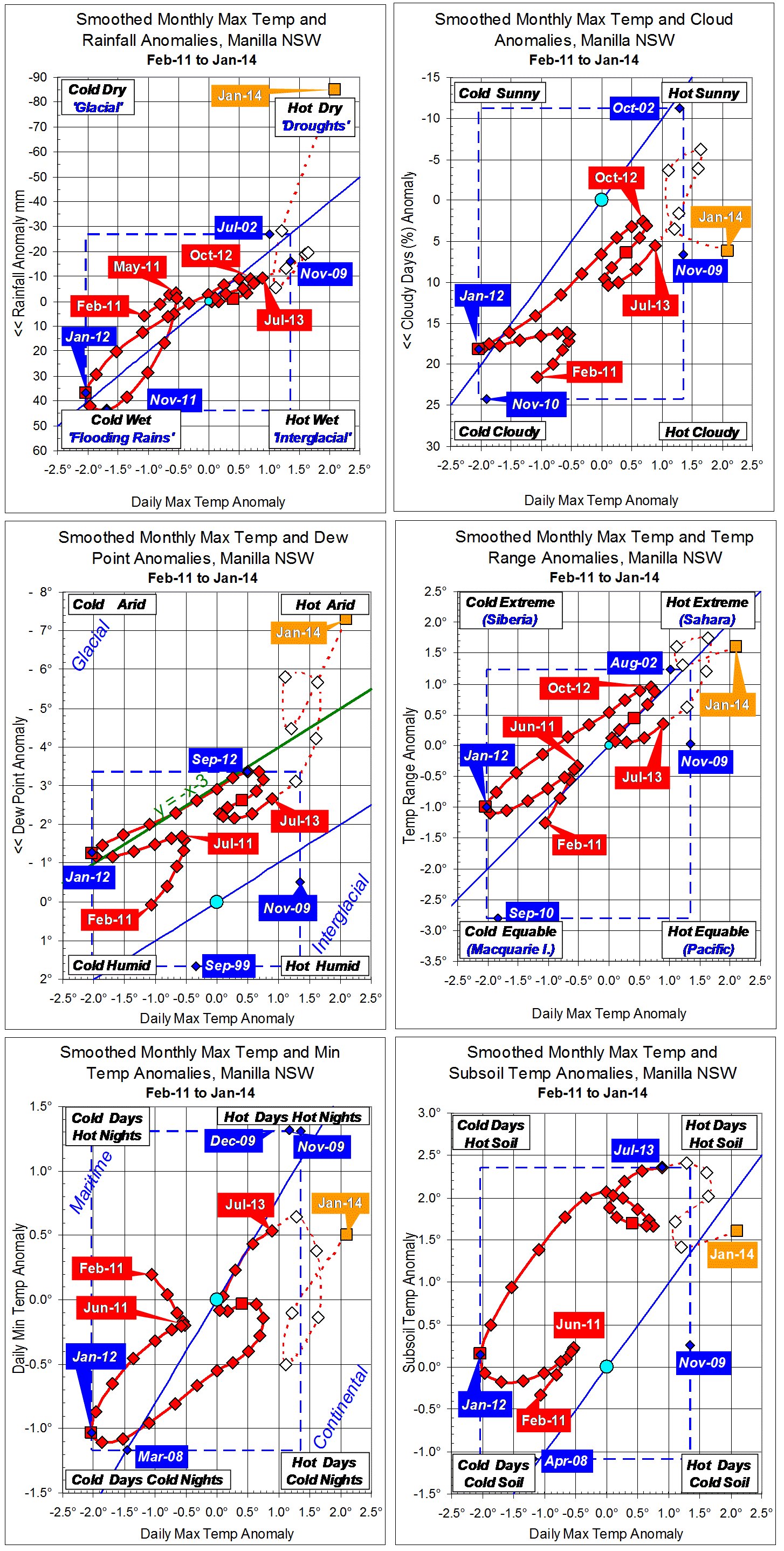
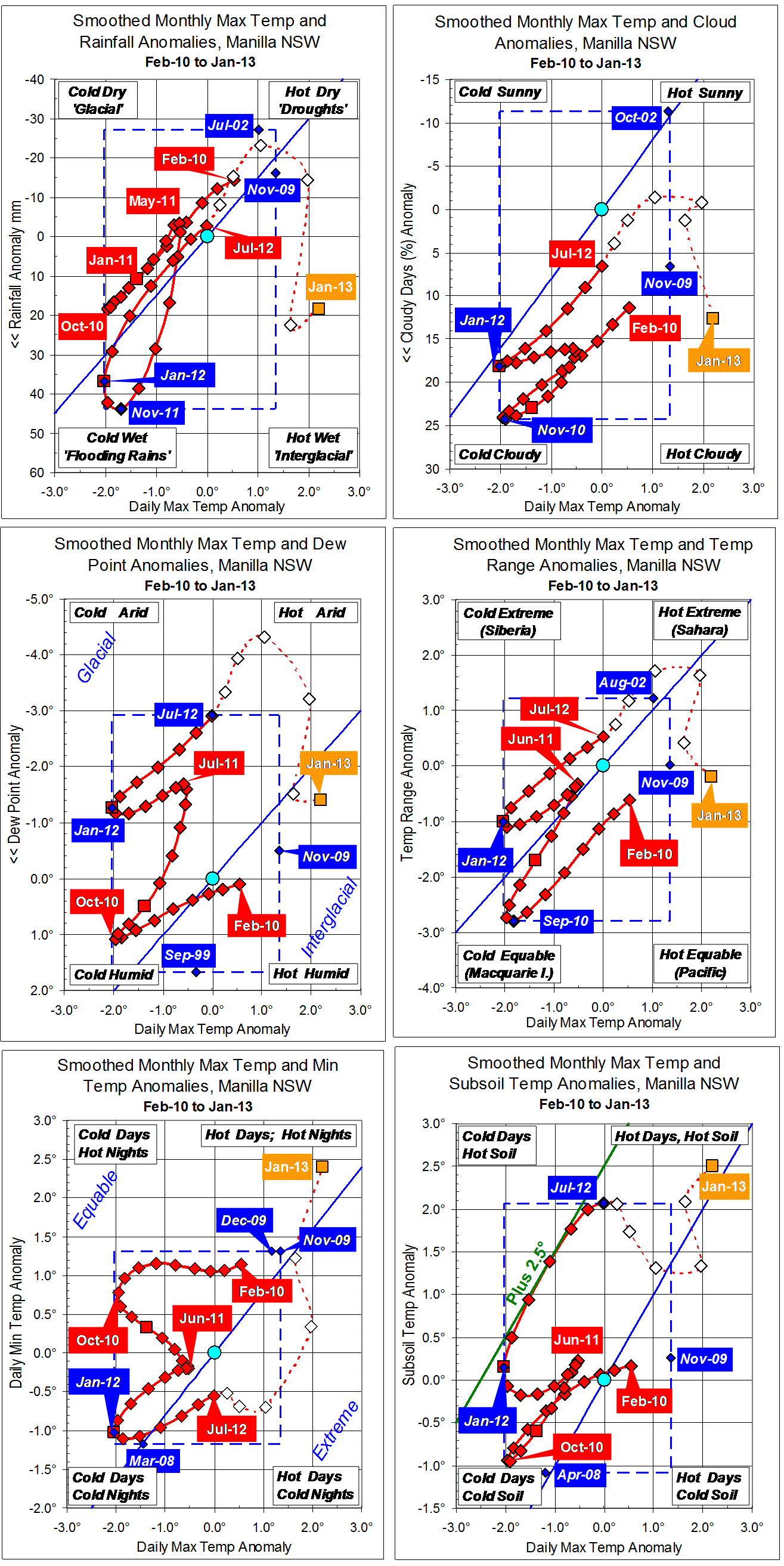
Parametric plots of smoothed climate variables at Manilla
“January 2015: rainy cool days”

January raw anomaly data (orange)
Anomalies for all variables except subsoil temperature moved across the graphs, from “droughts” in November to “flooding rains” in January. Subsoil temperature had been normal from February to December (11 months!), then became cooler than normal in January.
Most raw anomaly values for January were close to the fully-smoothed anomaly values of the La Niña-affected cool summer of 2012. This month’s daily temperature range was even narrower, and the subsoil temperature lower, but the daily minimum temperature was not so low.
Fully smoothed data (red)
The latest fully-smoothed data anomalies (July 2014) were near normal. (Dew point, like most recent values of that variable, was 3° lower than normal.)
Note:
Fully smoothed data – Gaussian smoothing with half-width 6 months – are plotted in red, partly smoothed data uncoloured, and raw data for the last data point in orange. January data points are marked by squares.
Blue diamonds and the dashed blue rectangle show the extreme values in the fully smoothed data record since September 1999.
Normal values are based on averages for the decade from March 1999.* They appear on these graphs as a turquoise (turquoise) circle at the origin (0,0). A range of anomalies called “normal” is shown by a dashed rectangle in aqua (aqua). For values in degrees, the assigned normal range is +/-0.7°; for cloudiness, +/-7%; for monthly rainfall, +/-14 mm.
* Normal values for rainfall are based on averages for the 125 years beginning 1883.