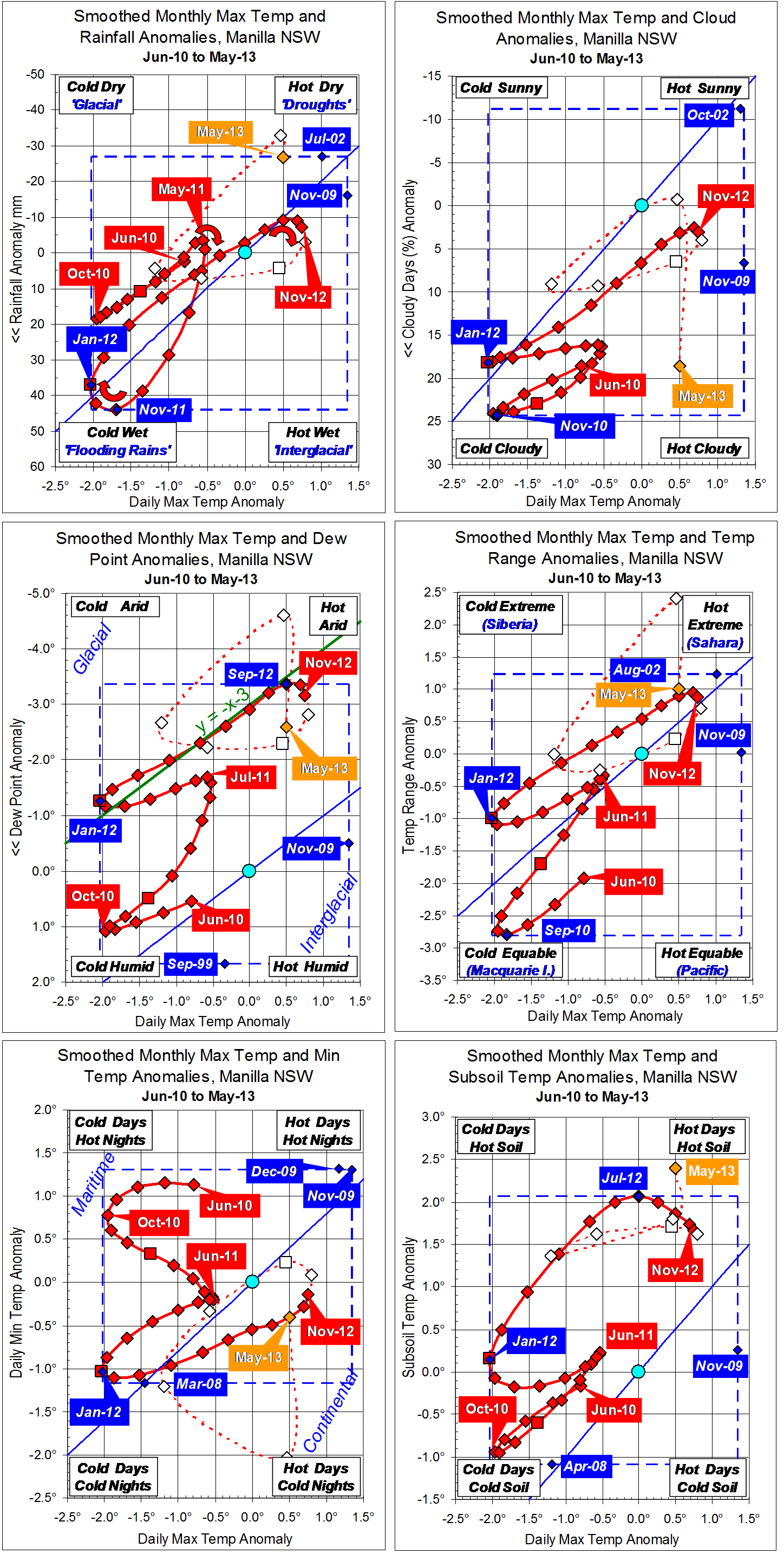
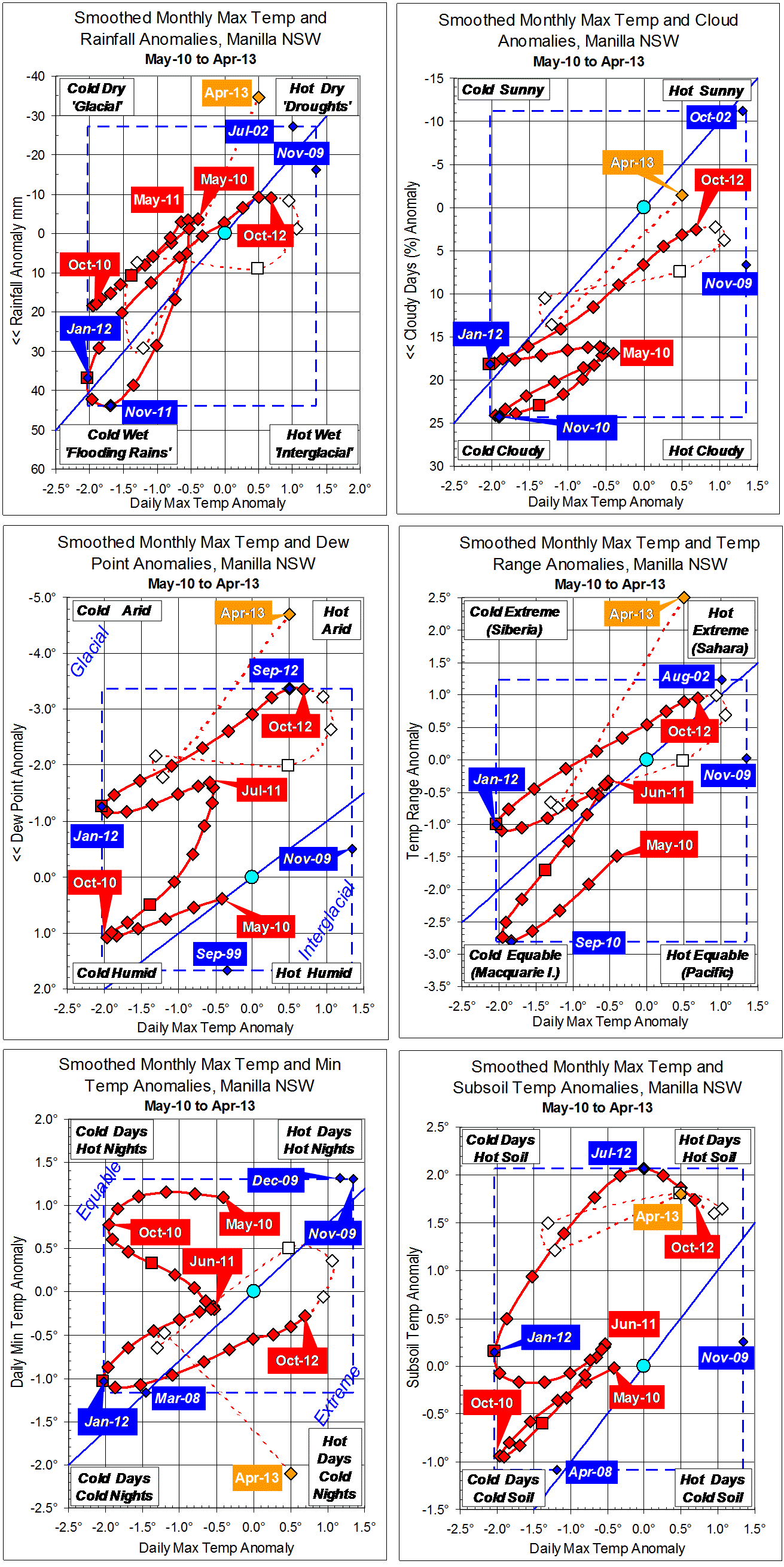
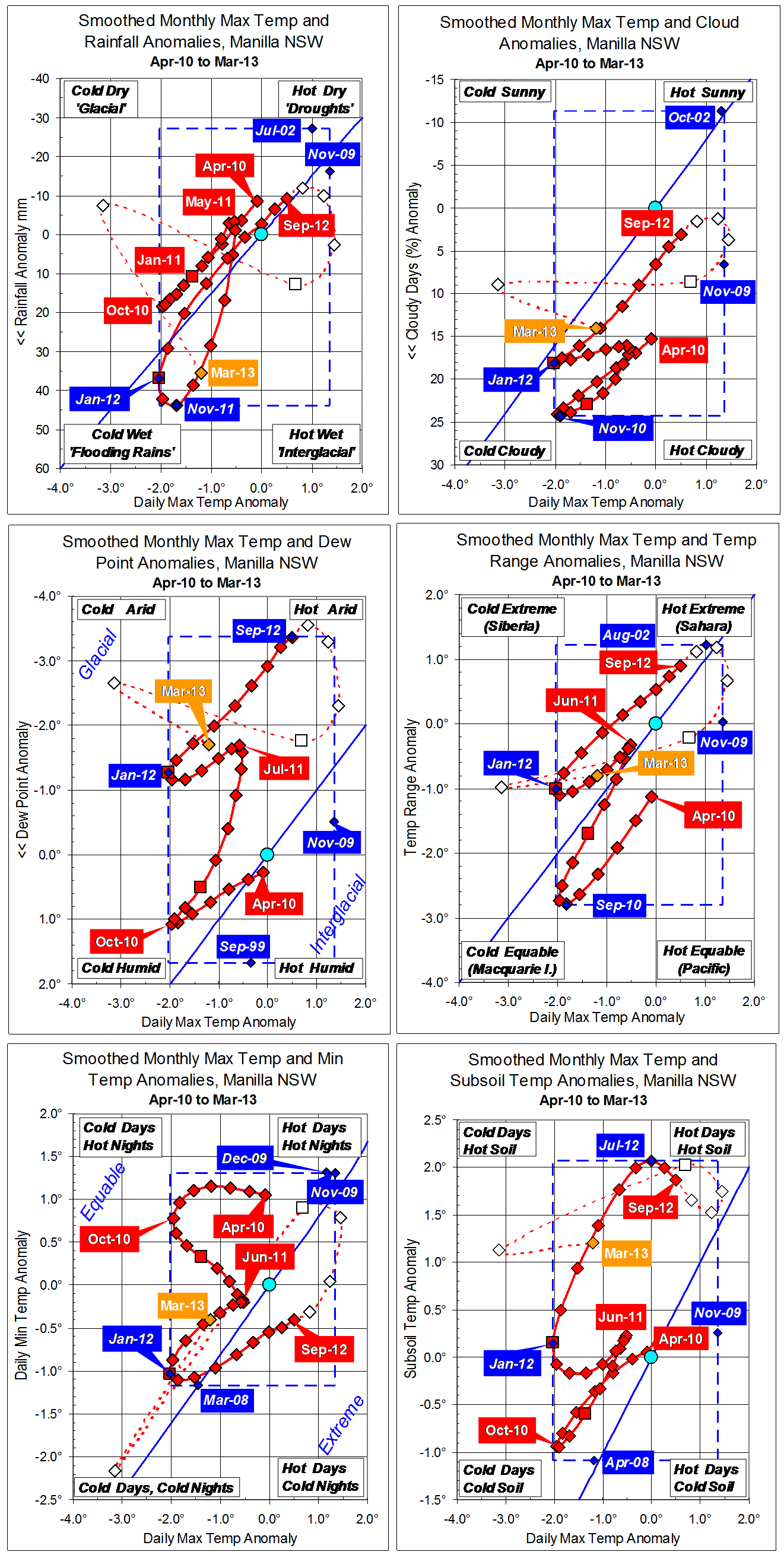
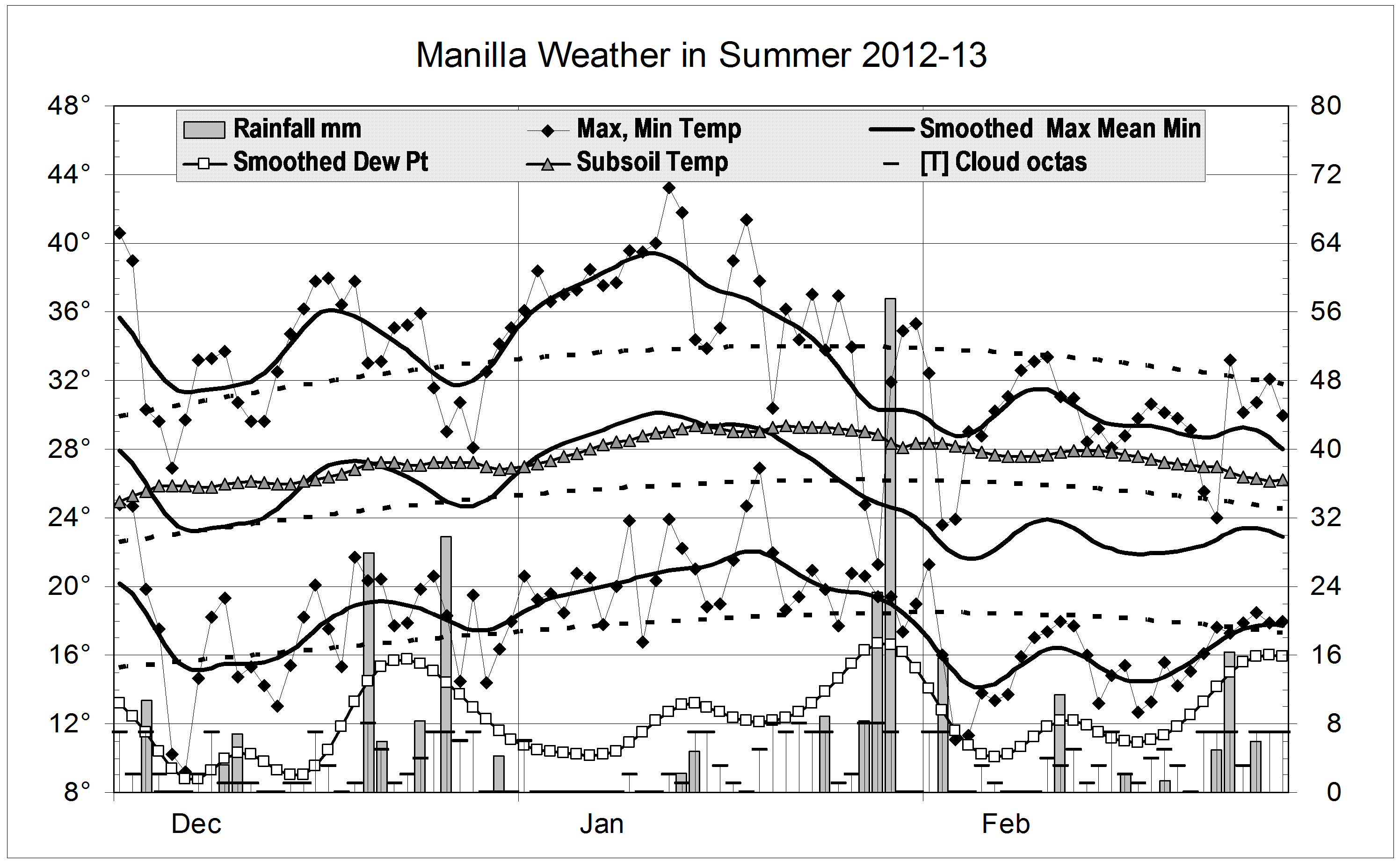
Three quarters of the rain this autumn fell in the first two days: 31 mm and 45.4 mm. After that, the heaviest falls were 6.2 and 6.8 mm late in May. Days were cool with the rain, and warm in late March and late April. The warm days in late March came with warm nights, but the warm days in late April brought very wide daily temperature ranges instead.
This autumn was like autumn last year. That is, it was near average in most respects, but with high subsoil temperature and plenty of cloud. Dew points were even lower, reaching a record low value of 6.1°.
Rain fell on 11 days (normal), totalling 103 mm. This is below the 125-year autumn average of 133 mm, and in the 46th percentile.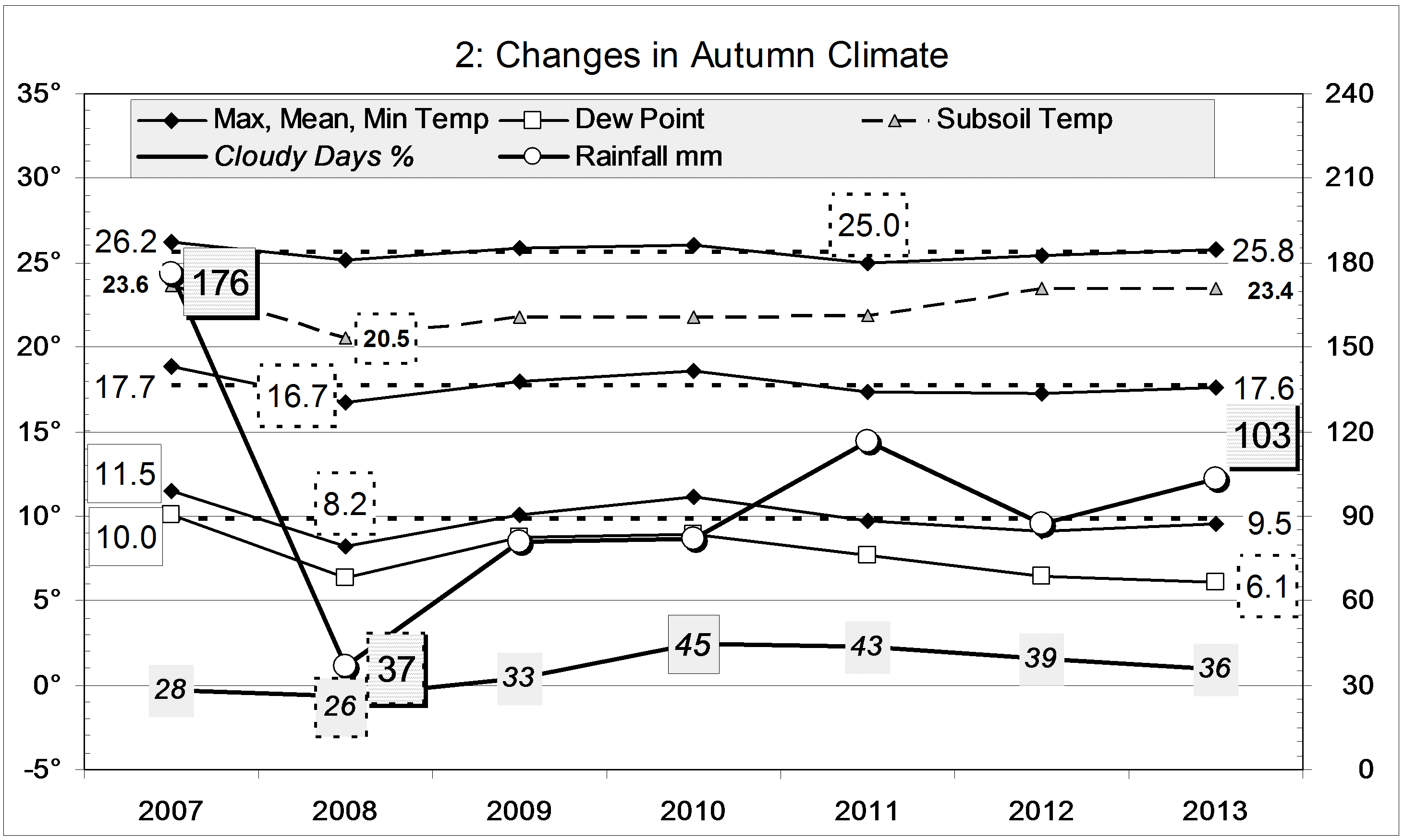
Data. Rainfall data is from Manilla Post Office, courtesy of Phil Pinch. Temperatures, including subsoil at 750 mm, and other data are from 3 Monash Street, Manilla.