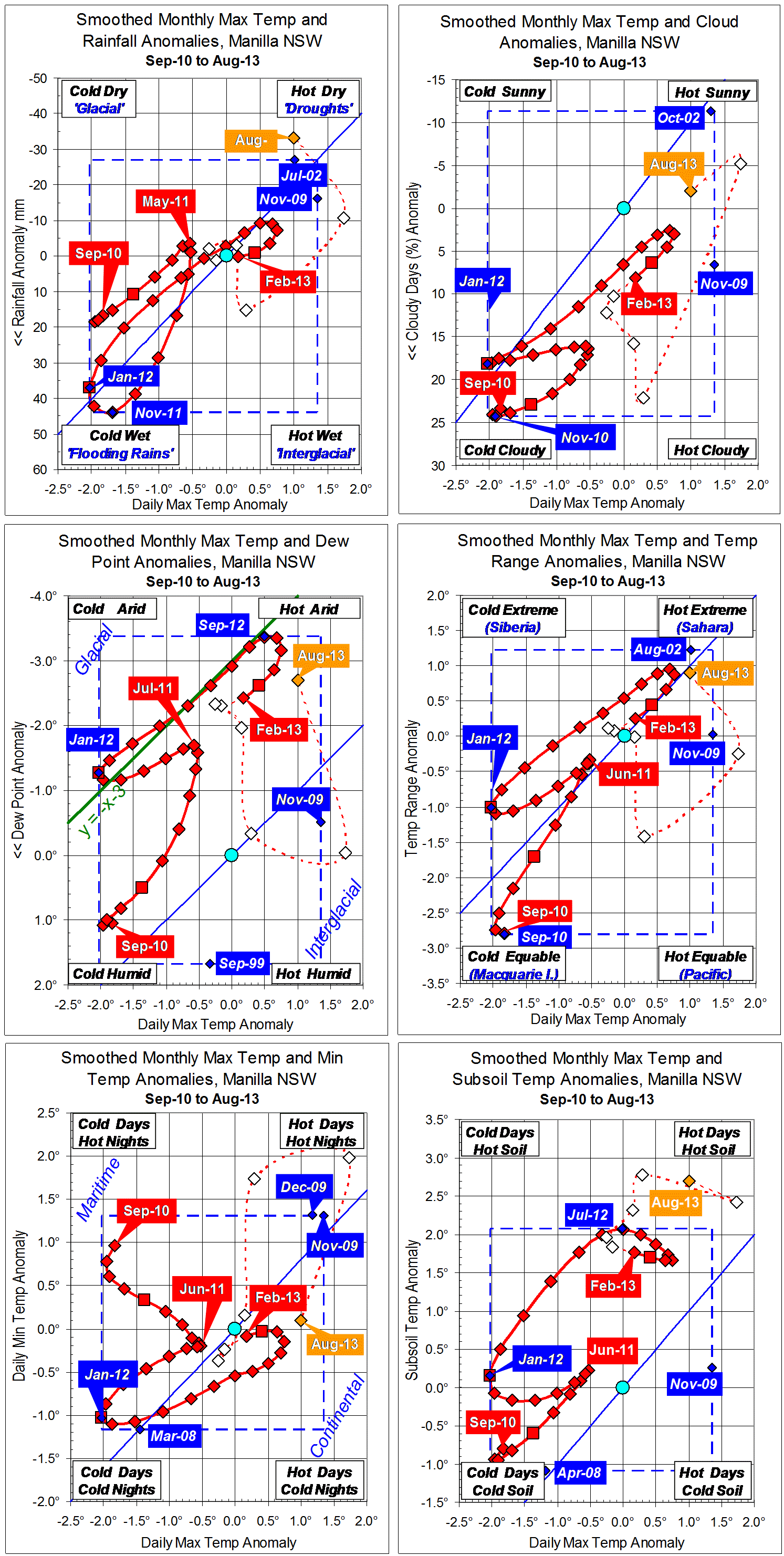
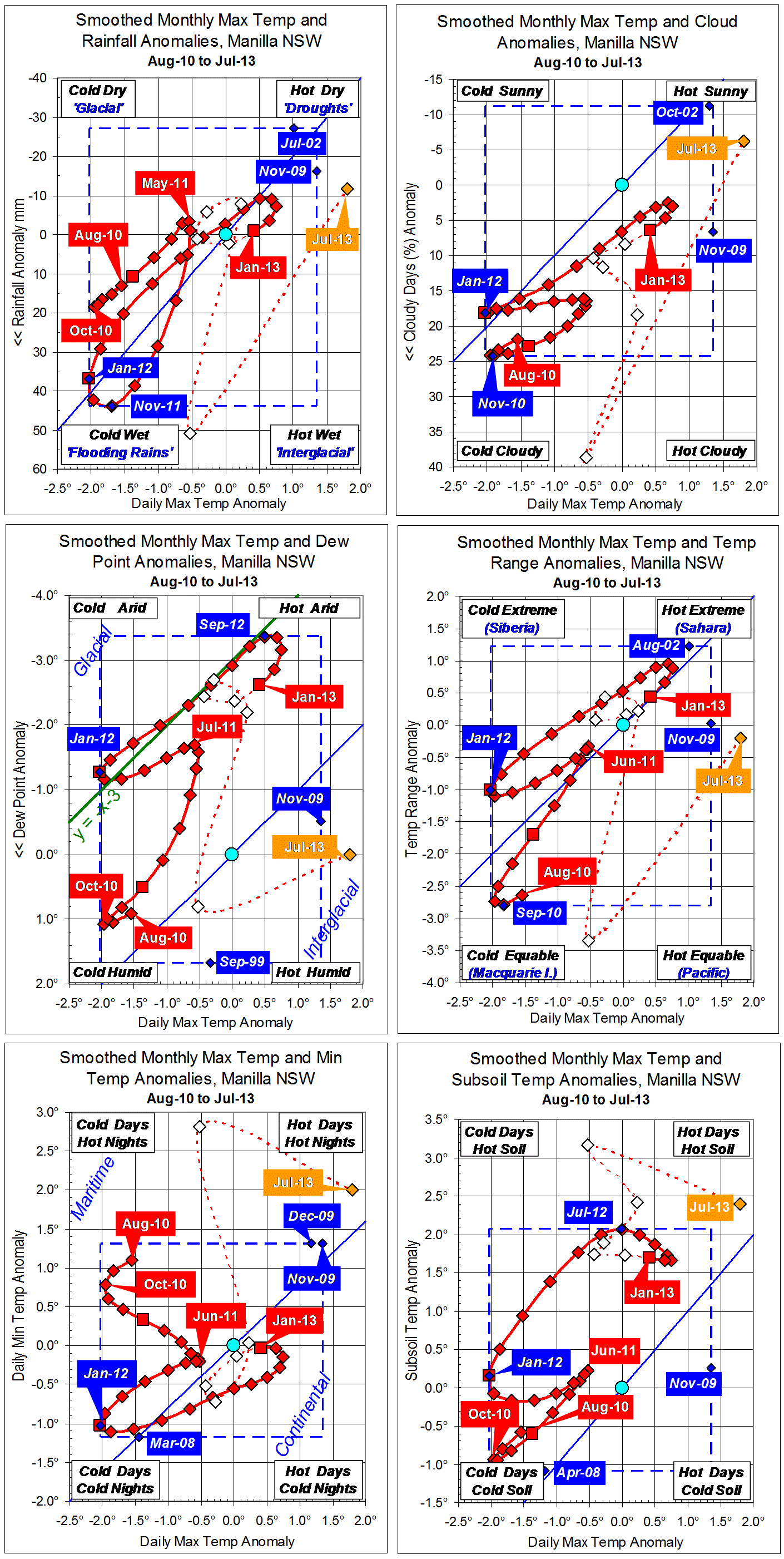
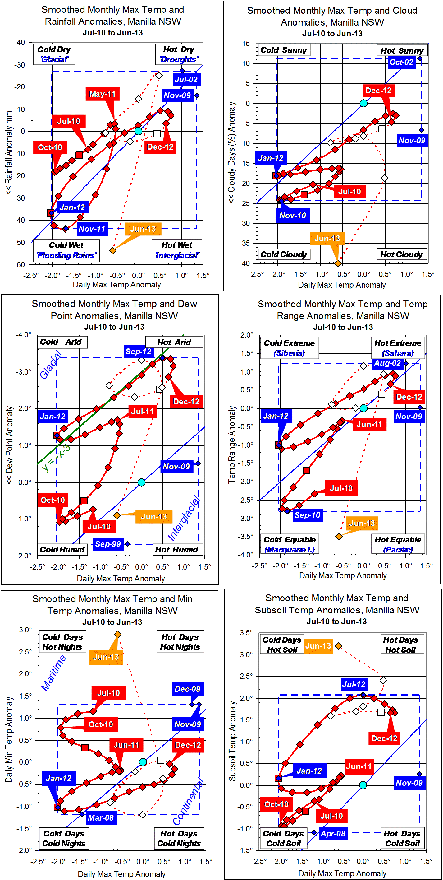
Parametric plots of smoothed climate variables at Manilla
“Desert-like climate”

Raw values of climate anomalies for September 2013 all show extreme aridity: they are in the top right corner of the graphs.
The latest fully-smoothed data point, March 2013, continues a trend towards normalcy and away from the mild drought seen in spring 2012.
Note:
Fully smoothed data – Gaussian smoothing with half-width 6 months – are plotted in red, partly smoothed data uncoloured, and raw data for the last data point in orange. January data points are marked by squares.
Blue diamonds and the dashed blue rectangle show the extreme values in the fully smoothed data record since September 1999.