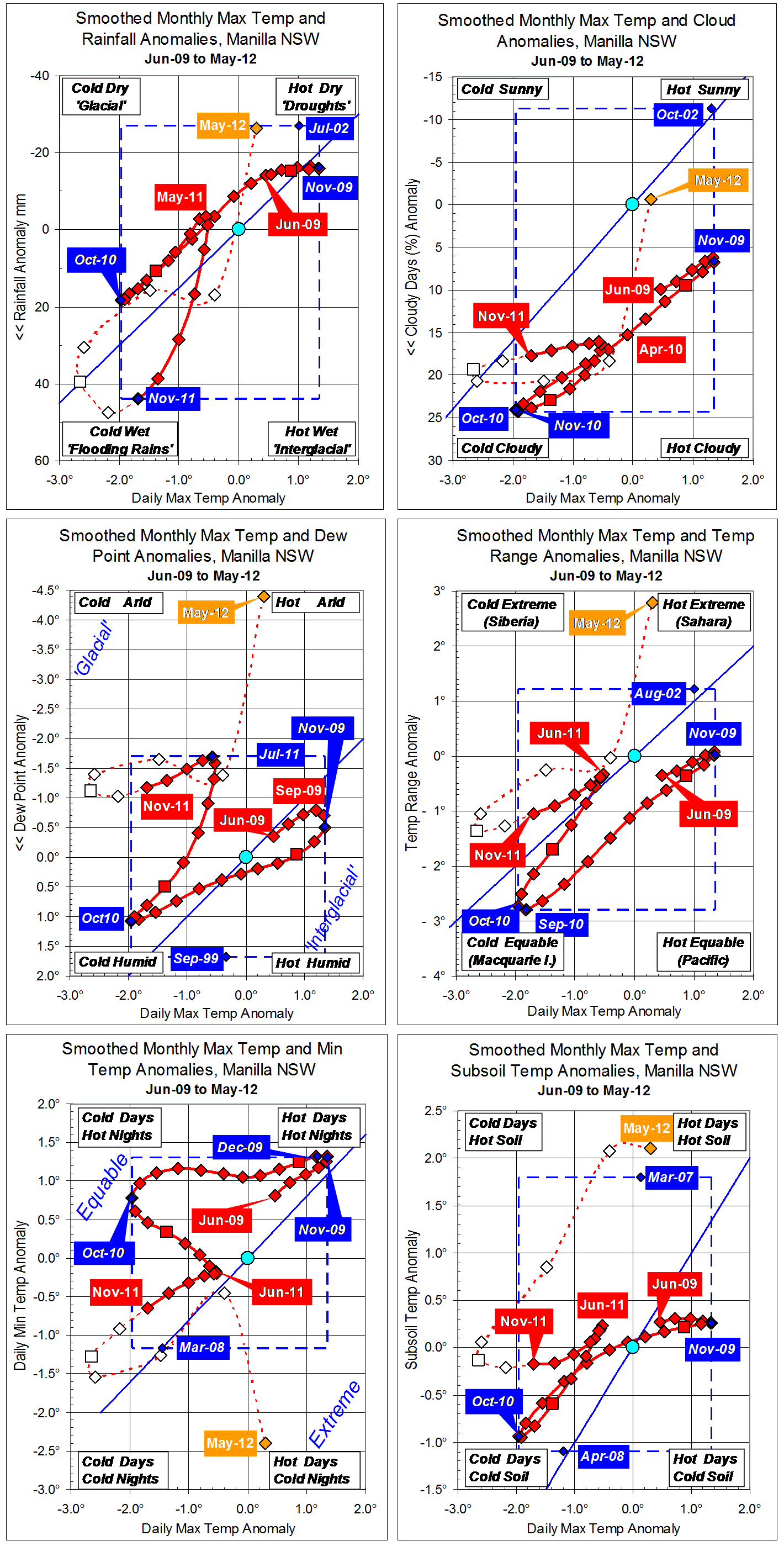
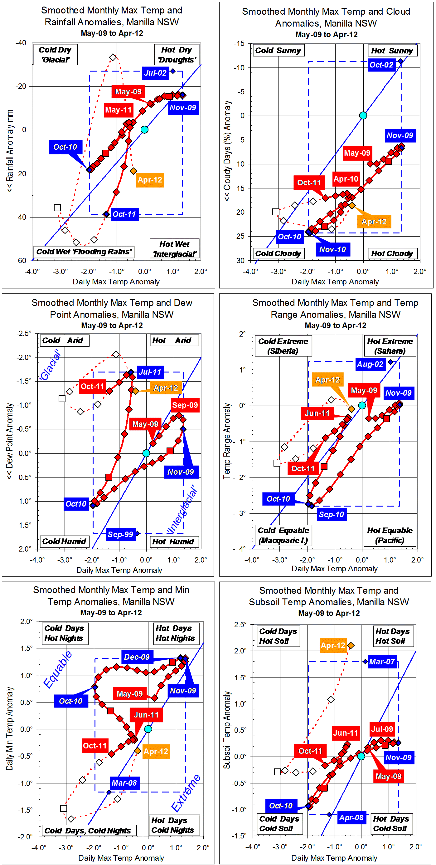
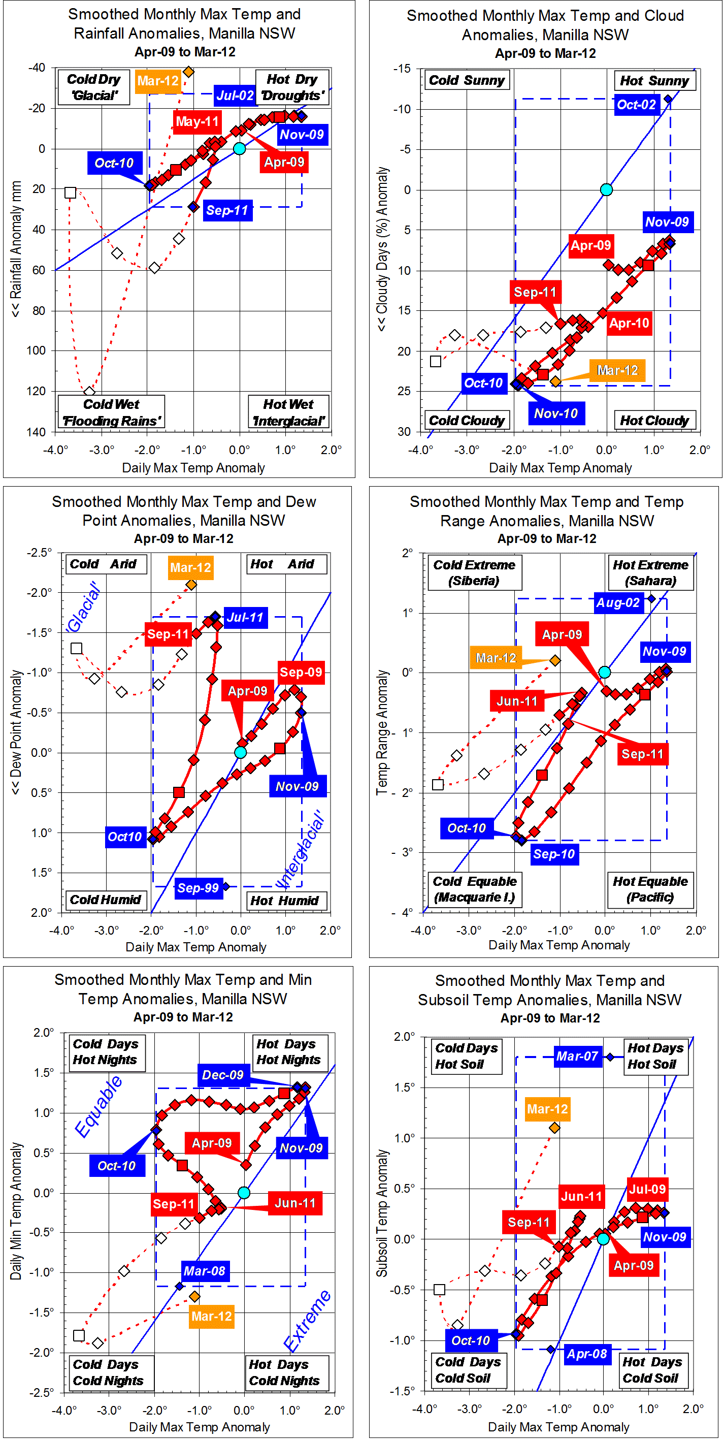
Parametric plots of smoothed climate variables at Manilla
“Back towards very wet”
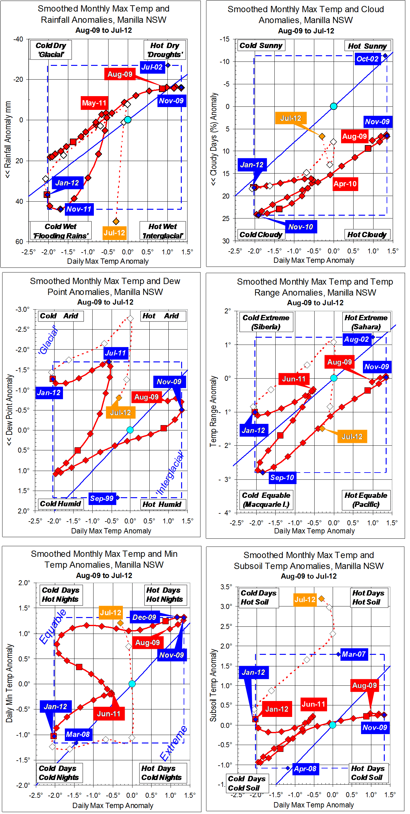
Most July 2012 anomalies are close to normal, and like those of the month before. Rainfall, however, is again very high, as in the spring and summer, and daily min temp has gone from very low in May to very high.
The subsoil remained extraordinarily warm. (Why?)
Fully-smoothed data (in red) show that the 13-year record low monthly max temp anomaly of October 2010 (-1.96 degrees) was beaten in January 2012, with a new low value of -2.03 degrees, perhaps to be beaten in the following month. At Manilla, the “flooding rains” climate phase of 2011-12 was very much wetter, and somewhat cooler than that of 2010-11.
Note: Fully smoothed data – Gaussian smoothing with half-width 6 months – are plotted in red, partly smoothed data uncoloured, and raw data for the last data point in orange. January data points are marked by squares. Blue diamonds and the dashed blue rectangle show the extreme values in the fully smoothed data record since September 1999.