
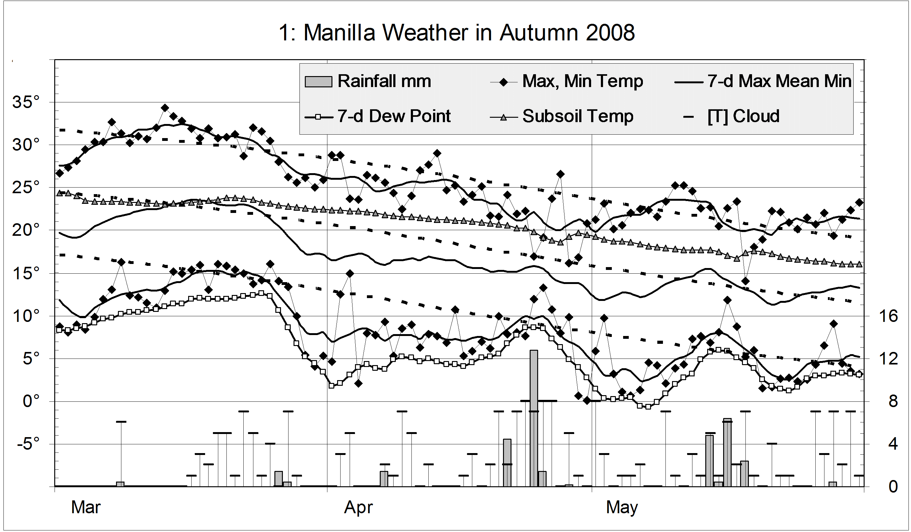
The daily weather log
Temperatures were about normal in mid-March and again during parts of May. Otherwise they were low. The daily temperature range was generally higher than usual, but was less on rainy days.
There were nine mild frosts, which is near the average.
Humidity was very low in early April and early May.
There were 13 rain days, which is normal. They were mainly in late April and mid-May, for a very low total of 37 mm. April the 24th was the wettest day, with 12.8 mm.
Cloud varied a lot from day to day. Clear skies were common in March.
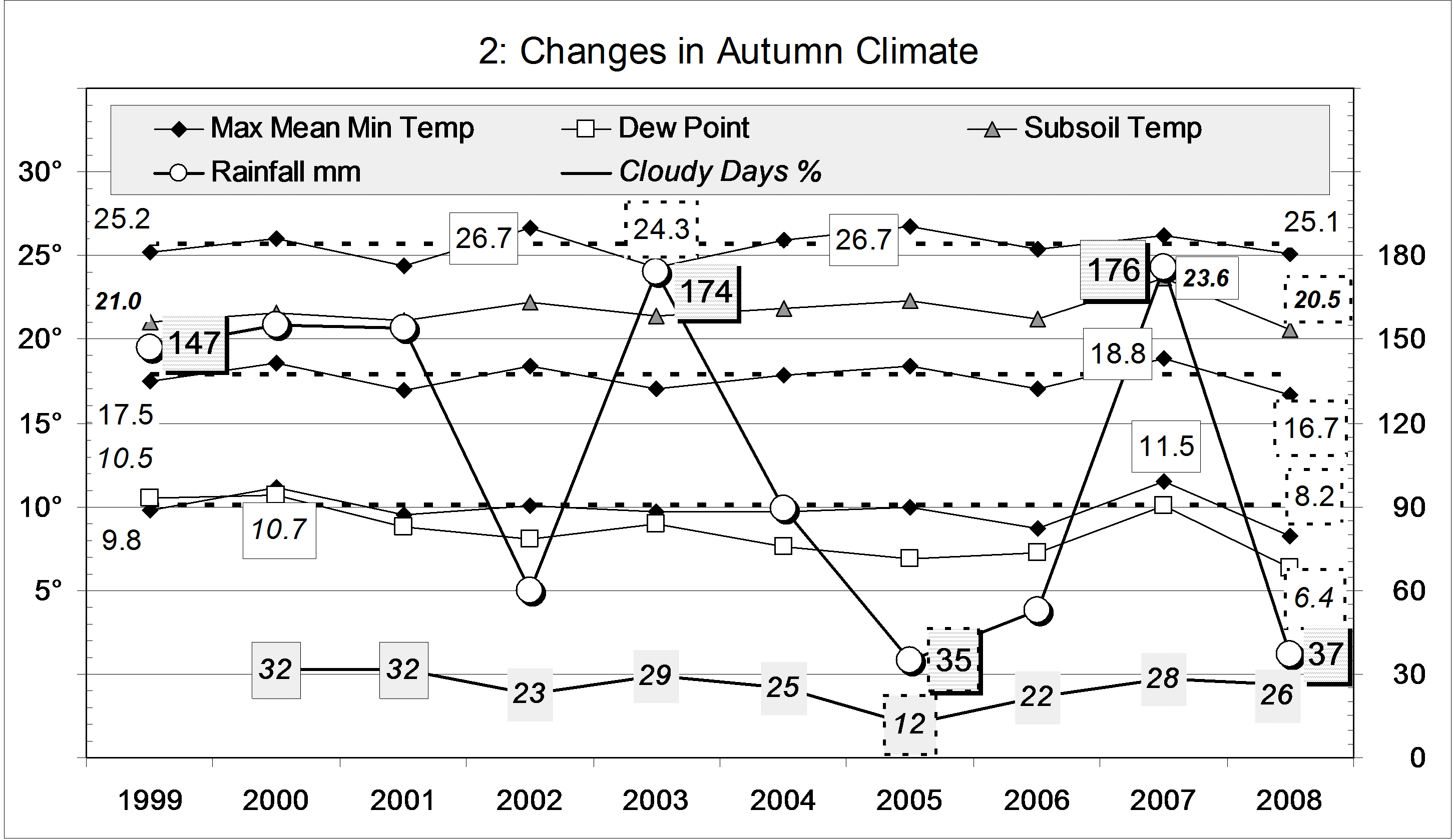
Comparing autumn seasons
This autumn was very cool: mean daily mean temperature and minimum temperature are the lowest in the ten year record. Mean daily maximum temperature was lower in 2003, which is one of three autumns sharing the next coolest mean temperature.
This autumn’s very cool nights (8.2°) caused the largest daily temperature range on the graph (16.9°), similar to the 16.8° of 2005. Both came with very low rainfall,
Autumn humidity seems to have decreased through the decade, with this autumn’s Dew Point of 6.4° the lowest.
This graph includes some very dry autumns. Autumn 2005 was the 7th driest on record, in the 6th percentile for autumn rainfall. This autumn was similar, in the 7th percentile. Autumn 2002 was in the 18th percentile, as that year’s drought had not fully developed. By contrast, autumn 2003 and 2007 were wet, in the 72nd and 75th percentiles.
(Contrary to the forecast, this autumn was dry. It was one of twelve autumns on record that had less than one fifth of the preceding summer’s rainfall. Three of the twelve were 2005, 2006, and 2008. This is amazing: something that usually happens one year in ten happened three years in four! Another three of the twelve were 1971, 1973, and 1976. At that time it was three years in six.)
At 26% cloudy mornings, this autumn was normal.
Data. Rainfall data is from Manilla Post Office, courtesy of Phil Pinch. Dew Point values before August 2005 are from Tamworth Airport 6 am data supplied by the Bureau of Meteorology. Temperatures, including subsoil at 750 mm, and other data are from 3 Monash Street, Manilla.


