
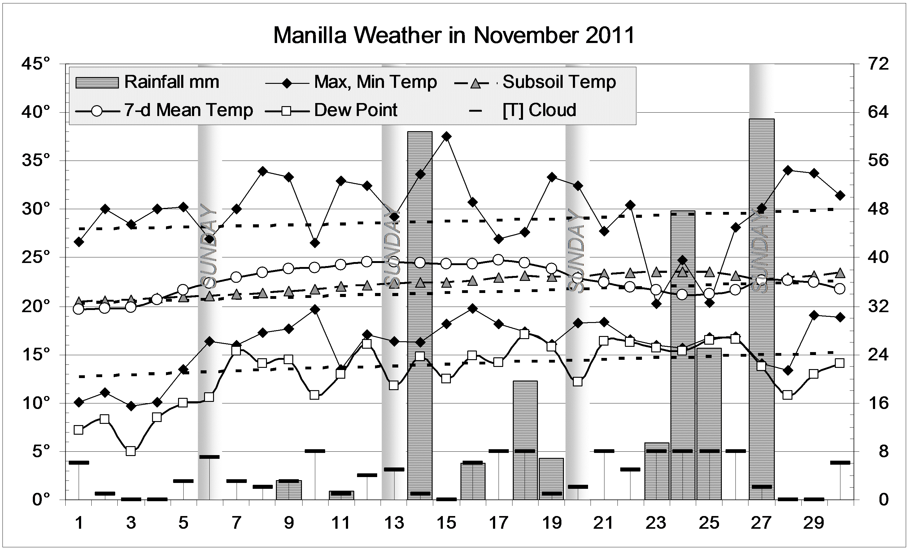
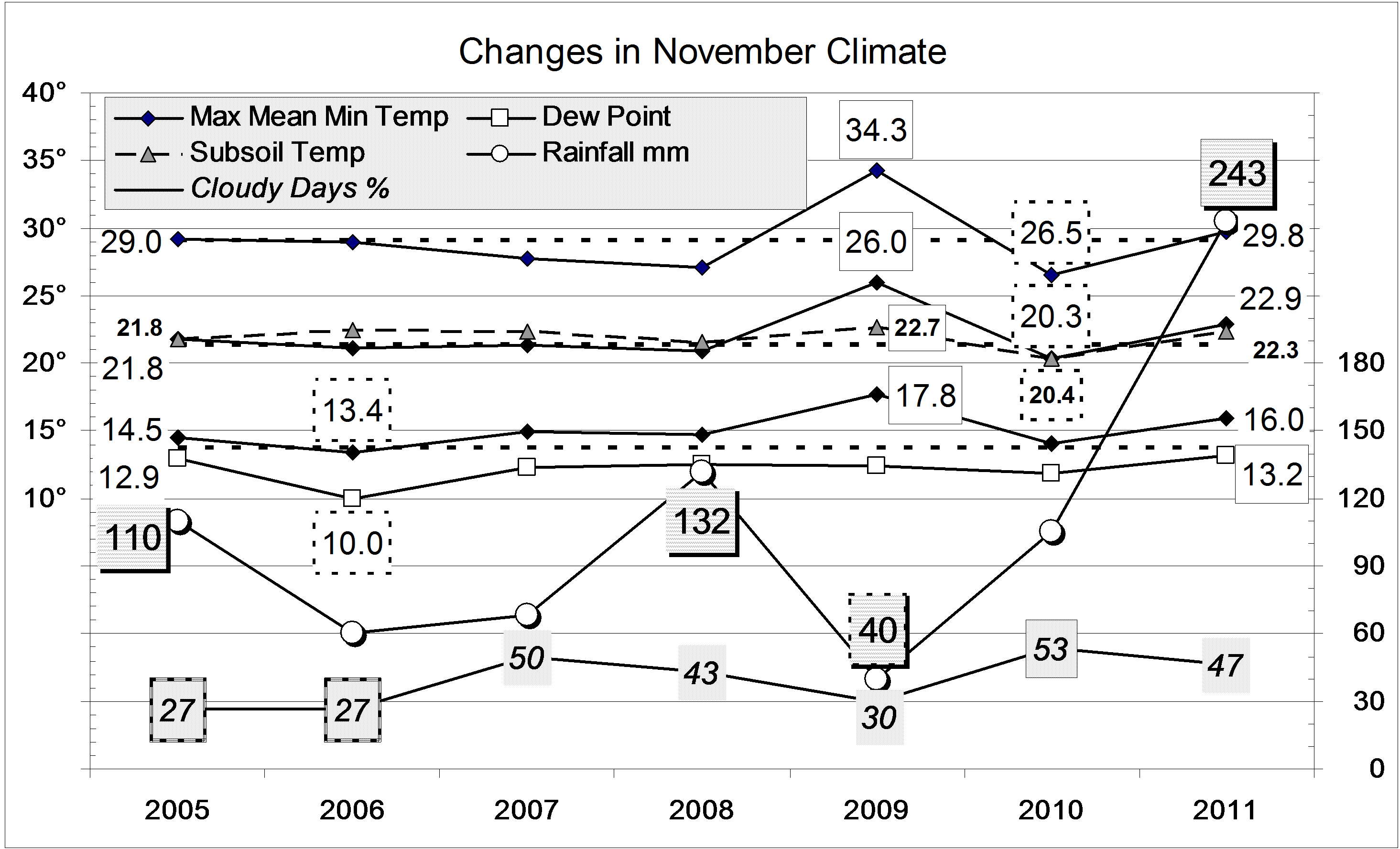
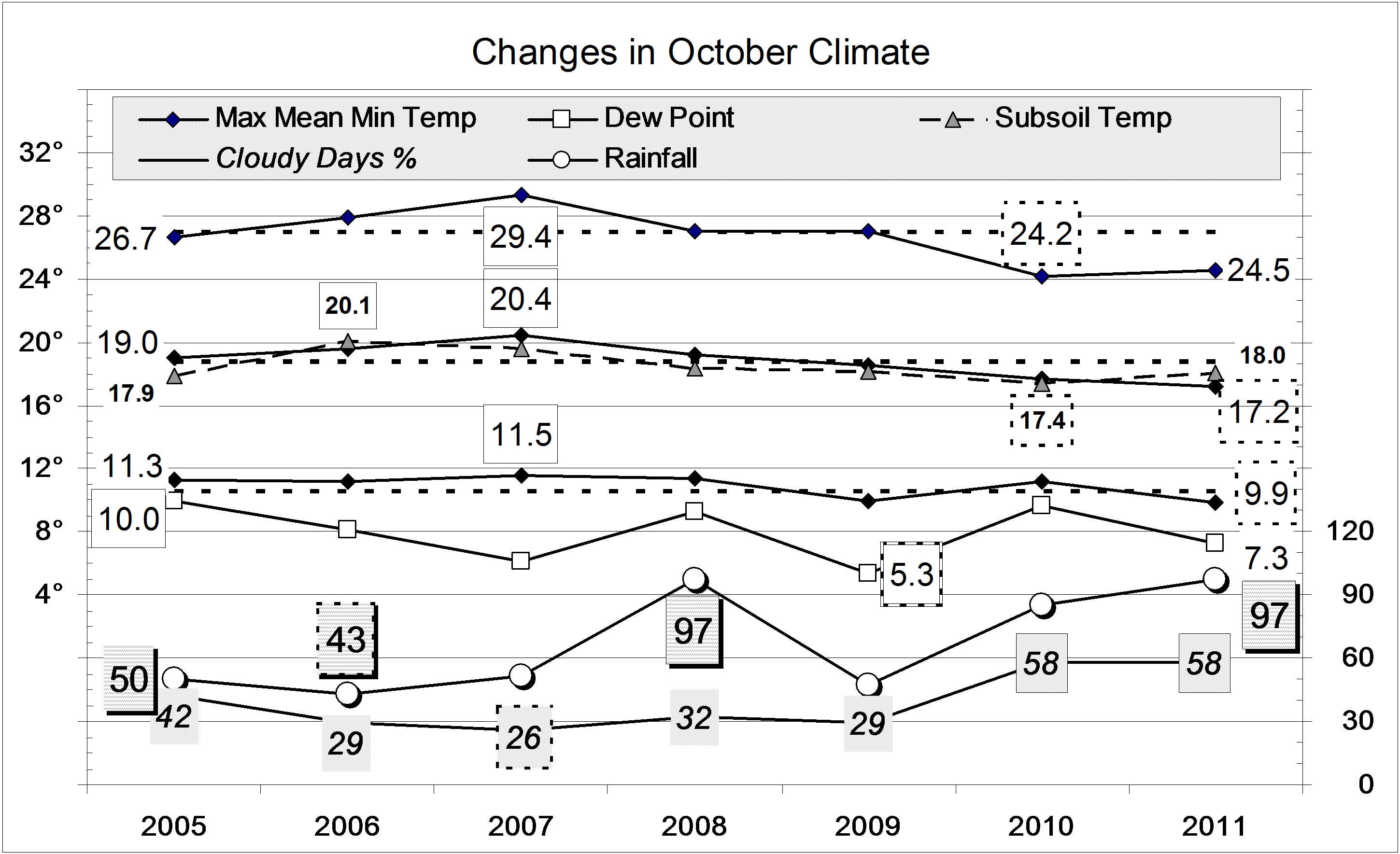
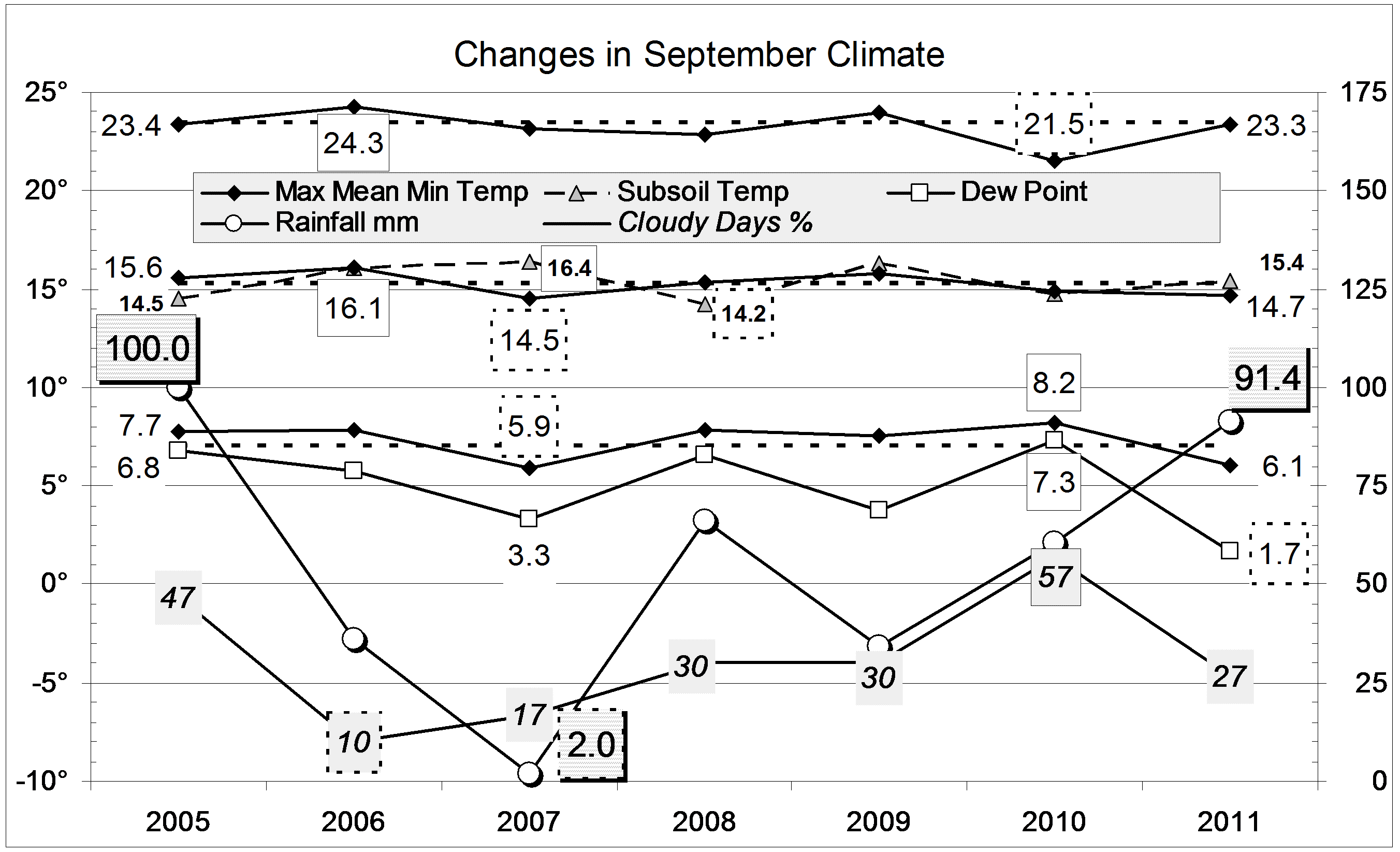
 This spring’s rainfall of 431.7 mm far exceeded that of any other spring in the record from 1883. Winter had been very dry, with only 55 mm. While there was a lot of rain in September (91.4 mm) and October (97.4 mm), much more fell in November (242.9 mm), mainly in the second half.
The only other springs with more than 300 mm were in two small groups: 1916 (326 mm) and 1917 (327 mm); and 1949 (330 mm), 1950 (379 mm), 1954 (319 mm) and 1955 (321 mm).
Apart from the extreme rainfall, all other weather readings this spring were normal. By contrast, spring 2009 had been warm and sunny, and spring 2010, cool and cloudy.
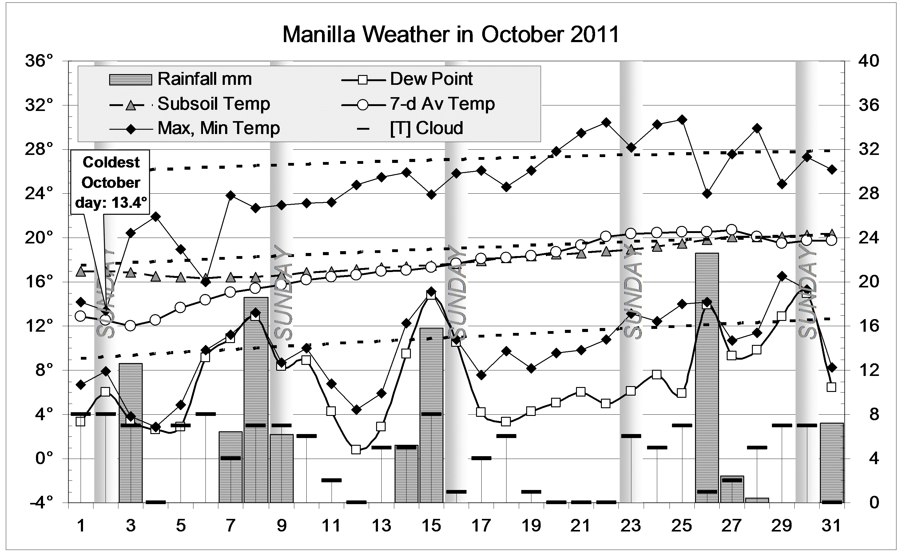
During the season, there were two very cool spells, early in September and very early in October. They were separated by a sunny warm spell with very low humidity: it had people changing into summer gear (then back again!). By mid-November, both days and nights were very warm, but then returned to normal.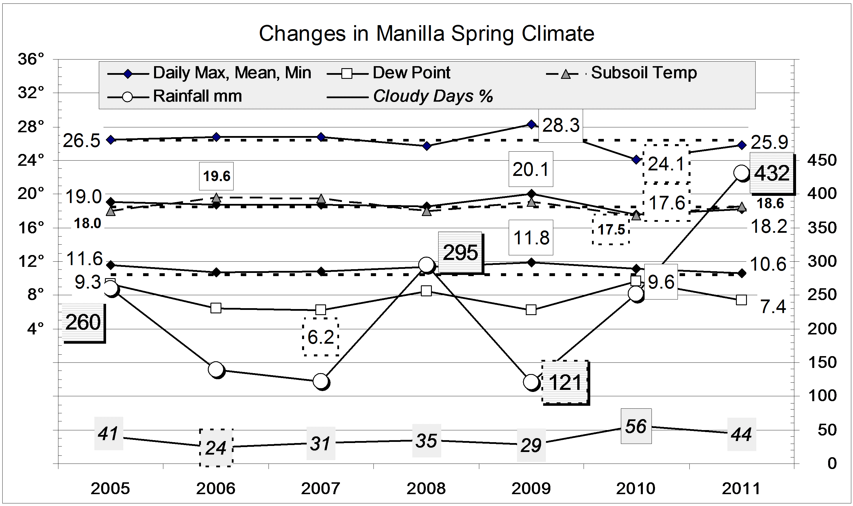
Data. Rainfall data is from Manilla Post Office, courtesy of Phil Pinch. Temperatures, including subsoil at 750 mm, and other data are from 3 Monash Street, Manilla.
 For temperature, this winter was normal. Otherwise, it was strange: it had the extreme low rainfall and low humidity that come with drought, without sunny skies or severe winter frosts.
