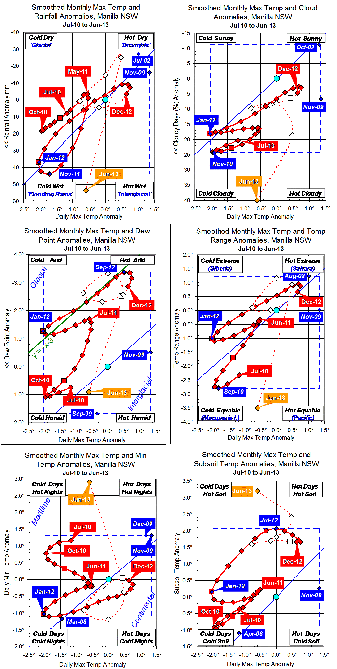
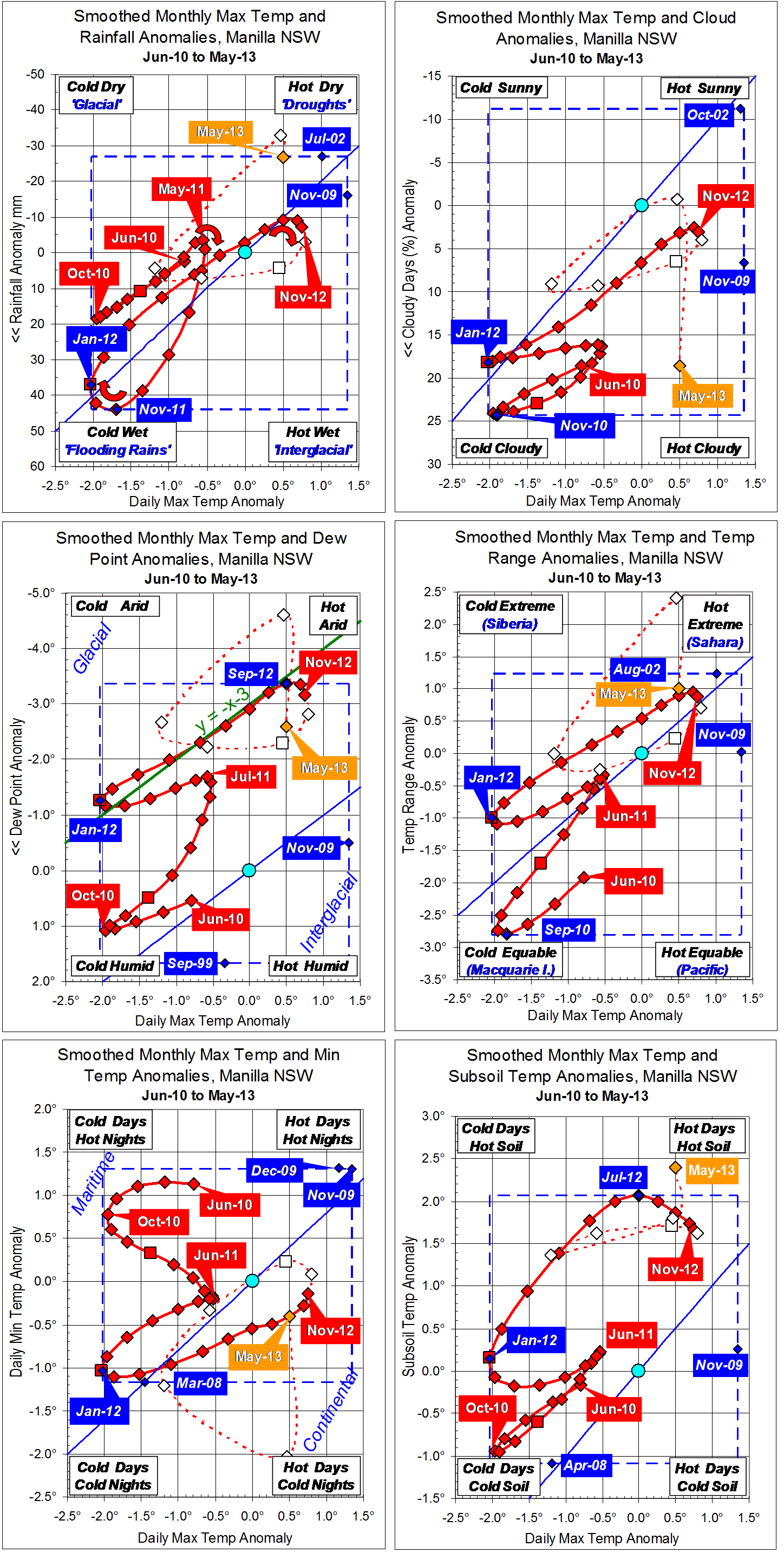
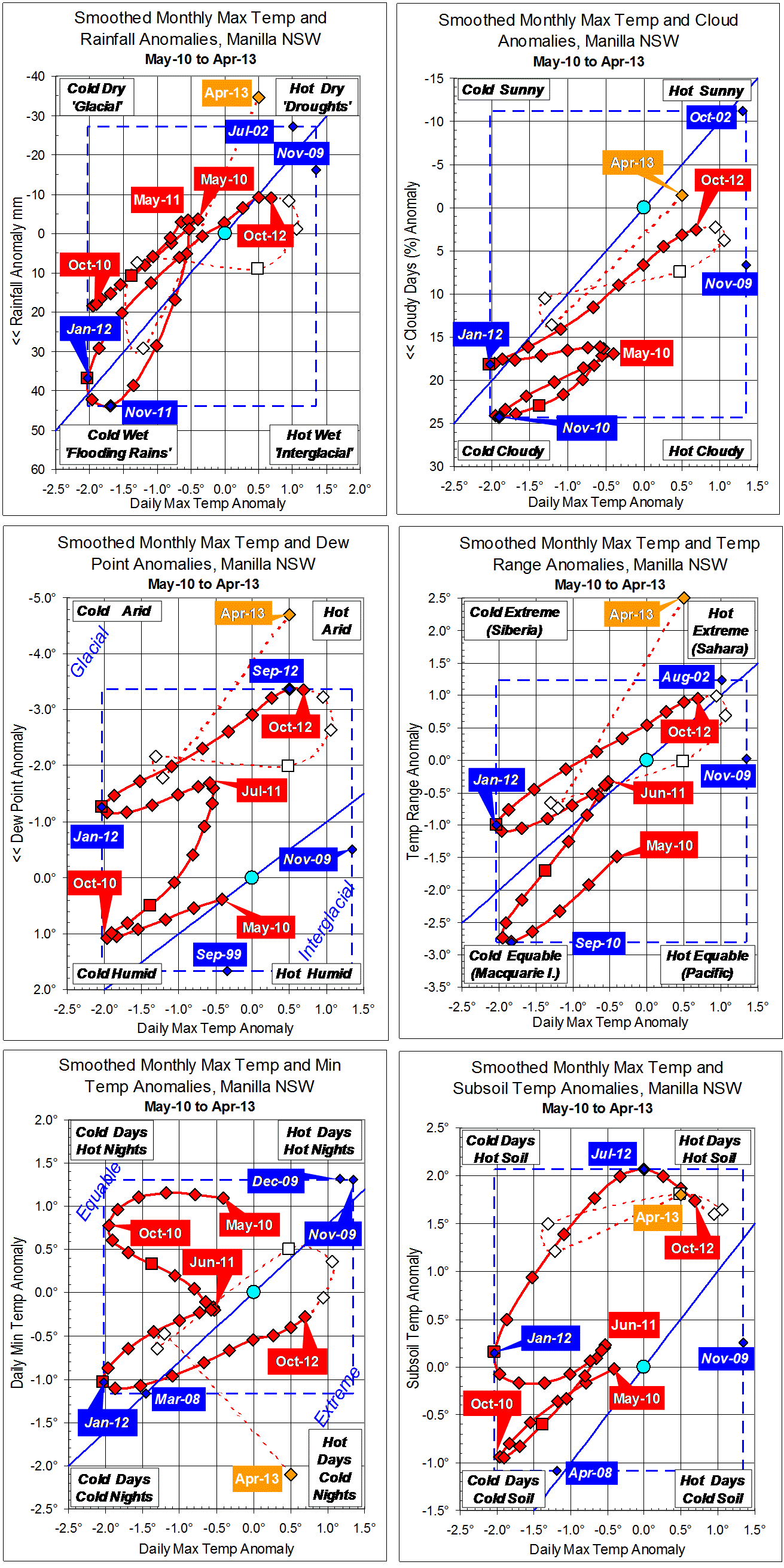
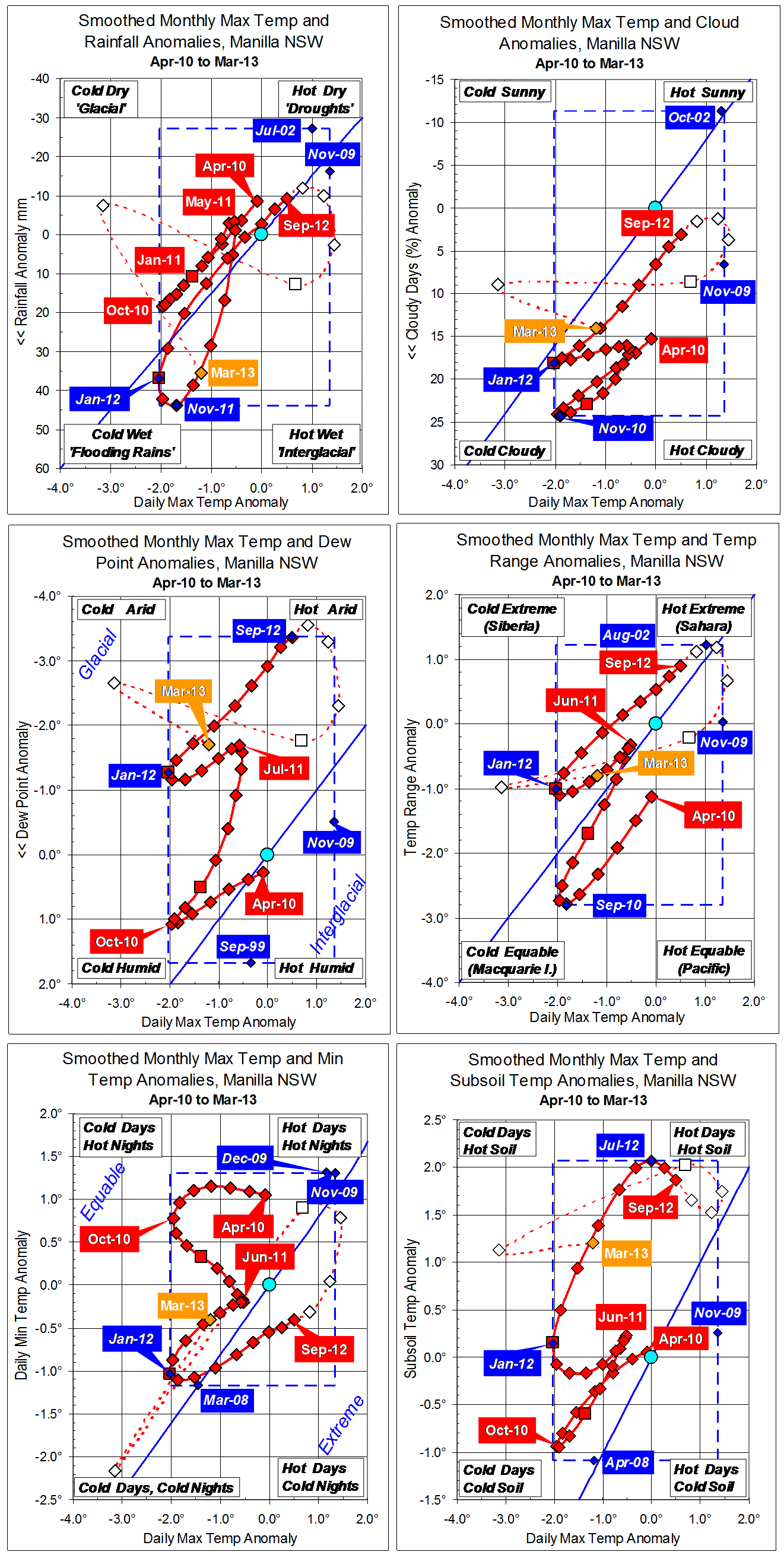
Parametric plots of smoothed climate variables at Manilla
“Very warm days and nights”
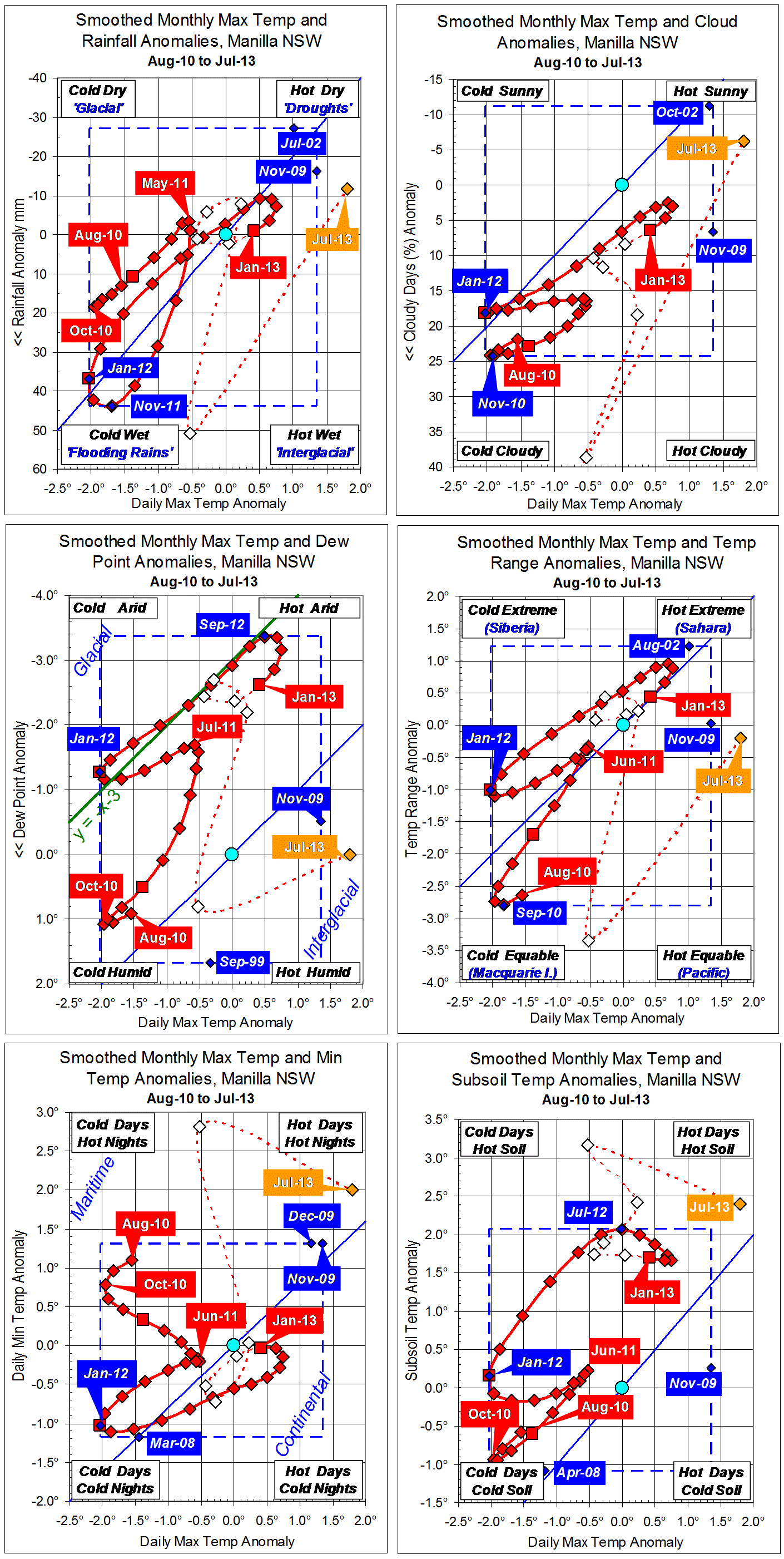
Raw values for July showed a big jump towards hot and dry for most variables, but dew point anomaly fell only to zero. Minimum temperature and subsoil temperature fell back a little from extremely high anomaly values in June.
The fully-smoothed data point for January 2013 continues a drift towards normal from the mild drought of October.
Note:
Fully smoothed data – Gaussian smoothing with half-width 6 months – are plotted in red, partly smoothed data uncoloured, and raw data for the last data point in orange. January data points are marked by squares.
Blue diamonds and the dashed blue rectangle show the extreme values in the fully smoothed data record since September 1999.