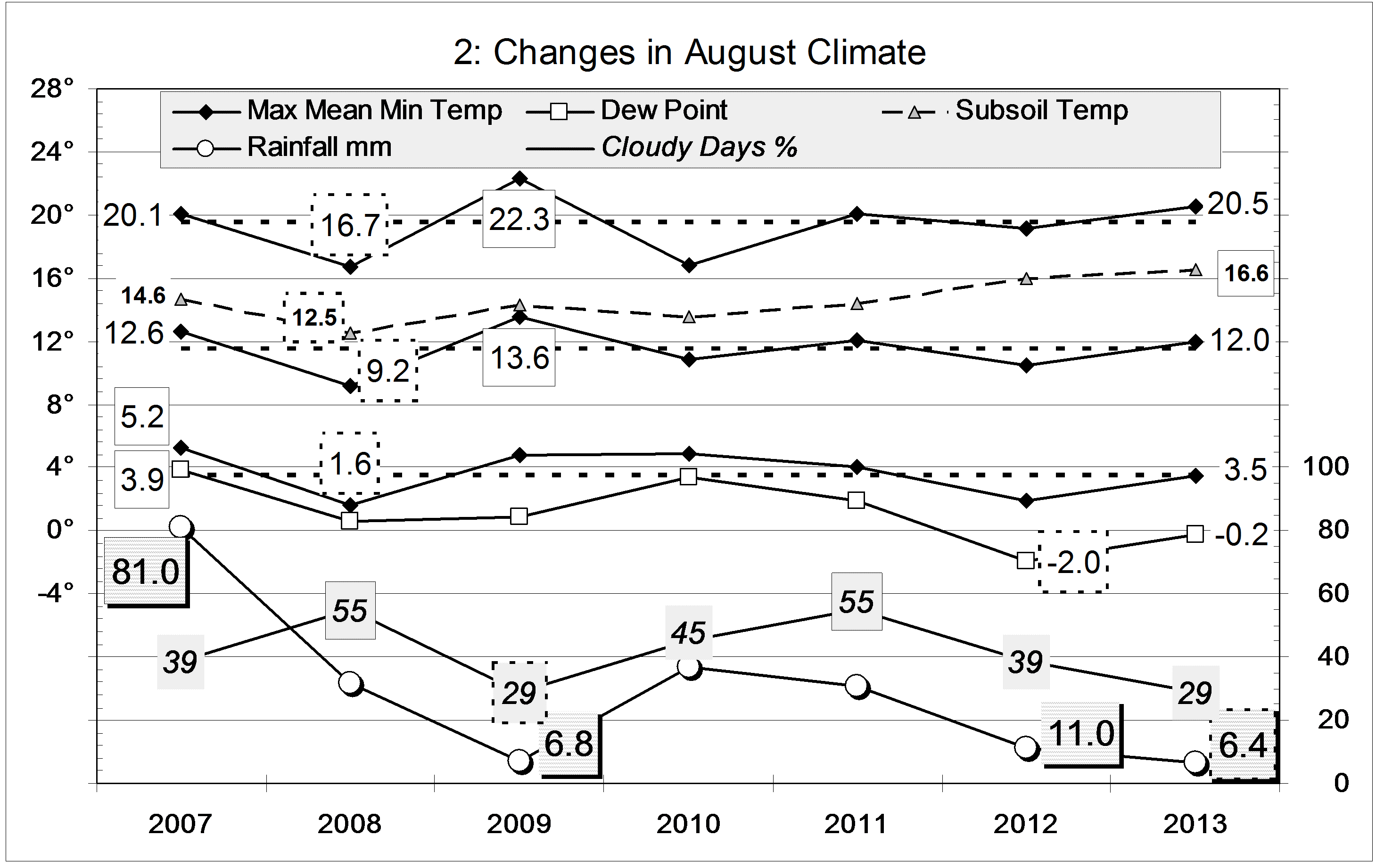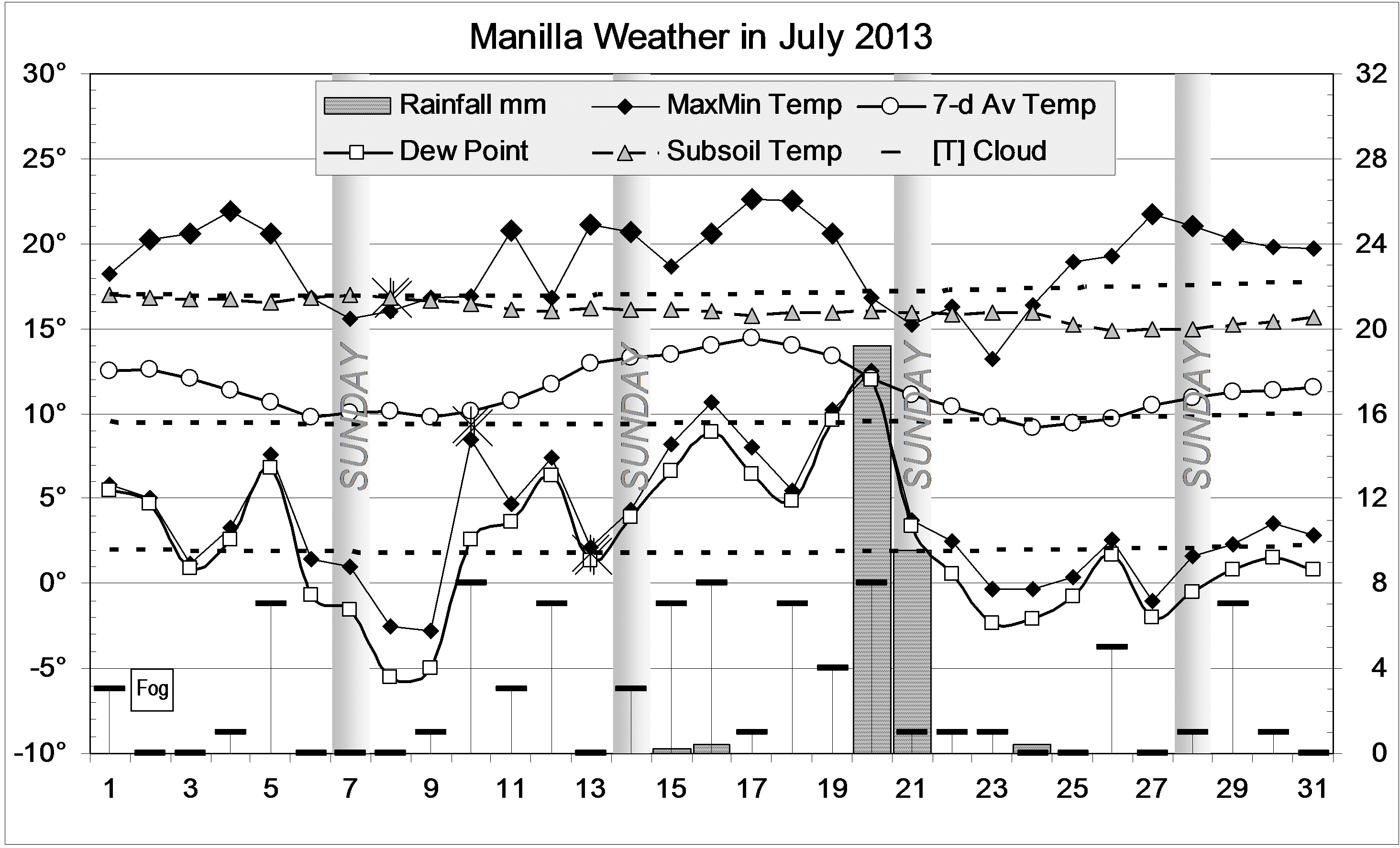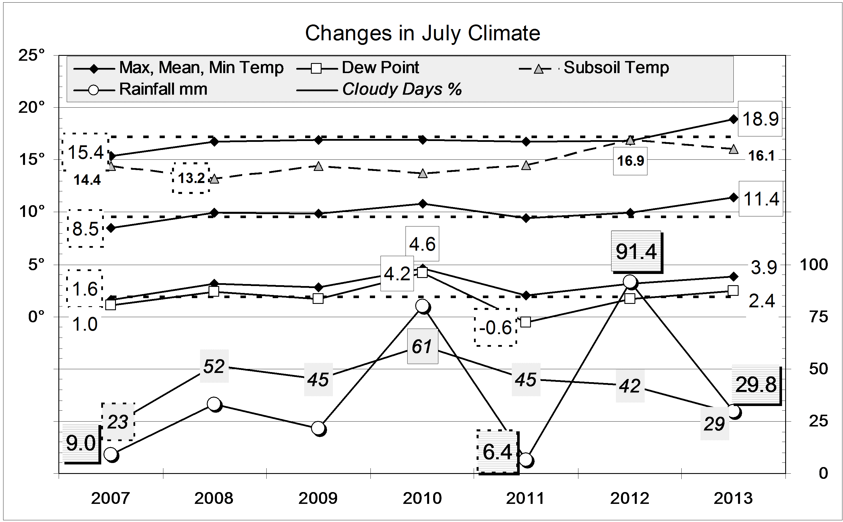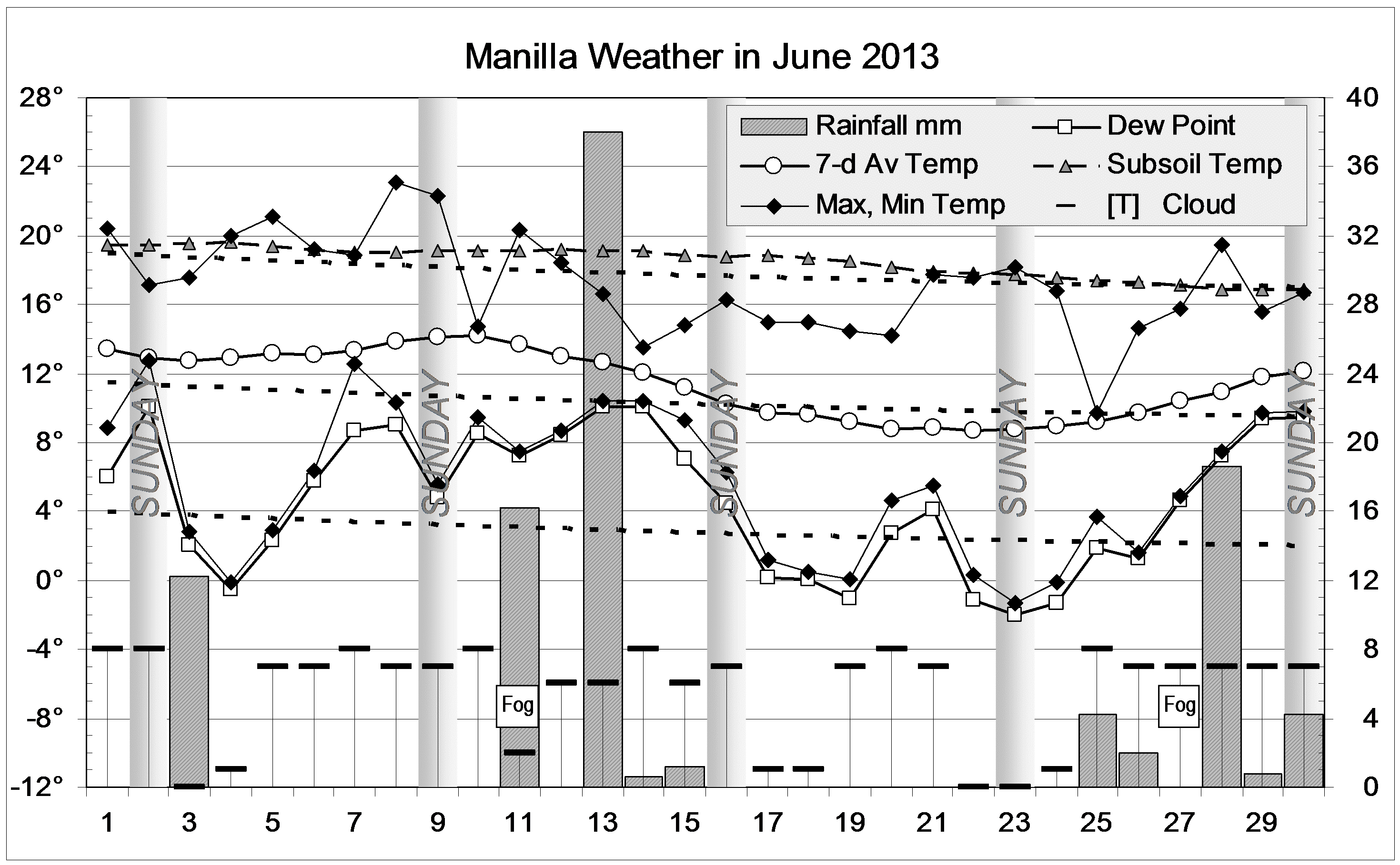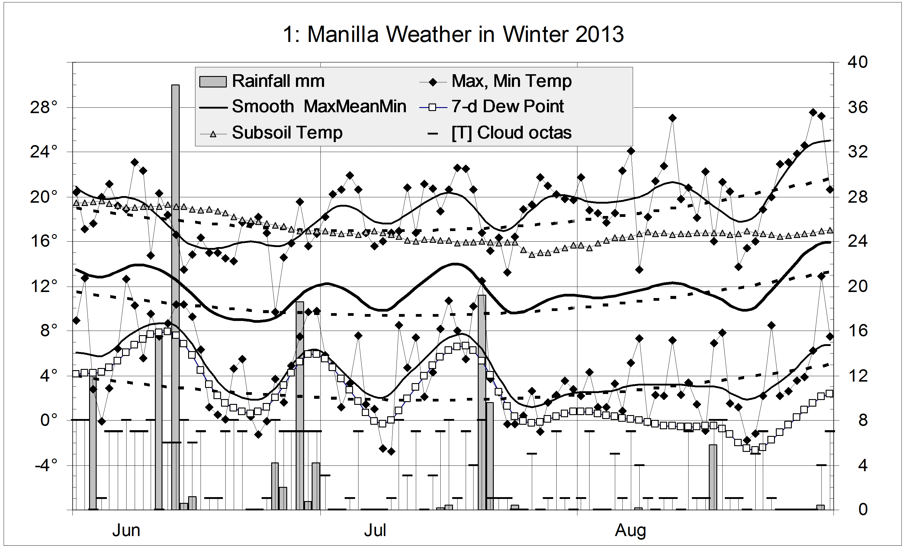
This winter, June was very cloudy and wet, July was very warm, and August was warm and dry. This pattern was common across northern NSW.
There were only 29 frosts, well below the winter average of 44, and fewer than in winter 2010 (32).
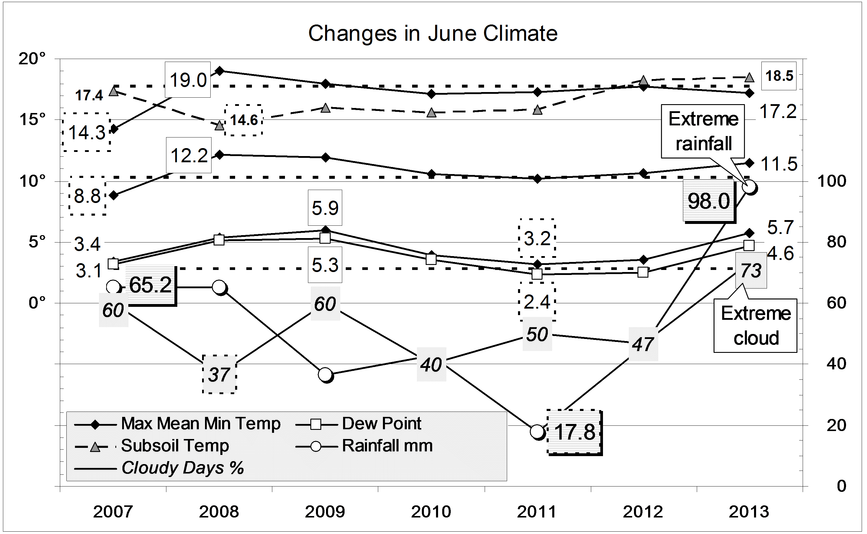
All winter average temperatures were above normal: daily max (18.9°), up by 0.8°; daily mean (11.6°), up by 1.2°; daily min (4.3°), up by 1.6°. In each case, winter of 2009 had been slightly warmer. As in last winter, the subsoil temperature was very high: 17.0°, which is 2.7 °above normal for winter in the decade from 1999. In that same decade, only 34% of winter mornings were cloudy; this winter’s value of 43% has become normal since.
The winter rainfall total of 134 mm is just above the average (125 mm) and in the 62nd percentile.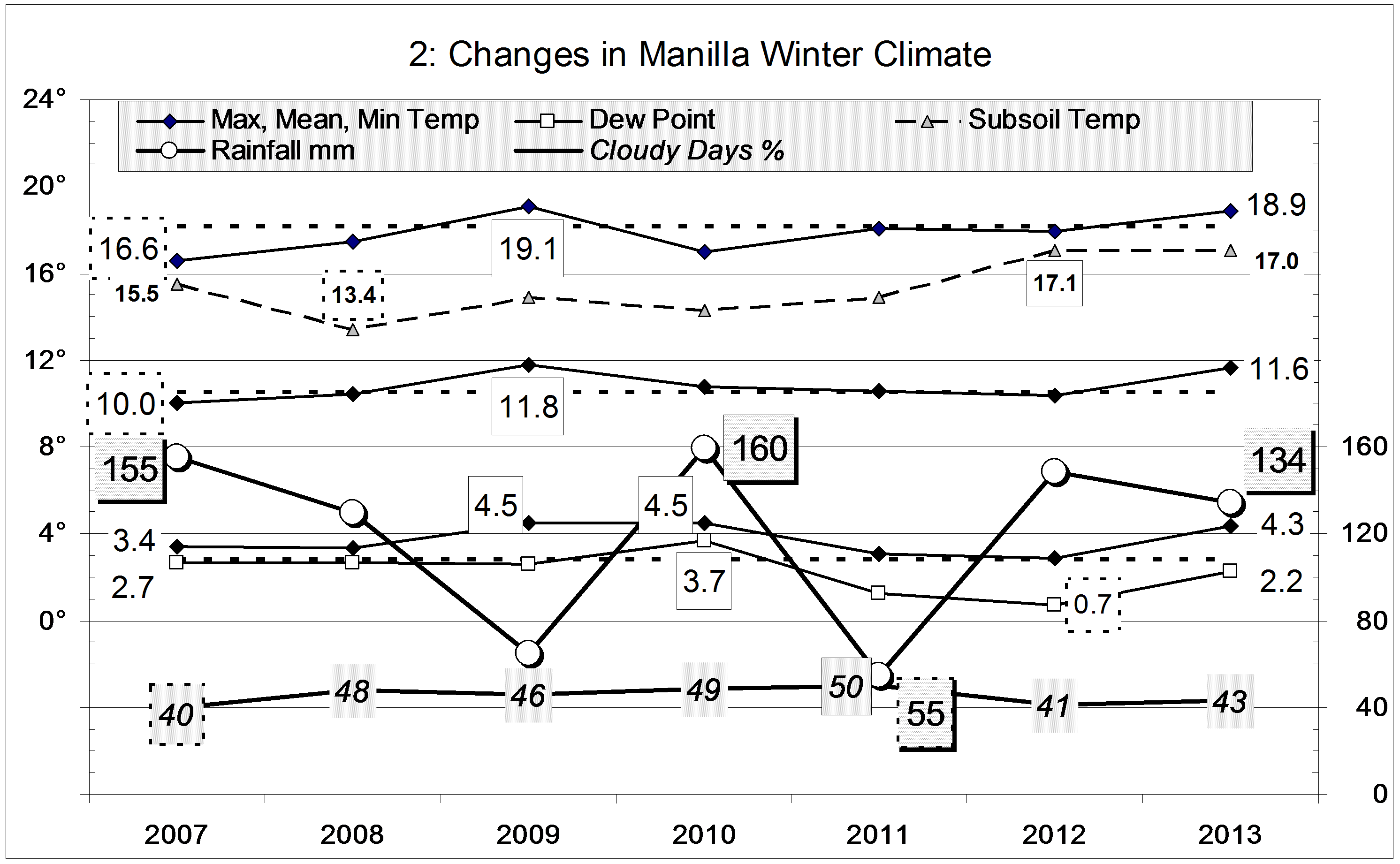
Data. Rainfall data is from Manilla Post Office, courtesy of Phil Pinch. Temperatures, including subsoil at 750 mm, and other data are from 3 Monash Street, Manilla.