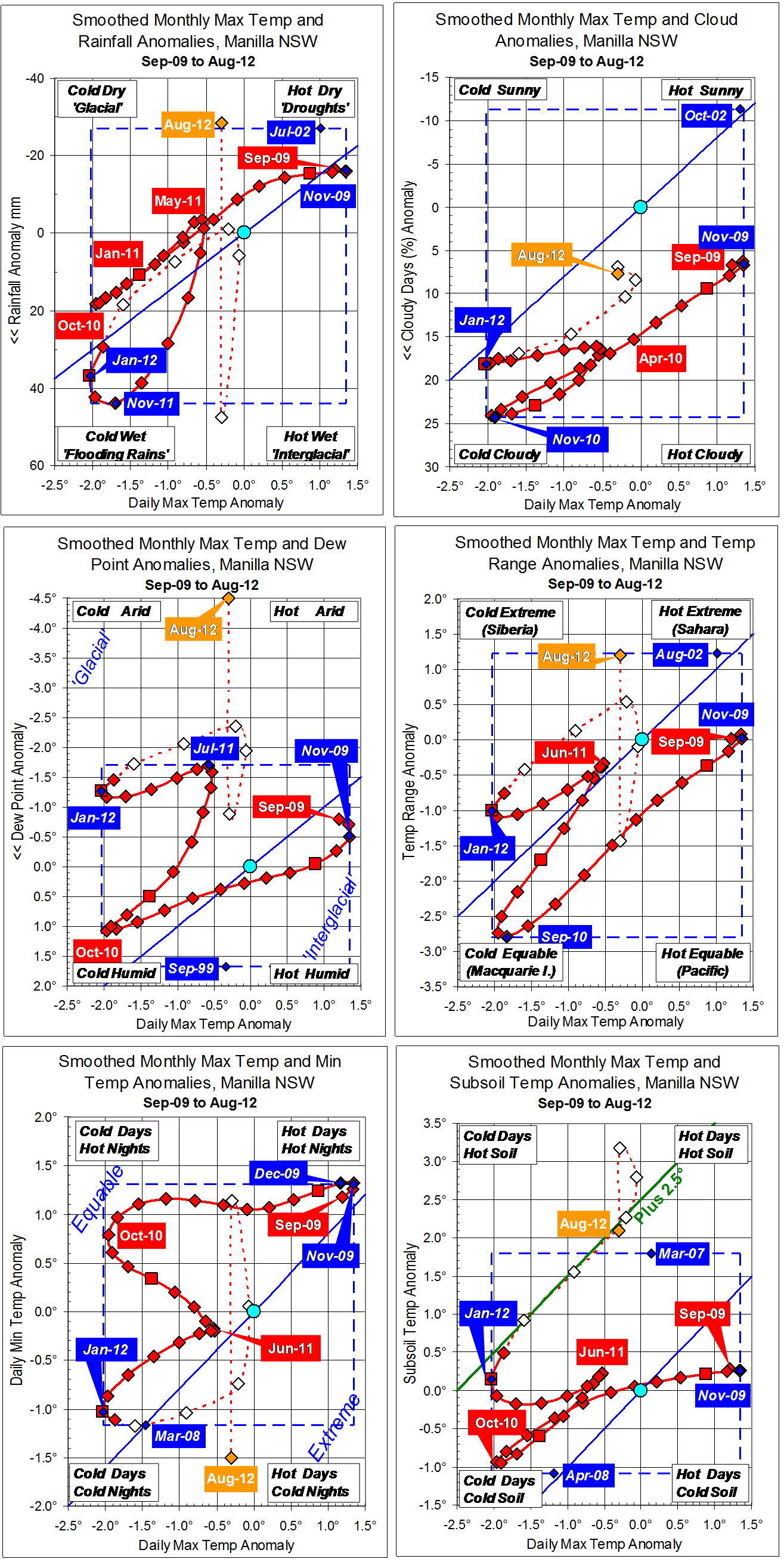
Parametric plots of smoothed climate variables at Manilla
“Rushing into drought”

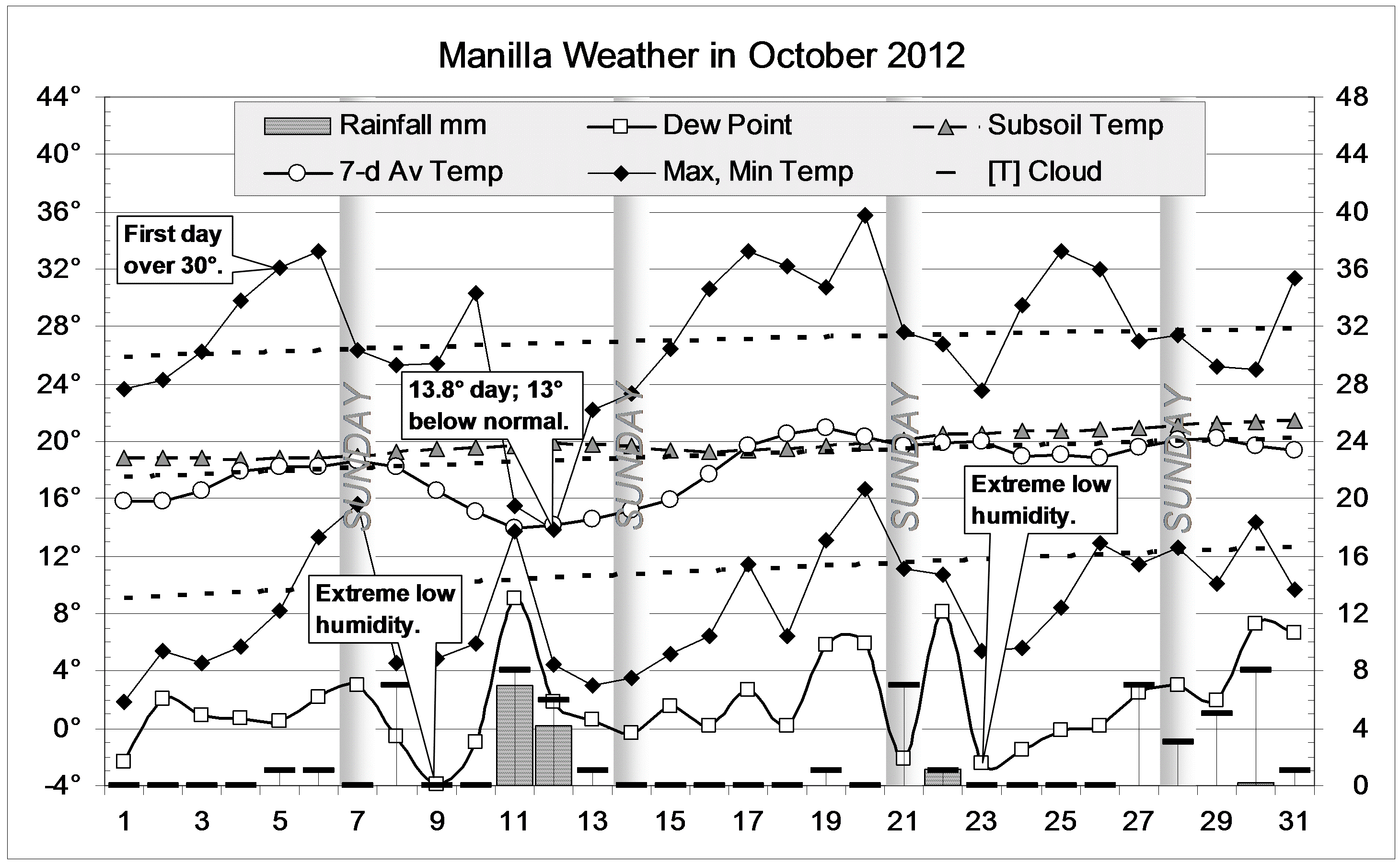
In October, while daily maximum temperature remained not far above normal, raw values of all other monthly mean anomalies (except minimum temperature and soil temperature) moved further in the “drought” direction. Most extreme was the dew point, which was nearly seven degrees below normal! Daily temperature range was also extremely wide. Rainfall was very low,and cloudiness lower than in recent months.
Minimum temperature anomaly moves erratically. October’s extremely low value resulted from moderate maximum temperature and extreme daily temperature range.
Subsoil temperature returned to normal after seven months above normal.
Fully-smoothed data (in red) now include April 2012. All variables for that month show an advance towards the top right corner of the graphs (typical of droughts).
The April 2012 value of smoothed dew point anomaly (-2.00°) is a new record low for smoothed data, beating the record of July 2011 (-1.70°).
Note: Fully smoothed data – Gaussian smoothing with half-width 6 months – are plotted in red, partly smoothed data uncoloured, and raw data for the last data point in orange. January data points are marked by squares. Blue diamonds and the dashed blue rectangle show the extreme values in the fully smoothed data record since September 1999.