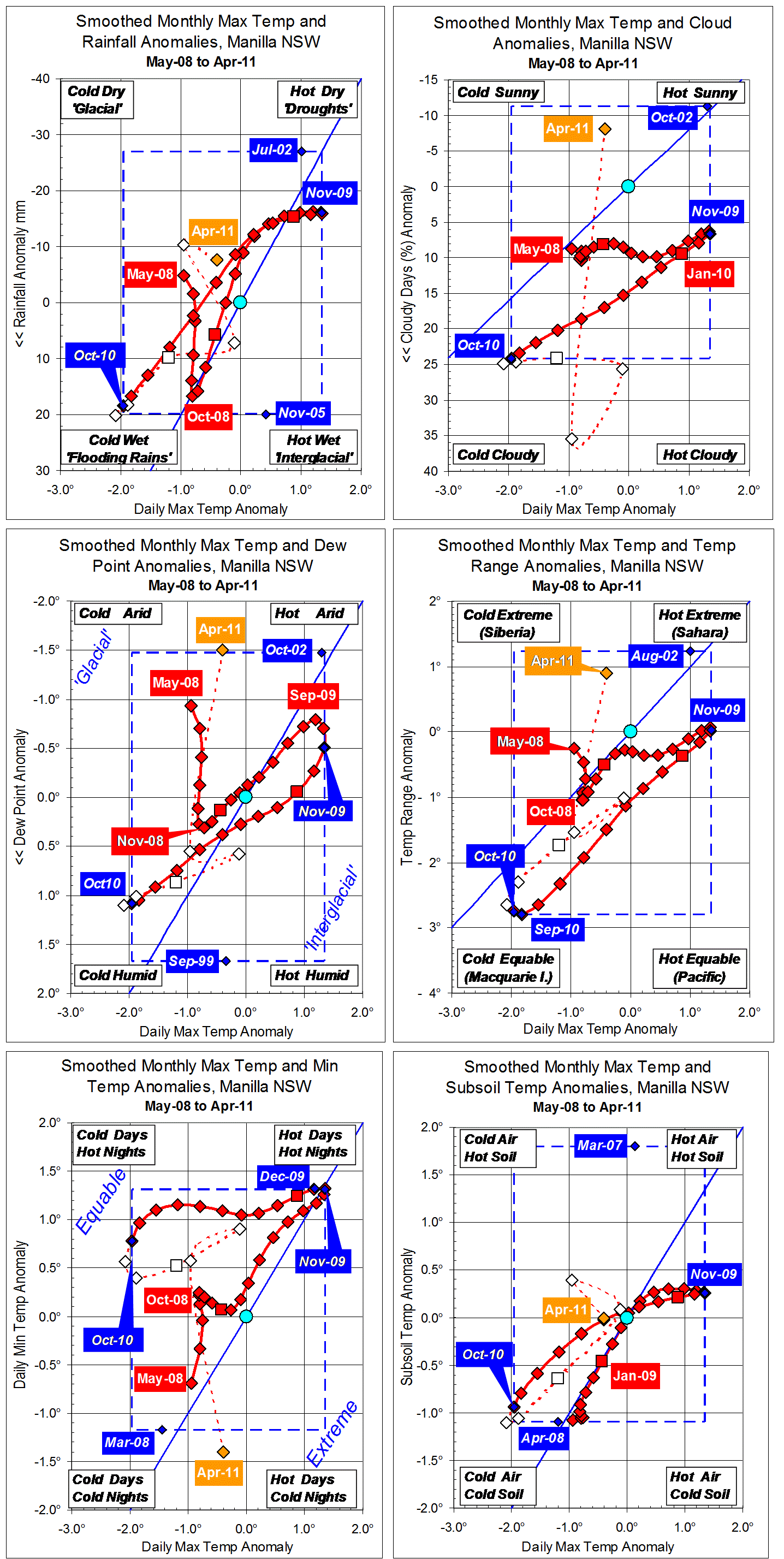
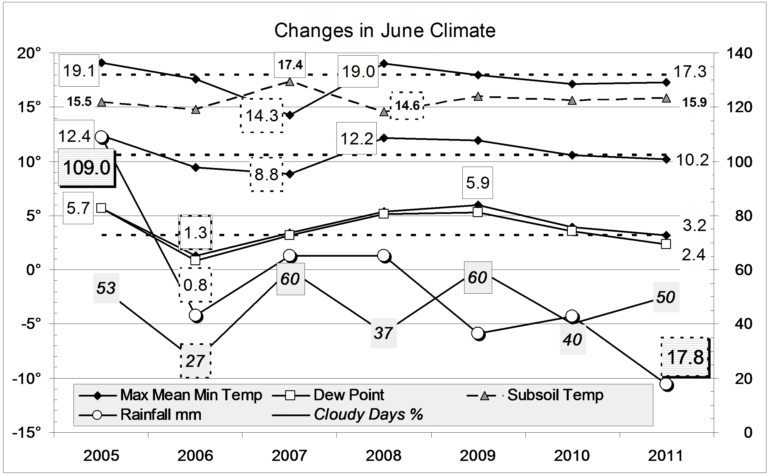
Parametric plots of smoothed climate variables at Manilla
“Flooding rains climate peaked here in October 2010”
Smoothed data for spring 2010
Fully smoothed data points for spring (SON) of 2010 are plotted in red on the left edge of the graphs. They show that several variables reached peak values during the season. First, temperature range anomaly reached a minimum in September. Next, in October, daily maximum temperature anomaly reached a minimum, rainfall anomaly a maximum, and Dew Point anomaly a maximum. In November, subsoil temperature anomaly reached a minimum. Cloudiness anomaly may have reached a maximum in that month, but perhaps smoothed December or January values will be higher. Daily minimum temperature anomaly did not peak. Through spring it fell steadily from a high positive value.
In a “weatherzone” post, I noted a tendency for variables to peak in a particular order.
“For a “flooding-rains” peak:
- First: Daily Temperature Range (min);
- One month later: Rainfall (max), Cloud (max);
- Two months later: Daily Maximum Temperature (min), Dew Point (max);
- Four months later: Daily Minimum Temperature (min), Subsoil Temperature (min).”
Not much is different in this case. In particular, daily temperature range was the first to peak (WHY?), and subsoil among the last. However, the time of rainfall maximum did not precede the time when daily maximum temperature reached a minimum.
Data after November 2010
During summer (DJF) most variables seemed to be moving towards “droughts” but this pattern broke down in autumn:
- Maximum temperature anomaly did not quite reach normal before falling again;
- Rainfall anomaly became negative then returned to positive;
- Cloud anomaly had just one negative value before returning to record cloudiness;
- Dew Point anomalies accelerated to extremely low values;
- Temperature range anomaly went very positive before falling slightly;
- Minimum temperature anomaly fell rapidly, independent of maximum temperature anomaly;
- Subsoil temp anomaly stabilised at a slightly positive value.
I am surprised that extreme cloudiness and extreme low humidity occur together. I am also puzzled about the weak association between daily maximum and minimum temperatures. This is a worry because daily minimum temperatures provide the most consistent signal of climate change during the last century.
Note: Fully smoothed data – Gaussian smoothing with half-width 6 months – are plotted in red, partly smoothed data uncoloured, and raw data for the last data point in orange. January data points are marked by squares. Blue diamonds and the dashed blue rectangle show the extreme values in the fully smoothed data record since September 1999.


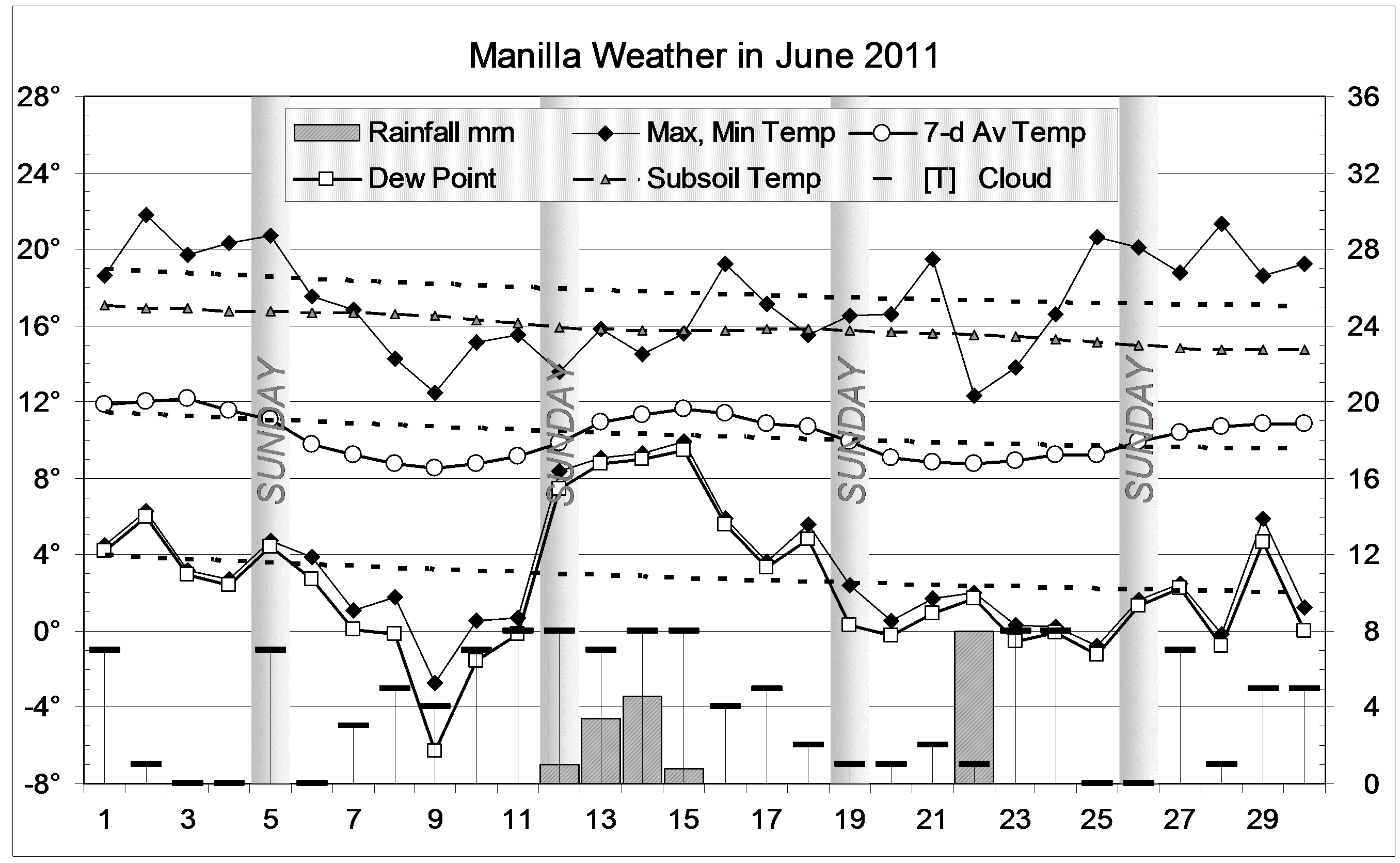

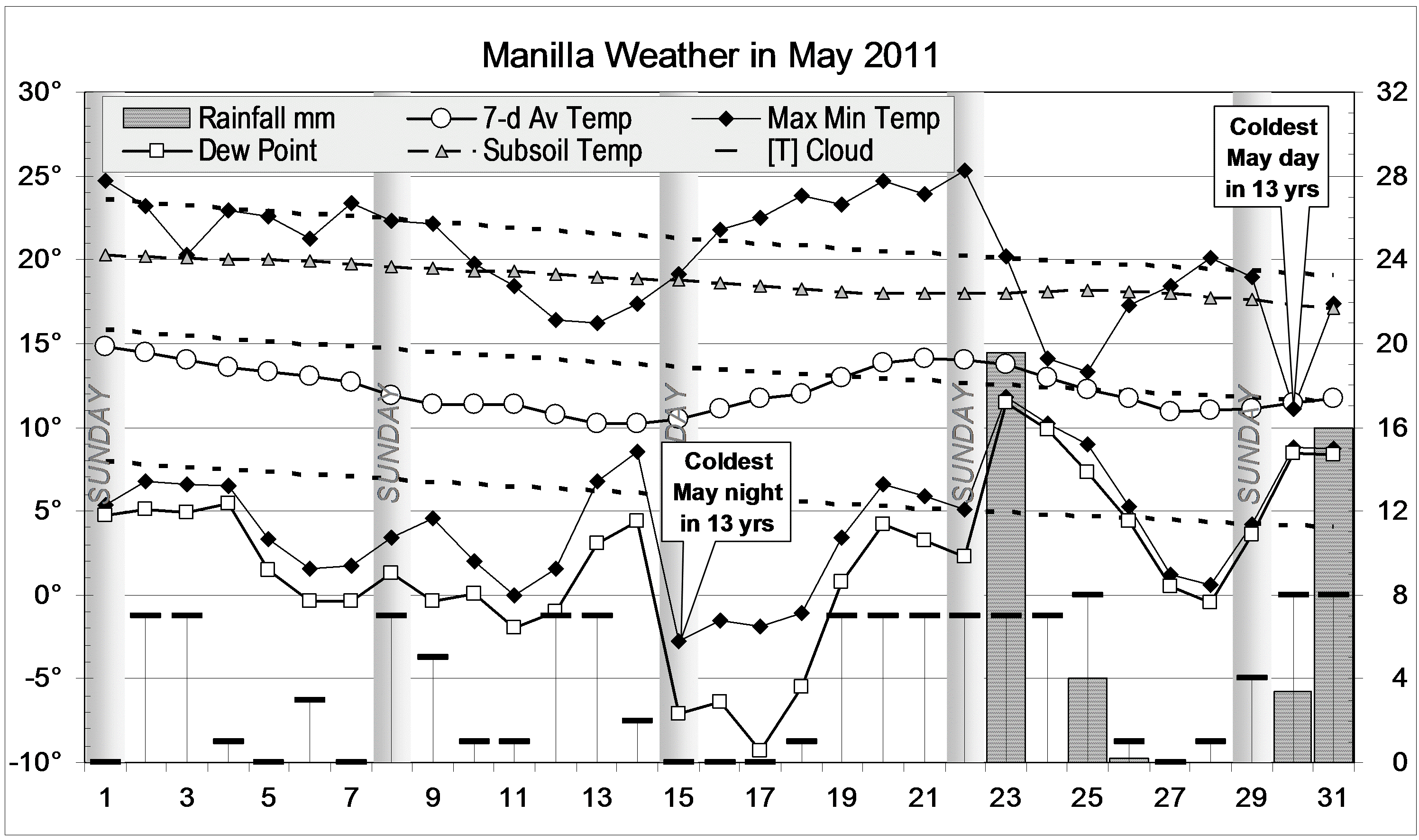
 Normal autumn weather was broken by an almost rainless period from mid-April to late May. Temperatures fell very low, particularly at night. The minimum of minus 2.8 degrees on 15/5/11 was a record for autumn. The coldest nights were exceptionally dry: 17/5/11 had the lowest Dew Point in thirteen years, -9.3°. Even during the extreme drought of July 2002, with four Dew Point readings below -6°, the air did not get nearly so dry.