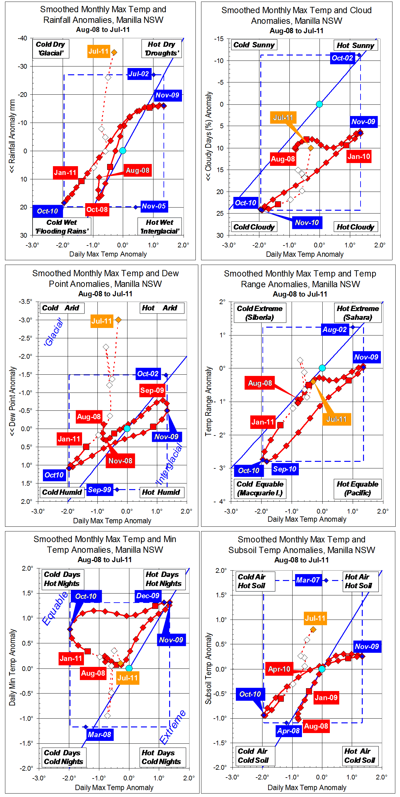
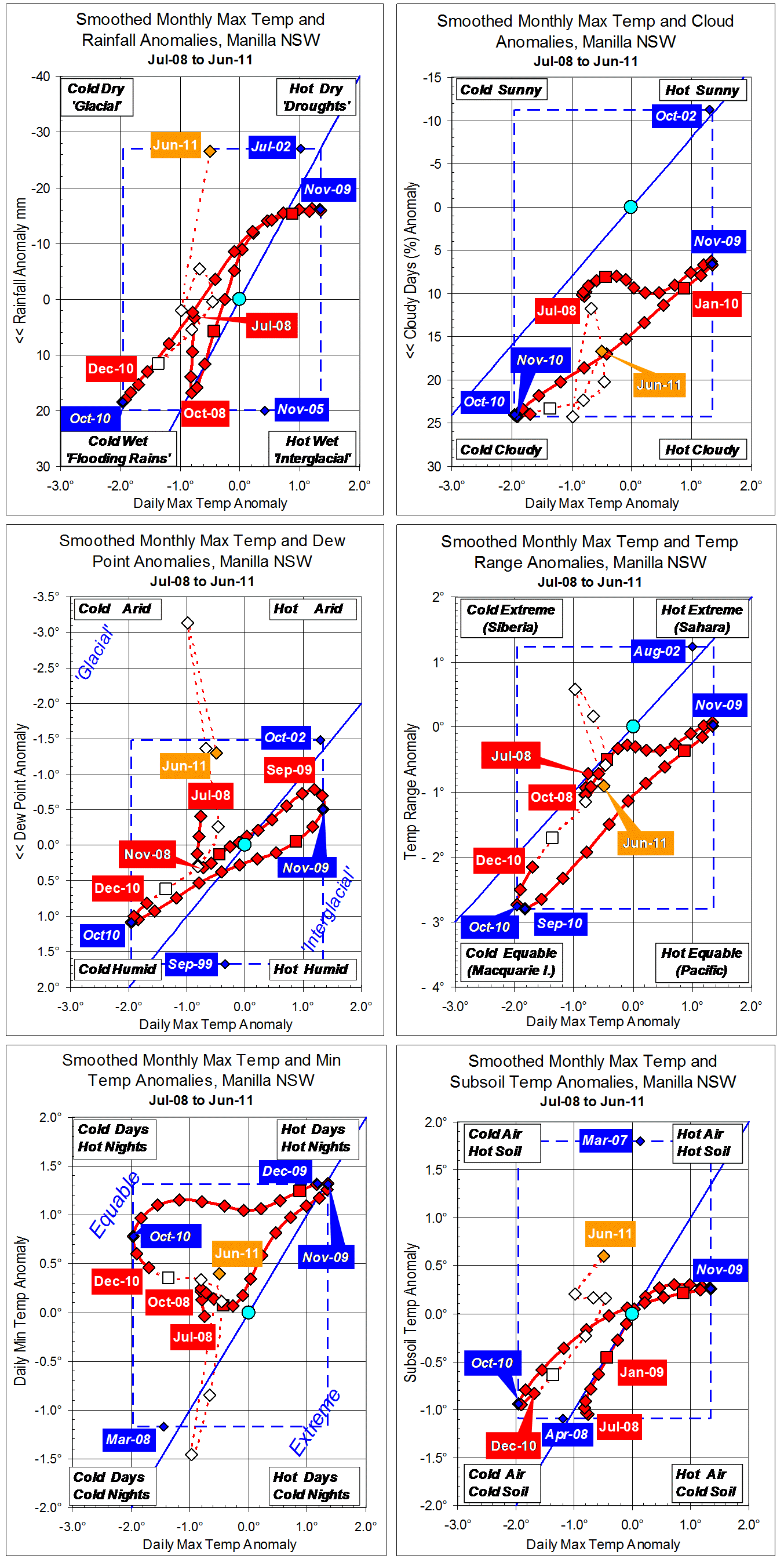
Parametric plots of smoothed climate variables at Manilla
“Summer showed warming and drying”
New fully-smoothed data for summer 2010-11
Daily maximum temperature anomalies (x-axis, all graphs) are more clearly shown on the top right graph. They rose at 0.3° per month: about the same rate as they had fallen in the winter. From the extreme cold (-1.96°) of October 2010, the February value was half-way back to normal.
Monthly rainfall anomalies (y-axis, top left graph) decreased through summer, exactly reversing the winter trend.
Cloudiness (top right graph) also reversed the trend seen in winter but, for a given temperature value, there was now more cloud.
Dew Point anomaly (centre left) fell much more rapidly than it had risen in winter. It was near normal by February.
Temperature range anomaly (centre right) rose much more rapidly during summer than that of maximum temperature, and reached higher values. As has appeared persistently in this data series, temperature range is the first variable to reach a positive or negative peak anomaly value. Here, its minimum value was in September, a month before the minimum value of daily maximum temperature. On these axes, the curve loops clock-wise as a result.
Daily minimum temperature anomaly (bottom left) fell steadily towards normal through spring and summer, completing a broad 30-month loop with daily maximum temperature anomaly.
Subsoil temperature anomaly (bottom right) fell along with daily maximum temperature anomaly.
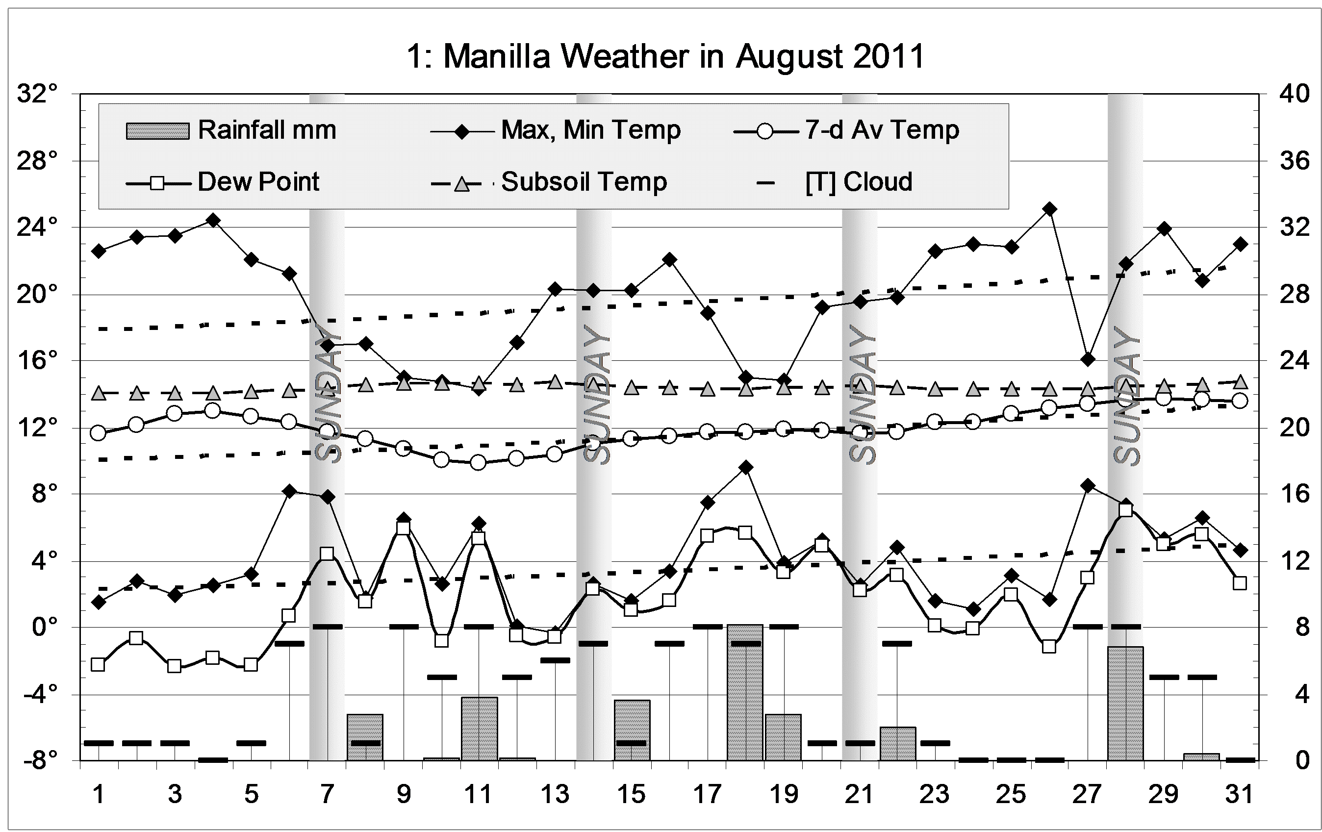
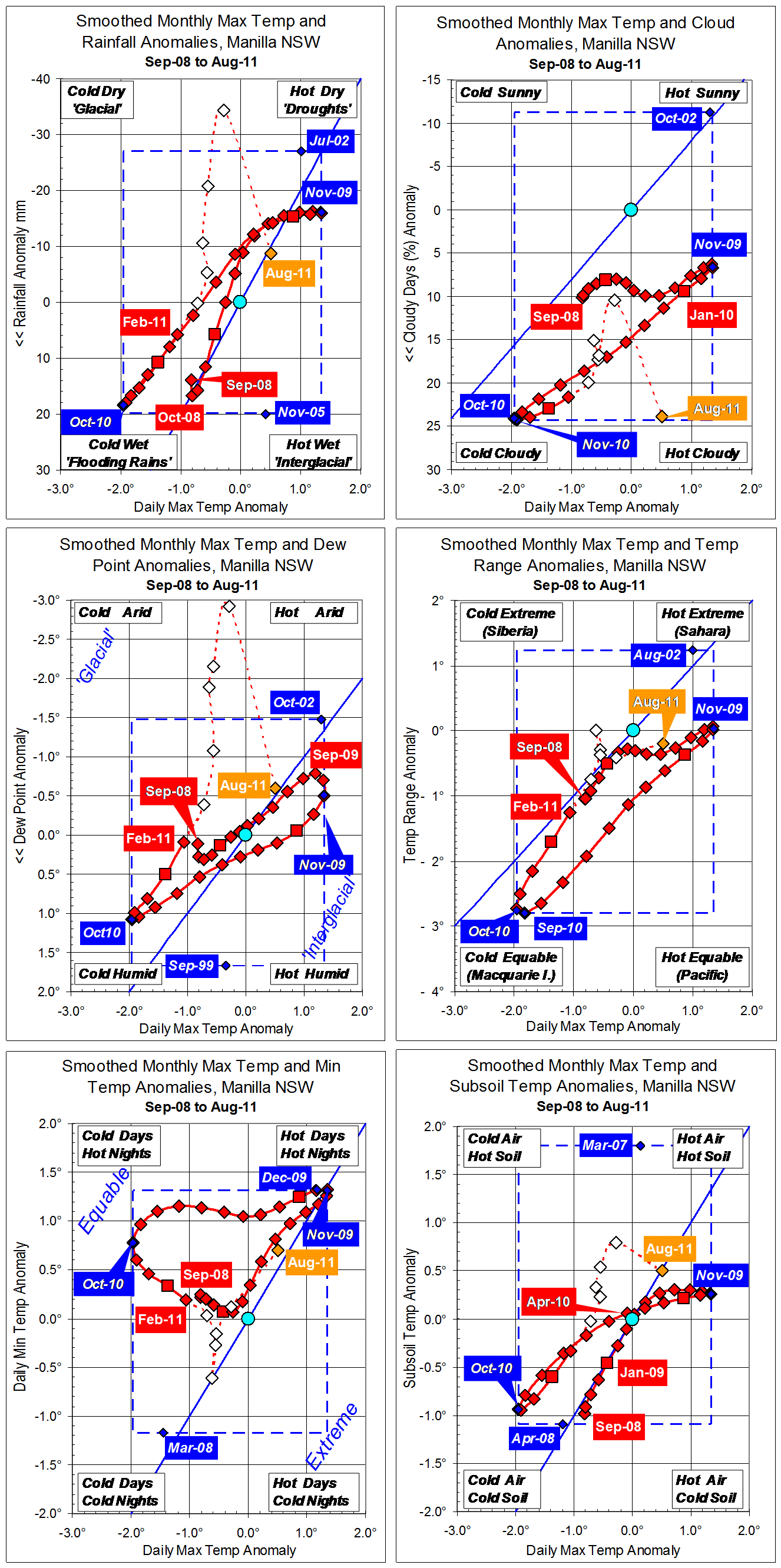
Partially smoothed and unsmoothed data since February
Early winter 2011 had very low rainfall, very low Dew Points, and warm subsoil. Raw anomaly values for August suggest that the climate has since returned to normal, if somewhat warm and dry.
Note: Fully smoothed data – Gaussian smoothing with half-width 6 months – are plotted in red, partly smoothed data uncoloured, and raw data for the last data point in orange. January data points are marked by squares. Blue diamonds and the dashed blue rectangle show the extreme values in the fully smoothed data record since September 1999.