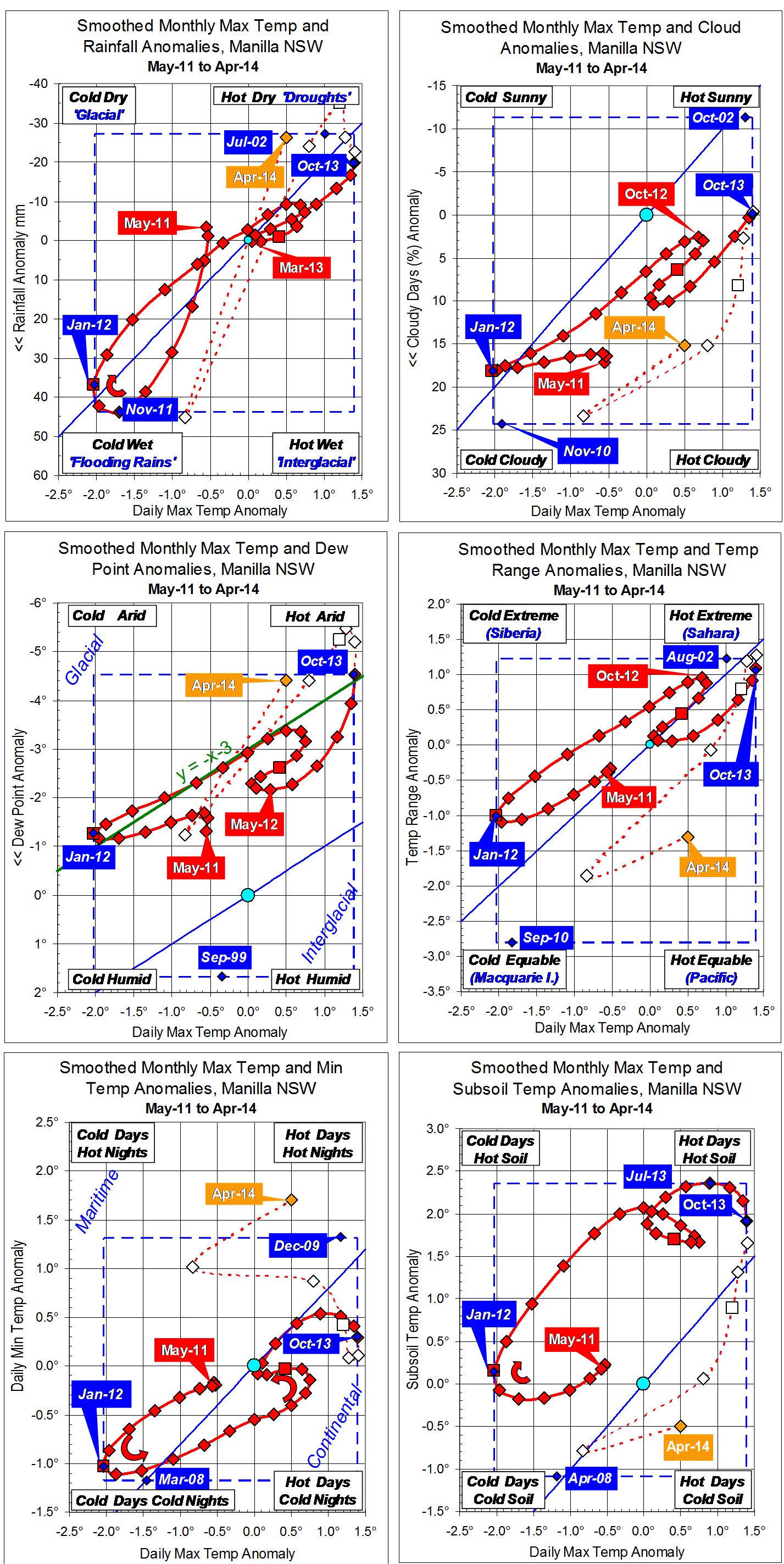
Parametric plots of smoothed climate variables at Manilla
“Drought status not clear”
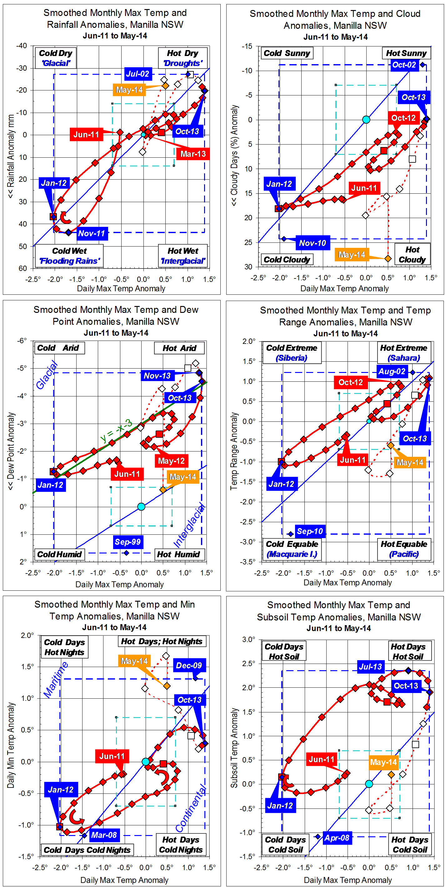
May data (orange)
Raw data for May 2014 give mixed signals on whether the drought is fading. Daily maximum temperature is now on the high limit of the normal range and rainfall again well into the “drought” range. However, other variables do not agree: skies were very cloudy, and dew point and daily temperature range were back to normal.
Fully smoothed data (red)
The spring months (SON) of 2013 are now fully smoothed, with some variables showing a drought peak in that season.
Smoothed daily maximum temperature anomaly peaked in October, reaching a record high of +1.39°, beating +1.34° in November 2009 and +1.30° in September-October 2002. Through spring the smoothed rainfall anomaly decreased; it may have reached a minimum in January. Dew point also decreased, the smoothed anomaly reaching a new record low of -4.85° in November, and likely to reach a minimum in December.
Cloudiness reached a minimum in October, and daily minimum temperature and subsoil temperature anomalies had reached maximum values earlier, in July.
Note:
Fully smoothed data – Gaussian smoothing with half-width 6 months – are plotted in red, partly smoothed data uncoloured, and raw data for the last data point in orange. January data points are marked by squares.
Blue diamonds and the dashed blue rectangle show the extreme values in the fully smoothed data record since September 1999.
Normal values are based on averages for the decade from March 1999. They appear on these graphs as a turquoise (turquoise) circle at the origin (0,0). A range of anomalies called “normal” is shown by a dashed rectangle in aqua (aqua). For values in degrees, the assigned normal range is +/-0.7°; for cloudiness, +/-7%; for monthly rainfall, +/-14 mm.