
Fine with a wide daily temperature range
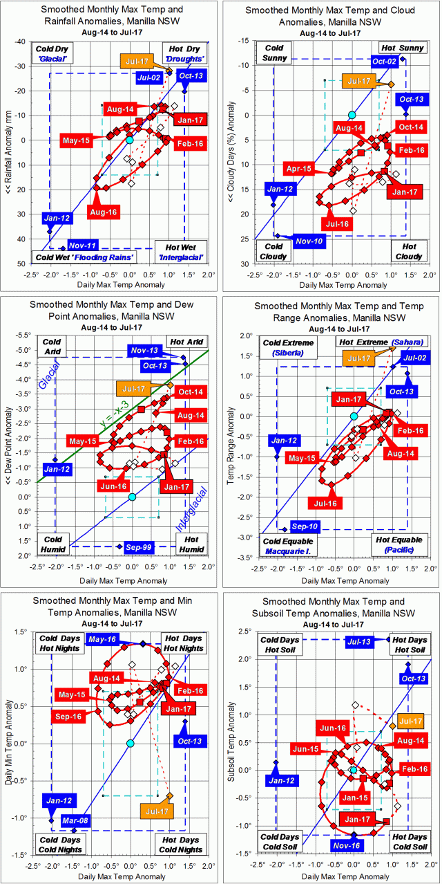
July raw anomaly data (orange)
In July 2017 the largest anomaly was the very wide daily temperature range (middle right graph). This was linked to the daily minimum temperature anomaly (lower left graph) falling suddenly very low.
All moisture indicators pointed to aridity (upwards), and the anomalies of both daily maximum temperature and subsoil temperature were high.
Fully smoothed data (red)
The latest available fully-smoothed data point, January 2017, showed continued warming in the anomalies of maximum, minimum and subsoil temperatures. These were coming to a peak: the maximum and minimum perhaps in February, but subsoil not for several months.
Moisture anomaly variables were near a peak of aridity. Dew point had peaked (low) in November, cloudiness (low) and daily temperature range (high) in January, with rainfall (low) likely in February.
Note:
Fully smoothed data – Gaussian smoothing with half-width 6 months – are plotted in red, partly smoothed data uncoloured, and raw data for the last data point in orange. January data points are marked by squares.
Blue diamonds and the dashed blue rectangle show the extreme values in the fully smoothed data record since September 1999.
Normal values are based on averages for the decade from March 1999.* They appear on these graphs as a turquoise (turquoise) circle at the origin (0,0). A range of anomalies called “normal” is shown by a dashed rectangle in aqua (aqua). For values in degrees, the assigned normal range is +/-0.7°; for cloudiness, +/-7%; for monthly rainfall, +/-14 mm.
* Normal values for rainfall are based on averages for the 125 years beginning 1883.
