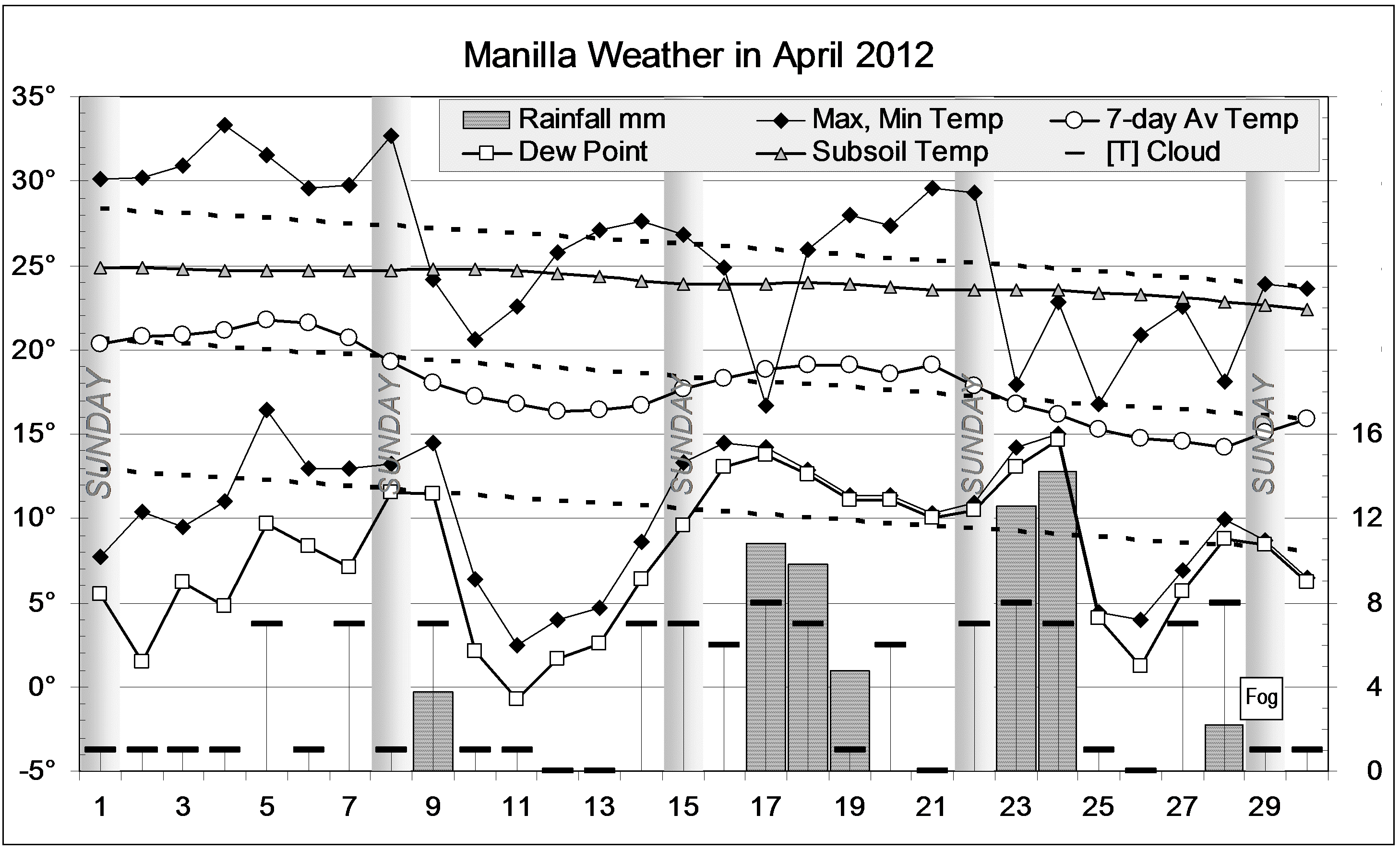
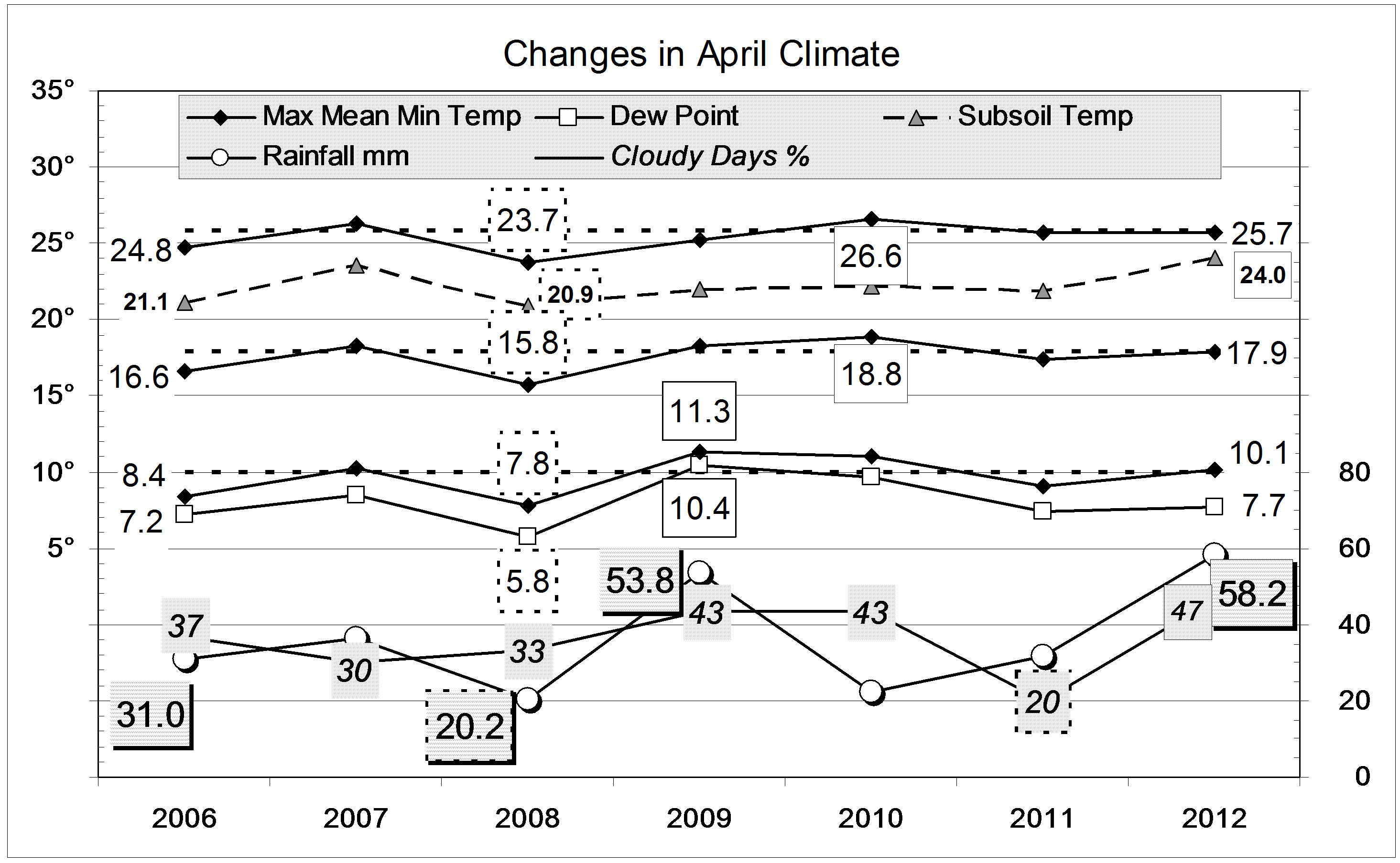
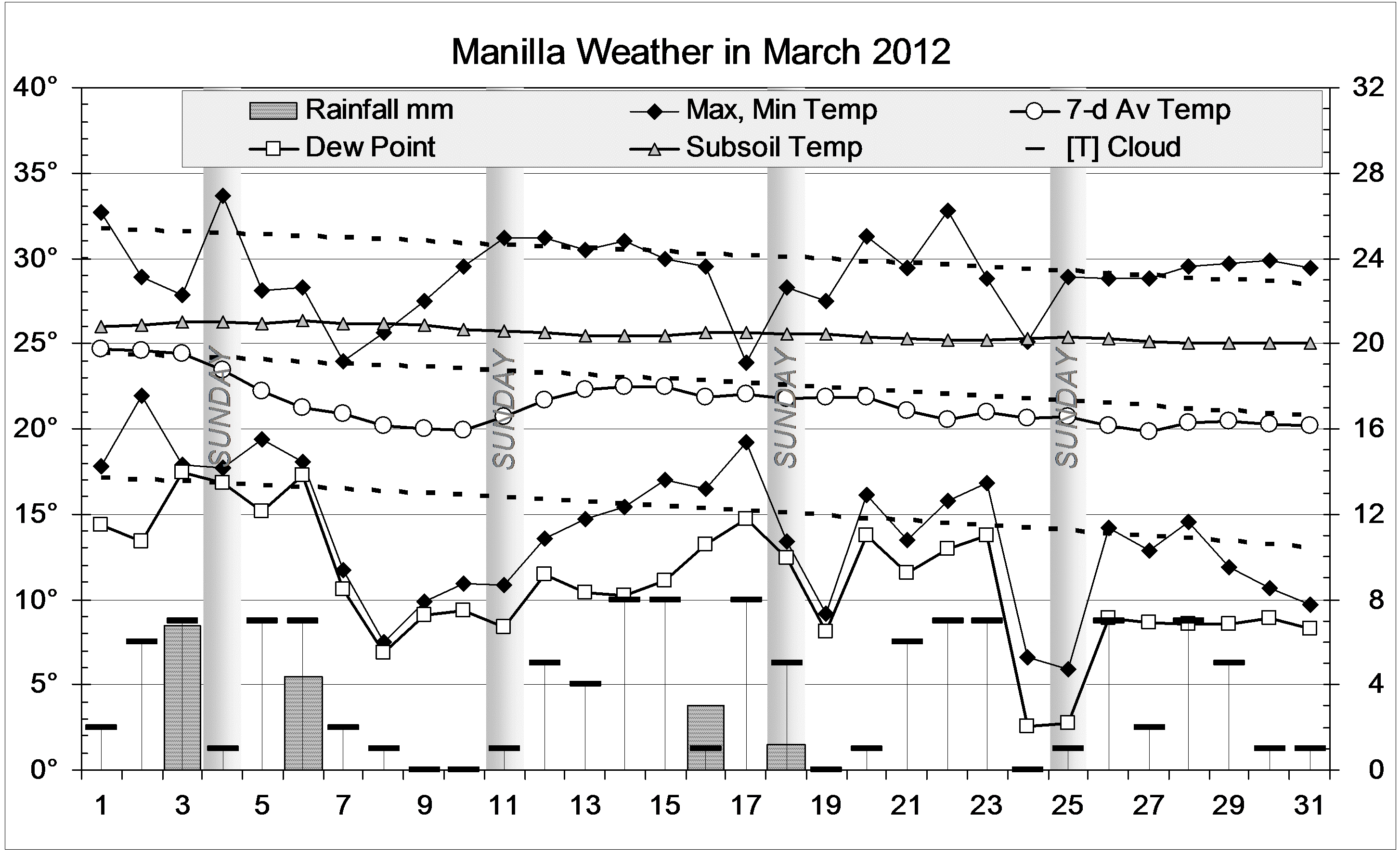
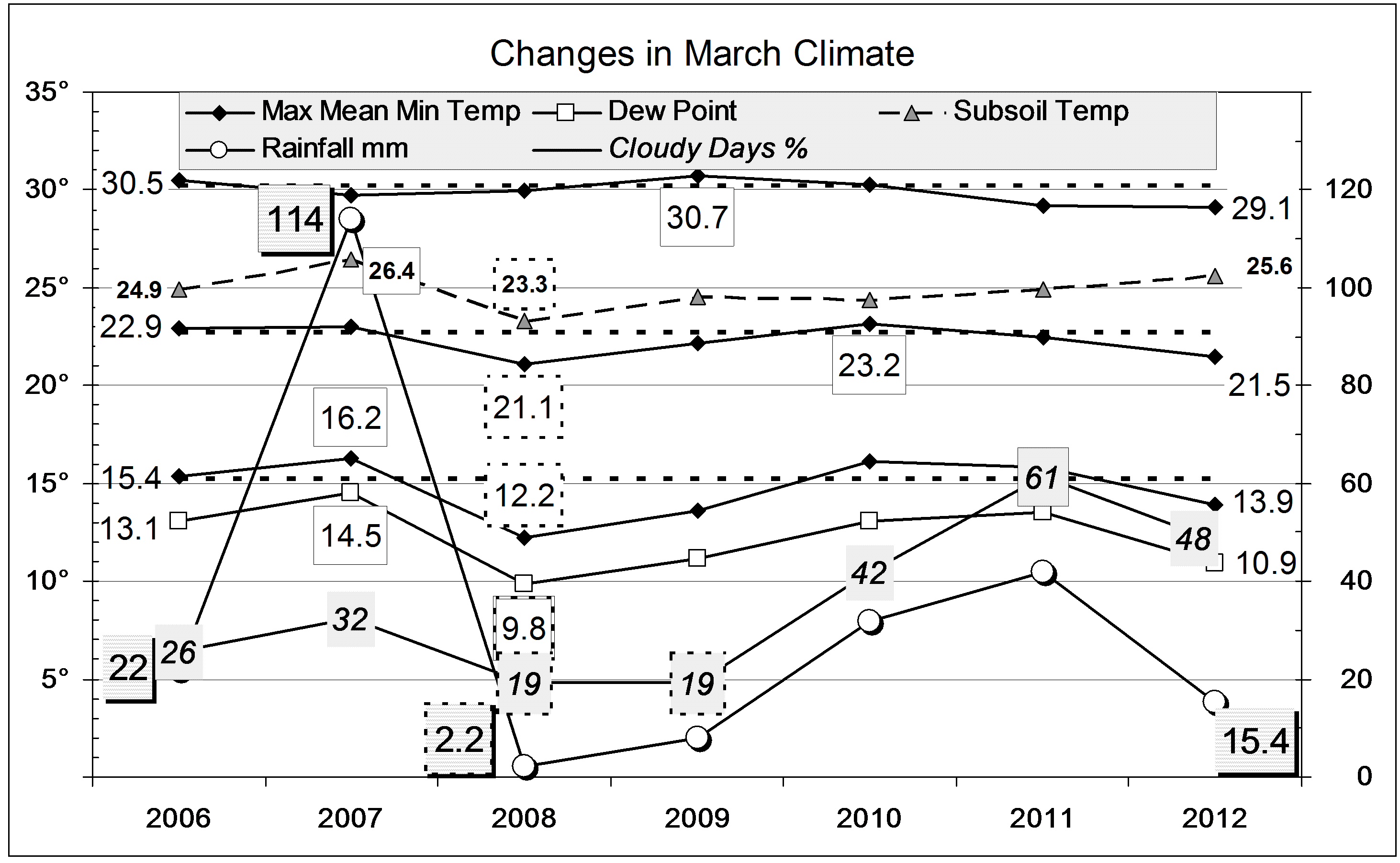
The daily weather log
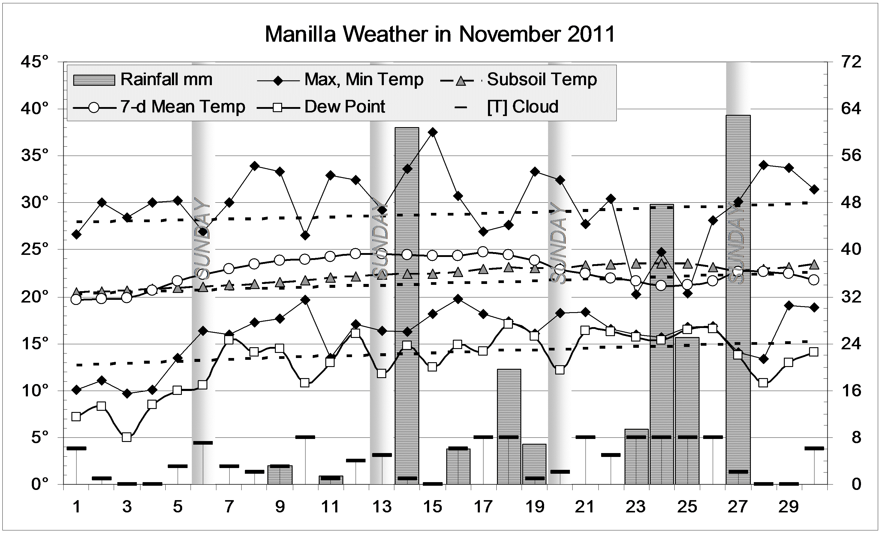
Nearly all the days and nights of December were several degrees cooler than normal. None of them were very cold, but no days and few nights were above normal either. As in much of NSW, cool weather continued for the whole month. In a normal December, most days are warmer than 30°, but this time only four were. There were eleven rain days, often with cloud on the hills and sometimes valley fog (in summer!). The highest rainfall (2 day) reading was 22.0 mm.
Comparing December months
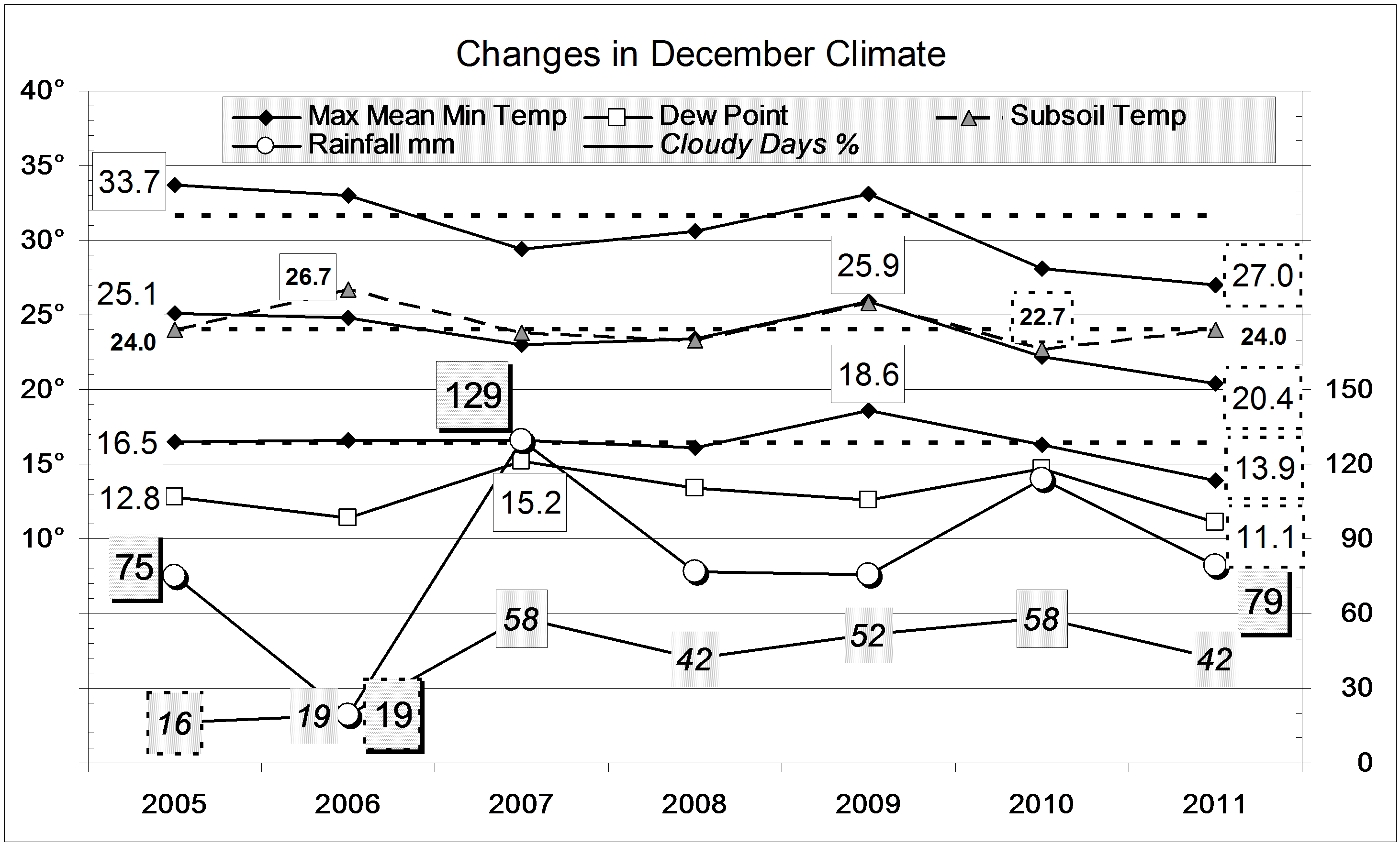
This December was even cooler than the last. It set new post-1998 record lows for mean daily maximum temperature (27.0°), mean daily mean temperature (20.4°), and mean daily minimum temperature (13.9°). This December’s days and nights were cooler than those of November, by 2.8° and 2.1° respectively.
Mean early morning Dew Point (11.1°) was also a record low value.
The mean daily temperature range (13.2°) was a bit wider than last years record narrow value (11.7°). The sky was rather cloudy, and the mean subsoil temperature (24.0°) normal.
The rainfall of 79.0 mm is in the 58th percentile for December, above the long-term average of 74 mm. Totals for groups of months up to 24 months are now all extremely high: above the 80th percentile. The greatest rainfall “shortage” is in the 12-year total, which has the lowest percentile value (41st percentile): in the last 12 years 7621 mm of rain fell, which is just 82 mm short of the median 12-year total of 7703 mm.
The year 2011
After a very dry winter, record-breaking spring rain made this an extremely wet year. The rainfall for the year, 839 mm, is in the 86th percentile. It was not quite as wet as 1998 (919 mm; the 6th wettest) or 1996 (890 mm; the 10th wettest). These three years (1996, 1998, 2011) are the wettest in the third of a century since 1978, which had 979 mm.
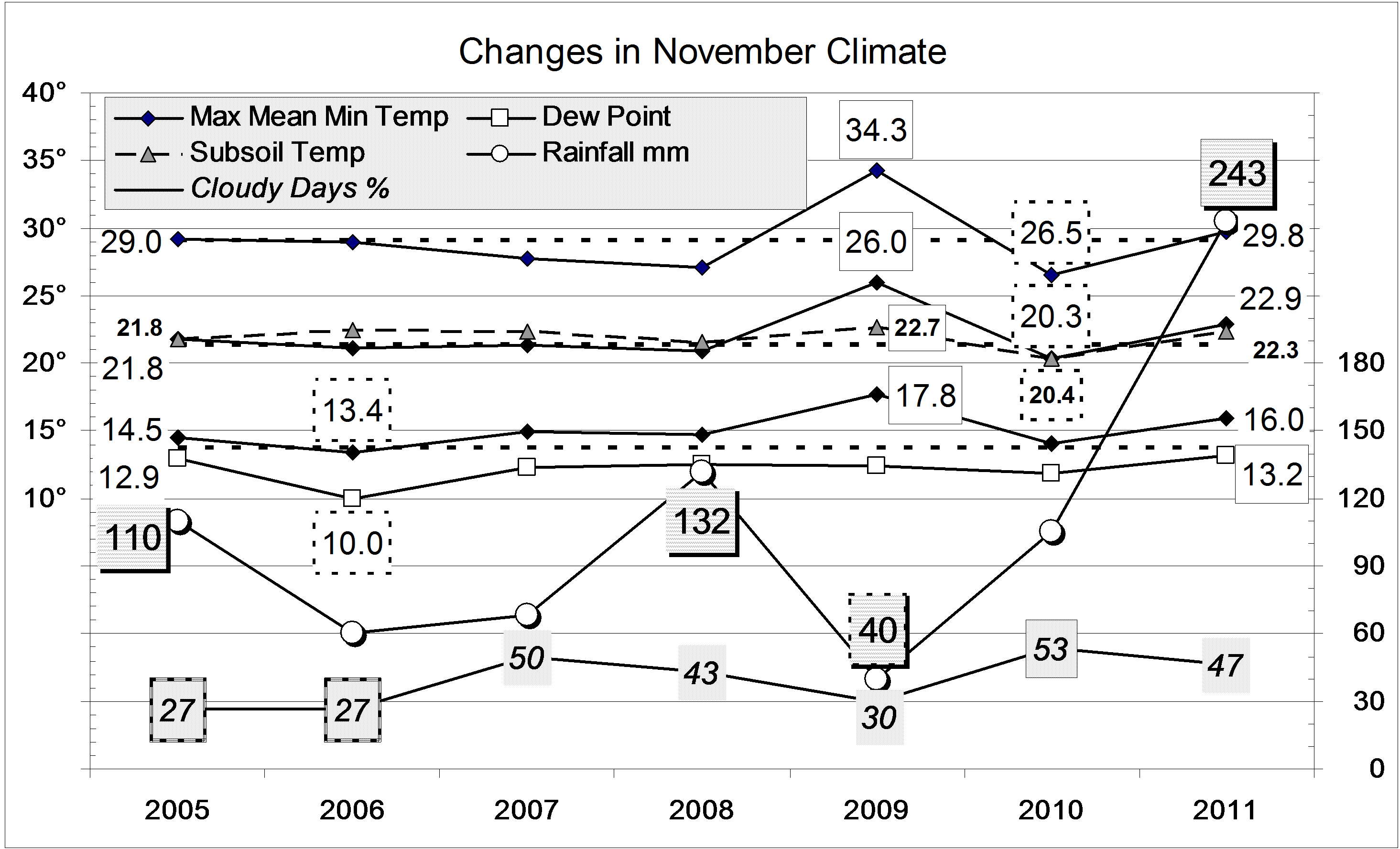
In other ways, the year was nearer to normal than 2010. There were 91 rain days, fewer than last year’s record 112 rain days. It was much less cloudy, which allowed days to become warmer and nights cooler than last year, when the climate had been more equable: like that on the coast.
Data. Rainfall data is from Manilla Post Office, courtesy of Phil Pinch. Temperatures, including subsoil at 750 mm, and other data are from 3 Monash Street, Manilla.