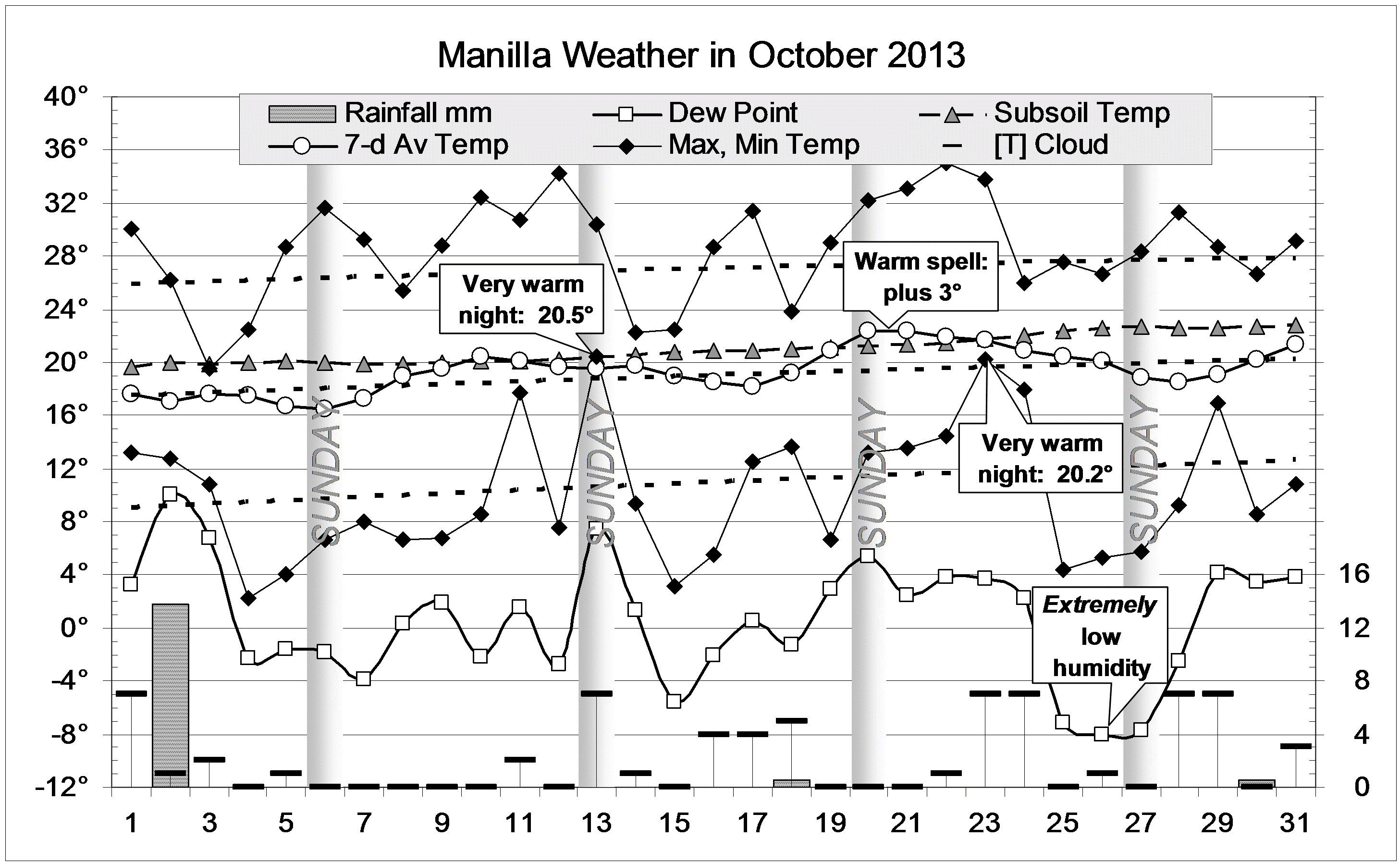
The daily weather log

By November the 11th, there had been only 70 mm of rain since the deluge in June. The humidity had been getting lower by the month. From that day, rain and high humidity returned. Days and nights became cooler than normal, with more cloudy skies. Most of the seven wet days were showery, but the 29th had steady rain.
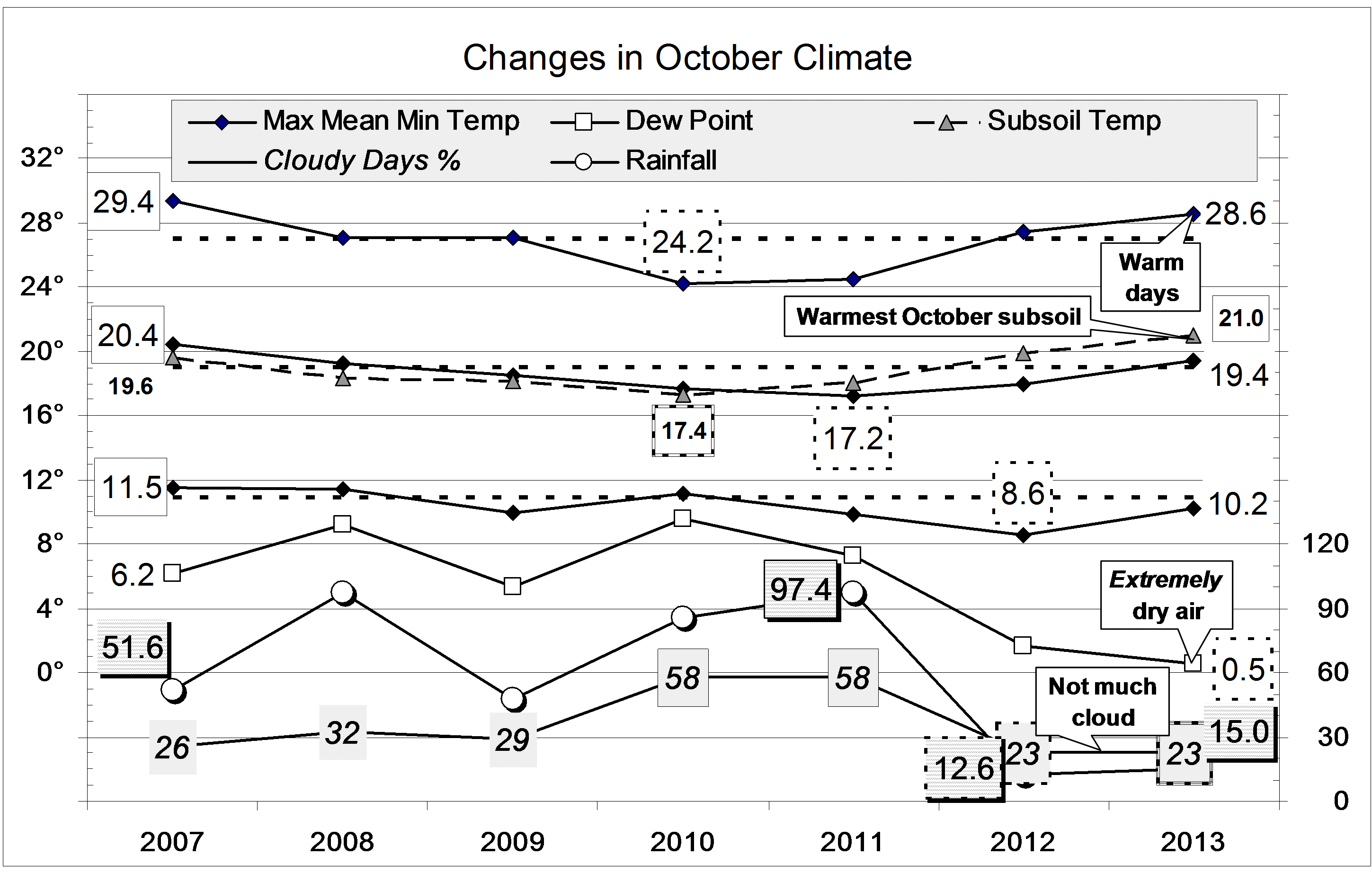
Comparing November months

The weather change on the 11th returned most monthly average values closer to normal. However, despite the rain, this was still an “Arid” month, with a record low November mean morning dew point, a wide daily temperature range, and few cloudy mornings. The mean subsoil temperature (23.8°) was 1.9° above normal, exceeded (in the 21st century) only by 24.7° in November 2002.
The total rainfall of 95.6 mm was in the 80th percentile, well above the average of 67 mm. This disposes of all serious shortages in rainfall totals. The worst figure now is the 5-month total of 166 mm, which is 56 mm below normal (19th percentile).
Data. Rainfall data is from Manilla Post Office, courtesy of Phil Pinch. Temperatures, including subsoil at 750 mm, and other data are from 3 Monash Street, Manilla.