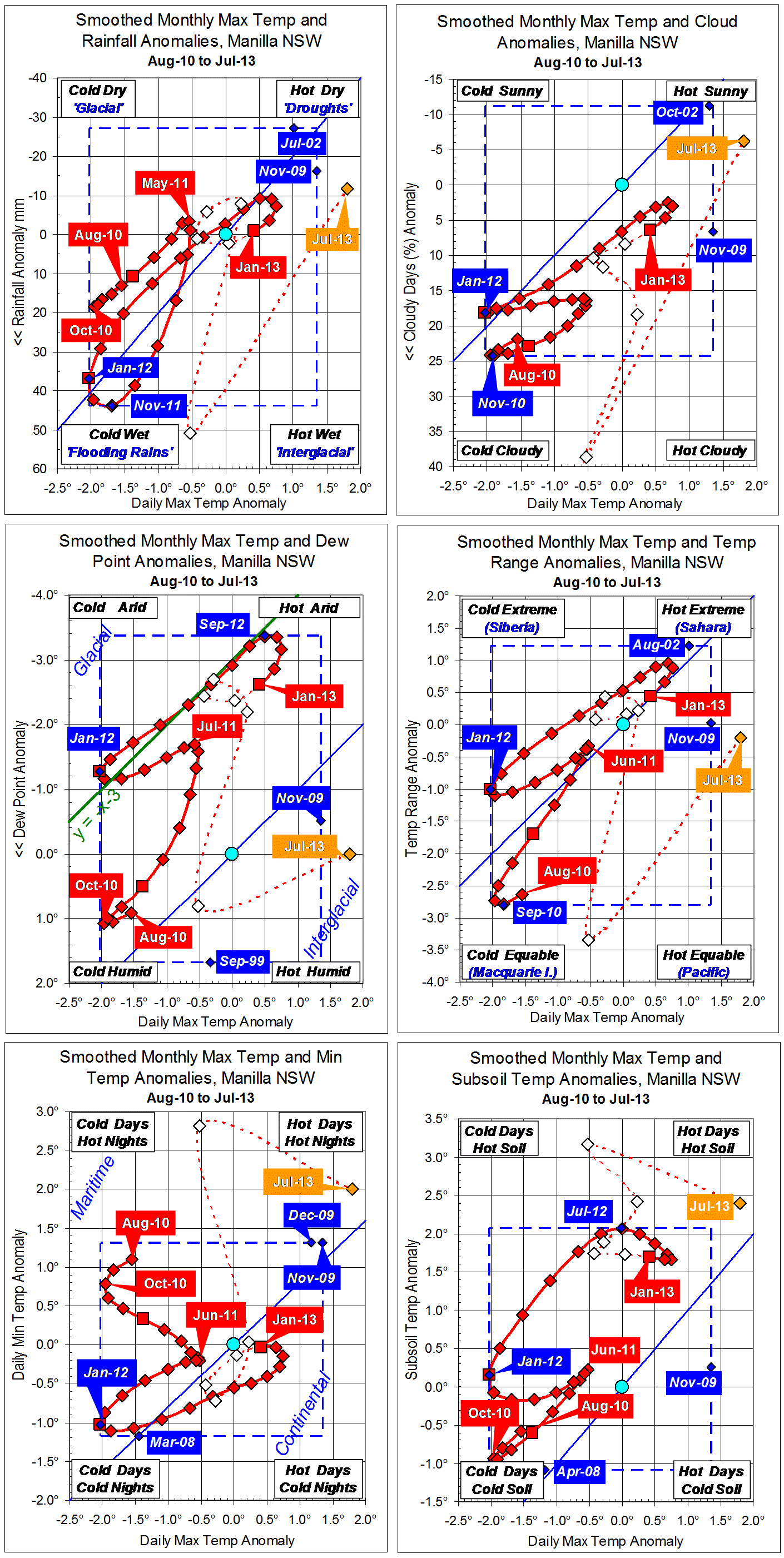
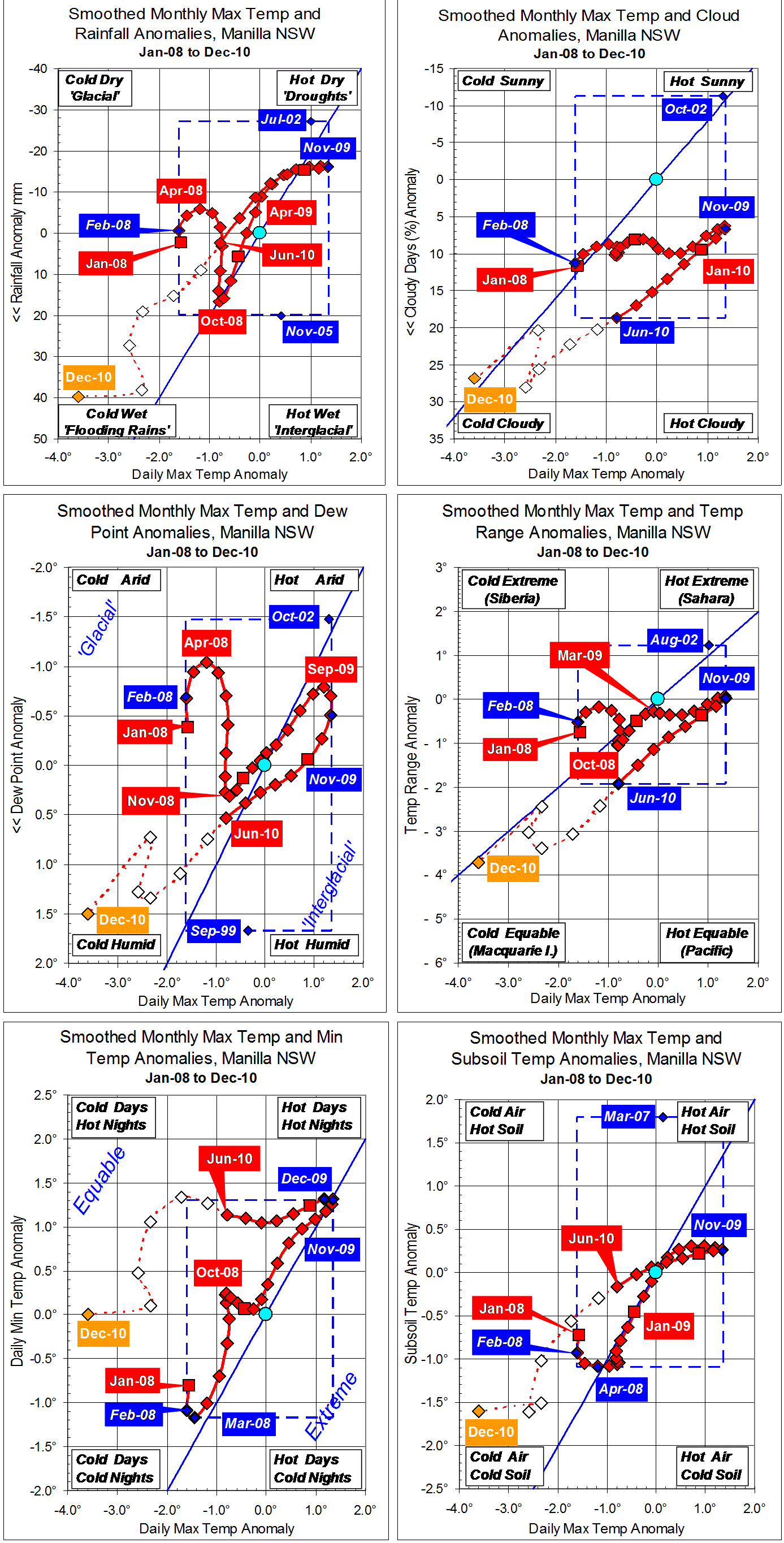
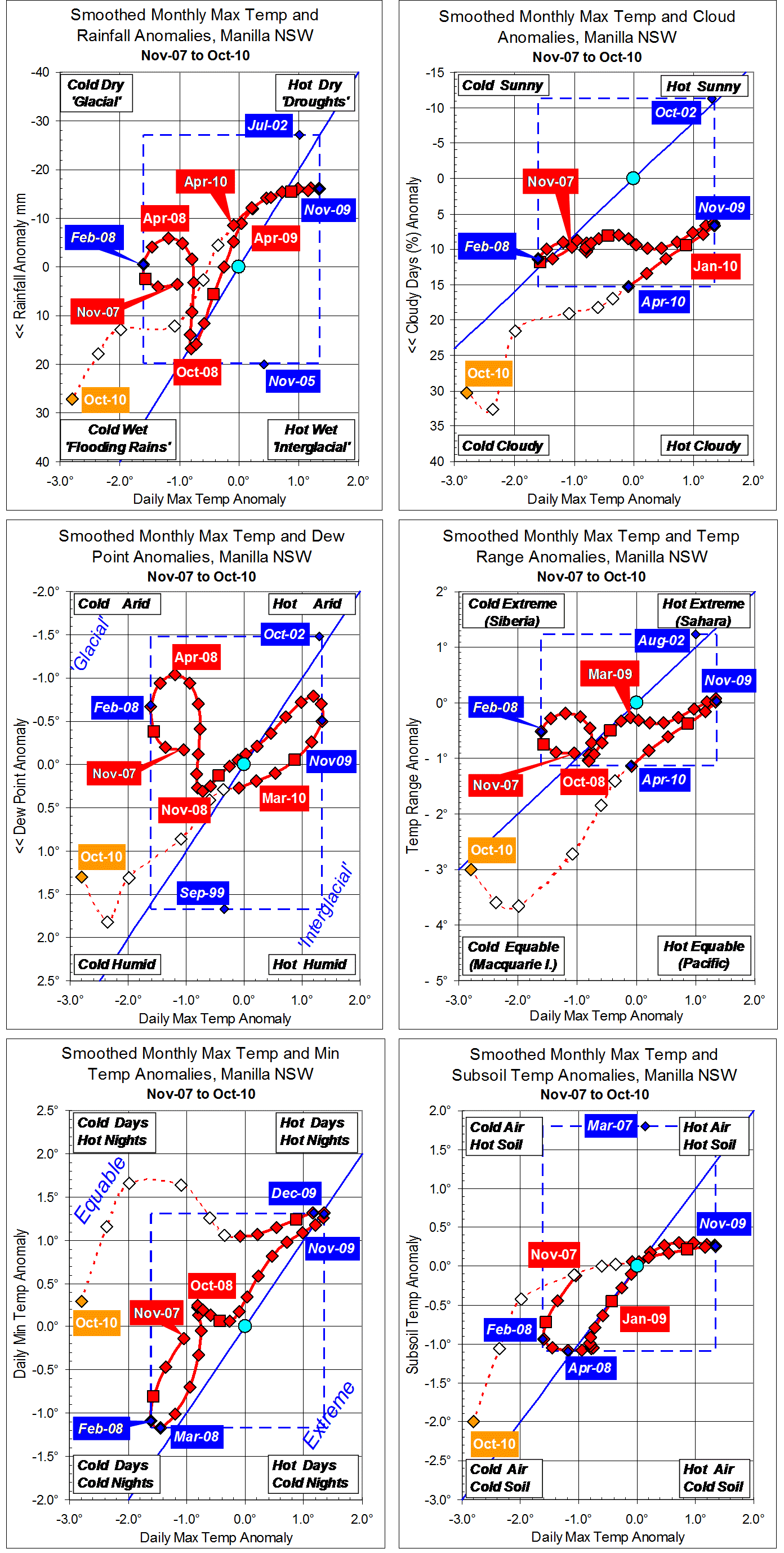
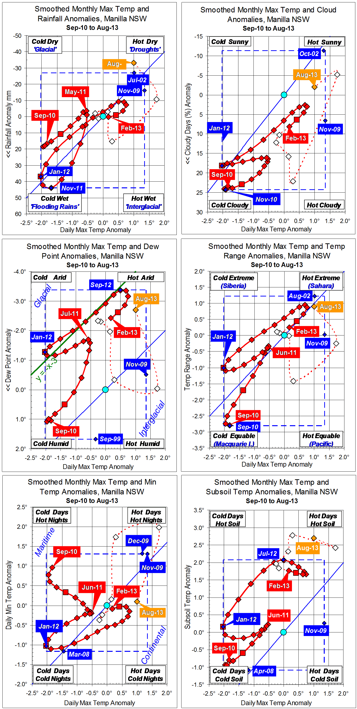
Parametric plots of smoothed climate variables at Manilla
“Still warm and dry”
The raw value of maximum temp anomaly for August was lower than for July. Other variables were typical of “drought”, except for minimum temp, which was normal.
The fully-smoothed data point for February 2013 completes a summer season that moved away from drought. By February, smoothed values of anomalies for rainfall, temperature range, and minimum temperature had returned to normal, but dew point was still very low, and cloudiness and subsoil temperature were high.
El Niño – Southern Oscillation (ENSO)
The first points on these graphs (September 2010) just catch the La Niña event of spring 2010, which was followed by another La Niña event in spring 2011. At Manilla, both events produced extremely low daily maximum temperature. The 2010 event produced extremes of cloudiness, humidity (high dew point), narrow daily temperature range, and low subsoil temperature. The 2011 event produced quite different results: extremely high rainfall and extremely cold nights.
Note:
Fully smoothed data – Gaussian smoothing with half-width 6 months – are plotted in red, partly smoothed data uncoloured, and raw data for the last data point in orange. January data points are marked by squares.
Blue diamonds and the dashed blue rectangle show the extreme values in the fully smoothed data record since September 1999.