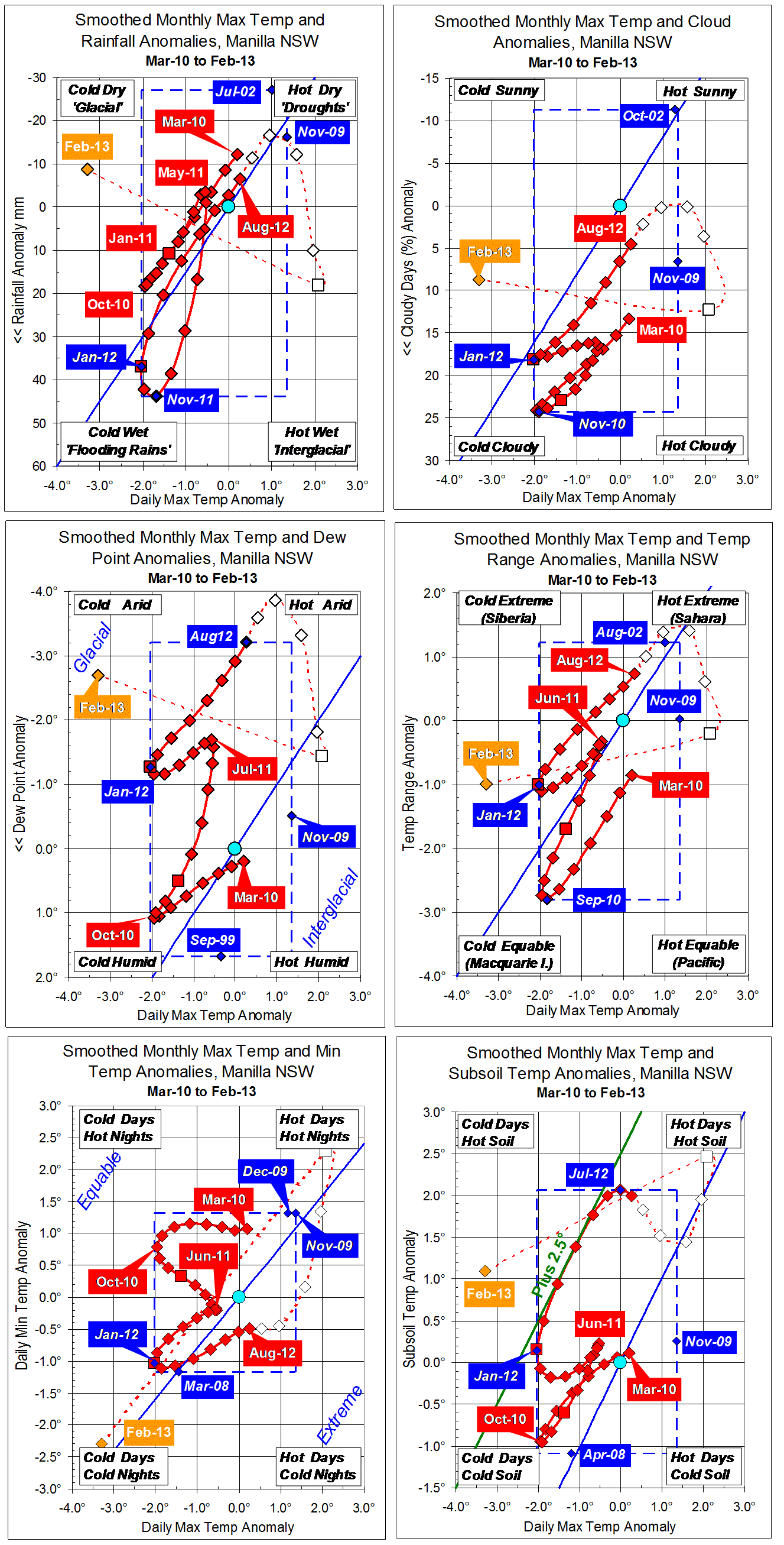
Parametric plots of smoothed climate variables at Manilla
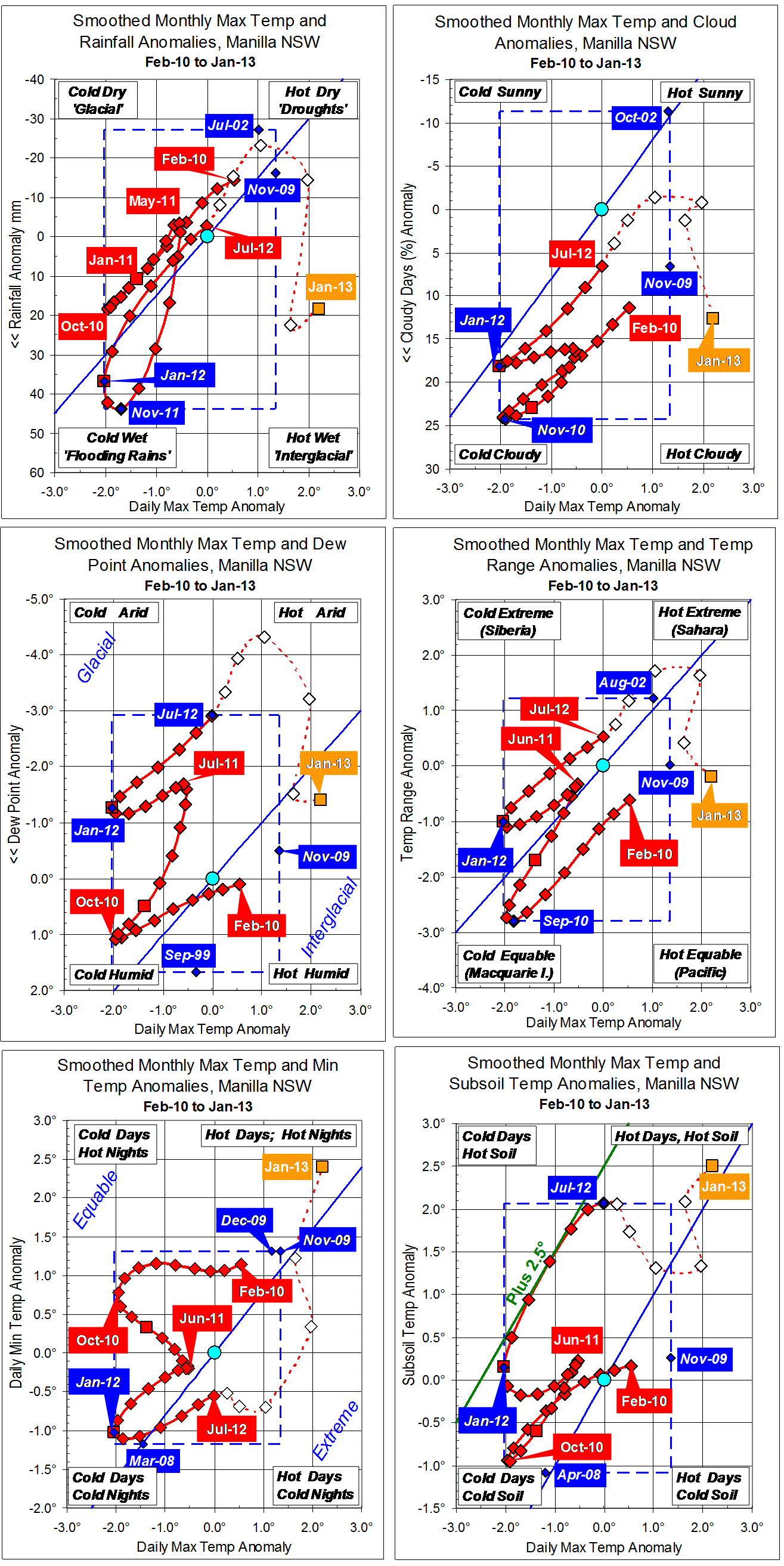
“Now cool and wet”
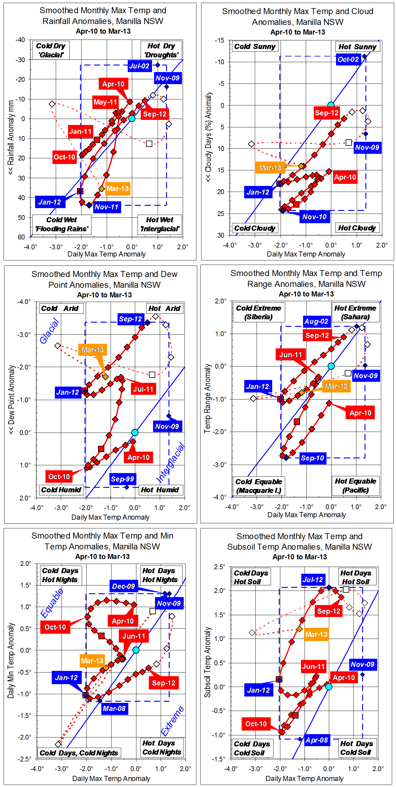
While raw values of temperature anomalies were not as low as in February, March was further towards cool, moist conditions than December or January, or any months since July.
Fully-smoothed data points (red) for September 2012 continued to move towards drought. The dew point anomaly reached a seventh successive new record low: -3.37 degrees.
Note: Fully smoothed data – Gaussian smoothing with half-width 6 months – are plotted in red, partly smoothed data uncoloured, and raw data for the last data point in orange. January data points are marked by squares. Blue diamonds and the dashed blue rectangle show the extreme values in the fully smoothed data record since September 1999.