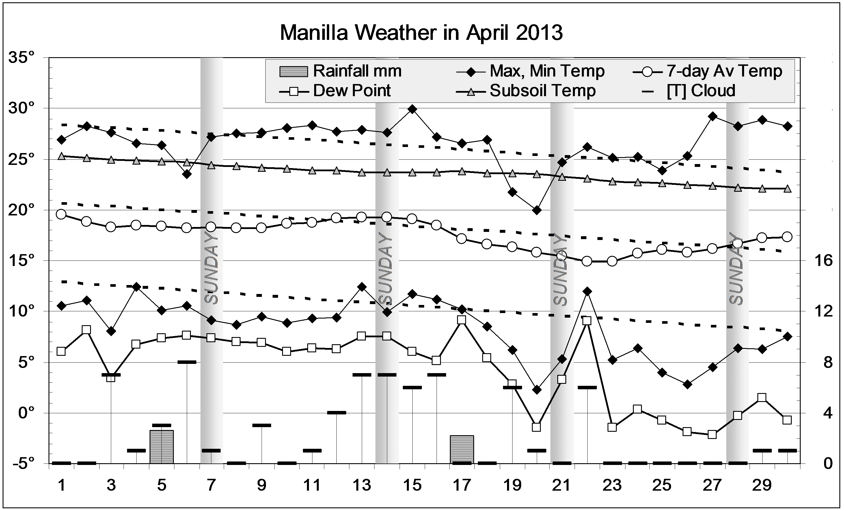
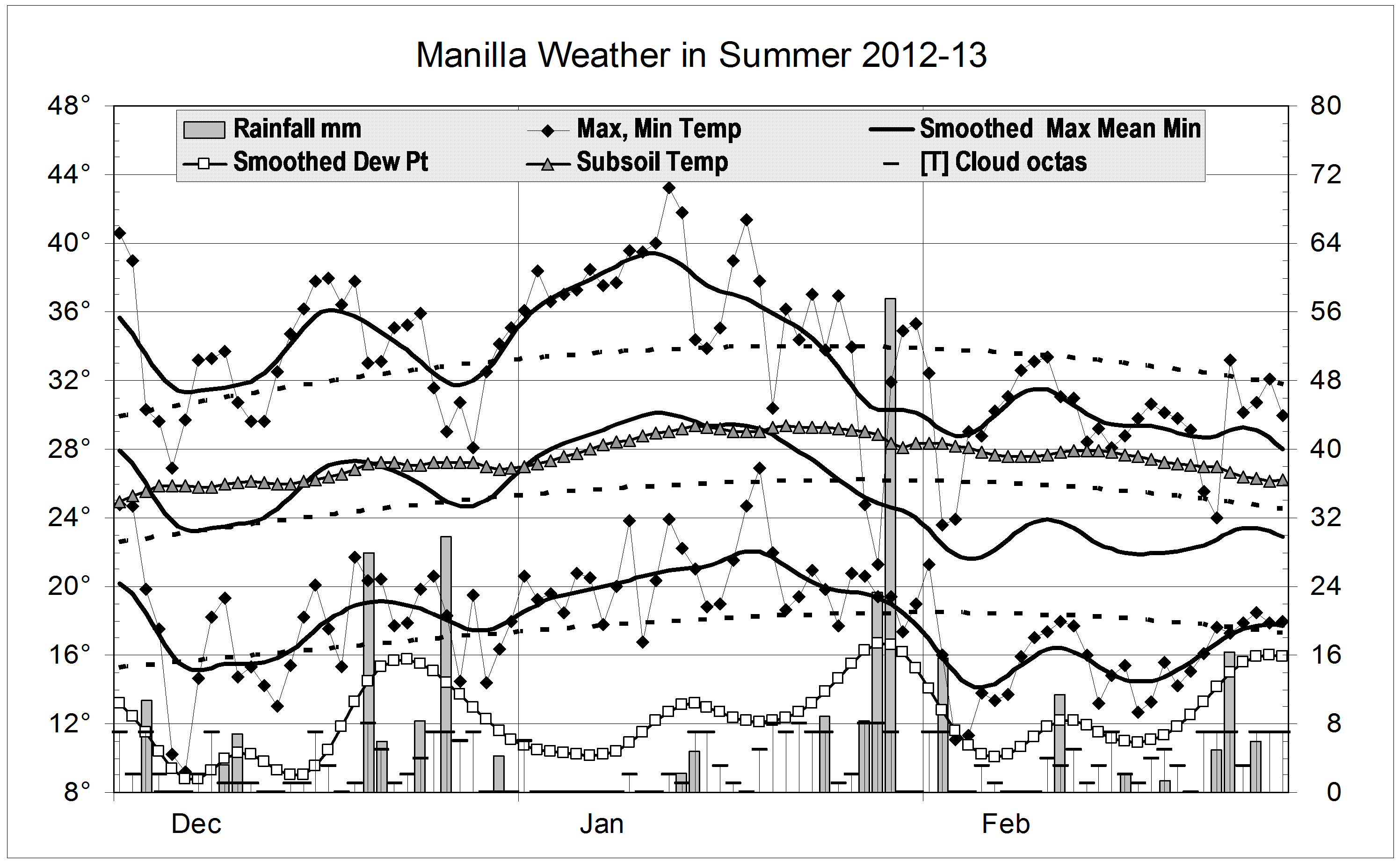
The daily weather log
For most of the month, days were sunny and fairly warm, while nights were cool (but not frosty). The last days were several degrees warmer than normal: as warm as the first days. Two afternoons had extremely dry air, with relative humidity below 10%. While two days had a little rain, the month ended with no readings above 5 mm in eight weeks.
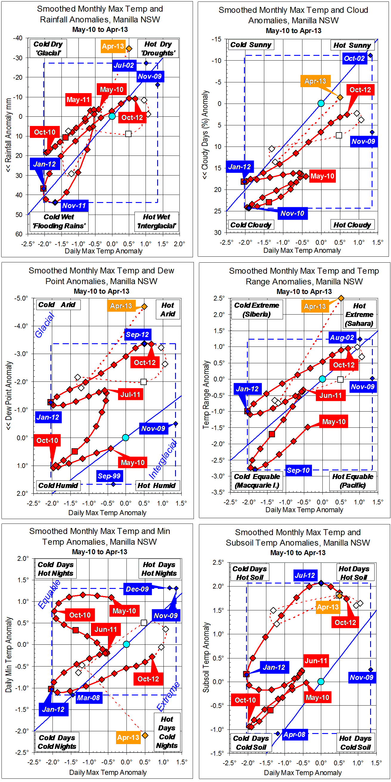
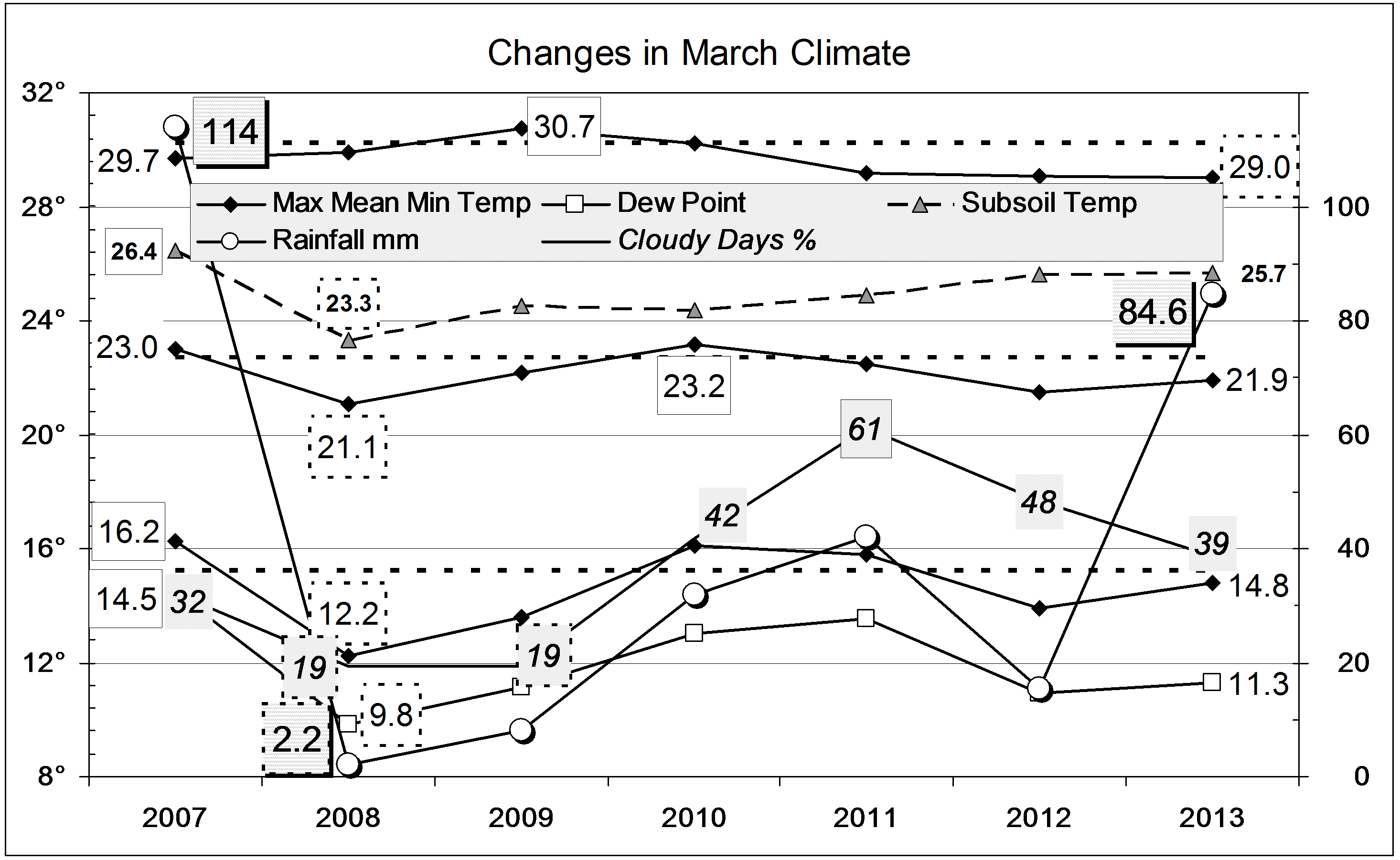
Comparing April months
The mean maximum temperature was a little high and the mean minimum rather low, making the daily temperature range (18.3°) an April record. The mean early morning dew point (4.3°) was also a record (low) value, but cloudiness was normal. The subsoil was almost 2° warmer than normal: its autumn cooling was about three weeks late.
The rainfall total of 4.8 mm was far below the average of 39.3 mm, but April has less rain than that in 15% of the years.
Five Recent Months had Very Dry Air
I have put headlines about very dry air on five monthly weather reports in the last twelve. It is true: the air has been much drier than it was from 1999 to 2009.
I judge the moisture in the air mainly by the dew point – the temperature when dew would form. Normally the early morning dew point, as a monthly average, changes through the year from 15 degrees in February to 2 degrees in July. In some recent months it has been far lower than what is normal for the month:
- May 2012: 4.4° below normal;
- August 2012: 4.4° below normal;
- September 2012: 4.6° below normal;
- October 2012: 6.6°(!) below normal;
- April 2013: 4.7° below normal.
Even in the 2002 drought, the furthest the dew point went below normal was 3.9°, in October.
One degree of change in dew point is like 5% change in relative humidity. In these months the morning relative humidity has been below normal by 20% to 35%. Afternoon humidity has been down by more: many days have gone below 10% humidity. These extremely low humidity values must affect crops and pastures, pests and diseases, and may affect health.
Data. Rainfall data is from Manilla Post Office, courtesy of Phil Pinch. Temperatures, including subsoil at 750 mm, and other data are from 3 Monash Street, Manilla.